Significant Weather Advisory: West-Central Walker & Tuscaloosa Counties Until 7:15 PM CST
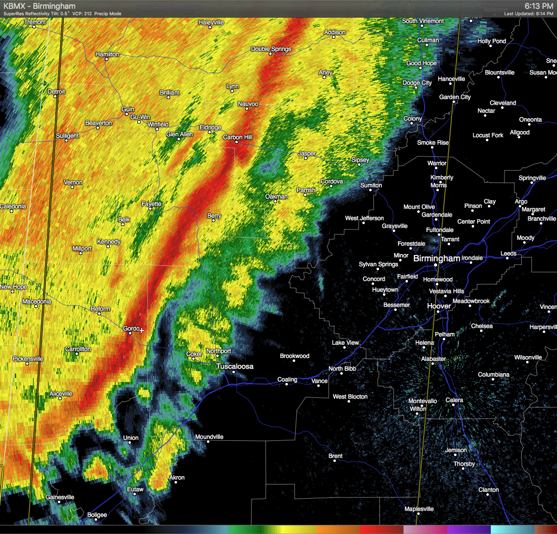
Strong thunderstorms are currently located in a line near Ashcraft Corner to near Aliceville. These storms are moving to the northeast at 55 MPH. Wind gusts of up to 50 MPH can be expected with these storms. Torrential rainfall is also occurring with these storms, and may lead to localized flooding. Areas in the path are listed below:
TUSCALOOSA, NORTHPORT, SUMITON, DORA, HOLT, BROOKWOOD, COKER, TUSCALOOSA AMPHITHEATER, BINION CREEK LANDING, BRYANT DENNY STADIUM, ARKADELPHIA, LAKE LURLEEN STATE PARK, UNIVERSITY MALL, DEERLICK CREEK CAMPGROUNDS, BANKHEAD LOCK AND DAM, TUSCALOOSA REGIONAL AIRPORT, SAMANTHA, MCFARLAND MALL, GORGAS STEAM PLANT AND WINDHAM SPRINGS
Category: Alabama's Weather, Severe Weather
About the Author (Author Profile)
Scott Martin is an operational meteorologist, professional graphic artist, musician, husband, and father. Not only is Scott a member of the National Weather Association, but he is also the Central Alabama Chapter of the NWA president. Scott is also the co-founder of Racecast Weather, which provides forecasts for many racing series across the USA. He also supplies forecasts for the BassMaster Elite Series events including the BassMaster Classic.Subscribe
If you enjoyed this article, subscribe to receive more just like it.


