6:45 PM Update For Central Alabama
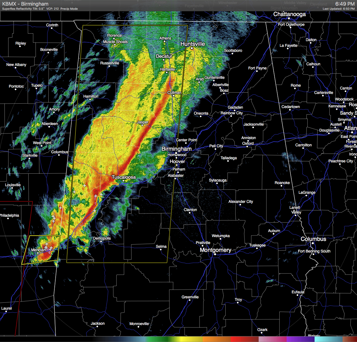
A strongly-forced squall line continues to move across west-central portions of Central Alabama. It still appears that the main risk from this squall line will be damaging straight line winds, but the possibility of an isolated tornado located in the southwestern parts of the state. Gradient winds will be strong out ahead of the squall line, and has already caused trees to fall down and multiple power outages across the area. Lightning has been nearly nonexistent in these storms tonight, and will probably only occur in the extreme southern parts of the squall line where instability values are greatest. Large scale lift is leaving these areas where instability is greatest, therefore the tornado threat is really low.
The line will be in the Tuscaloosa city limits within the next few minutes, entering into Birmingham by 7:30PM to 8:30PM, and into the Anniston area by 9:00PM to 10:00PM.
Category: Alabama's Weather, Severe Weather
About the Author (Author Profile)
Scott Martin is an operational meteorologist, professional graphic artist, musician, husband, and father. Not only is Scott a member of the National Weather Association, but he is also the Central Alabama Chapter of the NWA president. Scott is also the co-founder of Racecast Weather, which provides forecasts for many racing series across the USA. He also supplies forecasts for the BassMaster Elite Series events including the BassMaster Classic.Subscribe
If you enjoyed this article, subscribe to receive more just like it.


