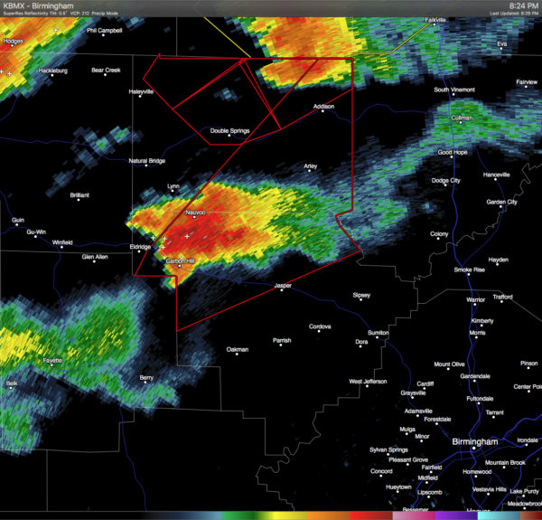
New Tornado Warning: E Winston & NW Walker Counties Until 9:30 PM CST
A severe thunderstorm capable of producing a tornado was located over Carbon Hill, and was moving to the northeast at 45 MPH. If you are in the path of this storm, you need to seek shelter immediately! Locations in the path of this storm are listed below:
JASPER, CARBON HILL, ARLEY, ADDISON, KANSAS, NAUVOO, SARDIS, CAMP MCDOWELL, CURRY, HELICON, SMITH LAKE, ASHBANK, INMANFIELD, POPLAR SPRINGS, FALLS CITY, CORINTH REC AREA, NESMITH, HOUSTON, BLACK POND AND BEAR BRANCH.
Category: Alabama's Weather, Severe Weather


