Rain Has Pushed South of Birmingham At Midday, But Clouds Remain
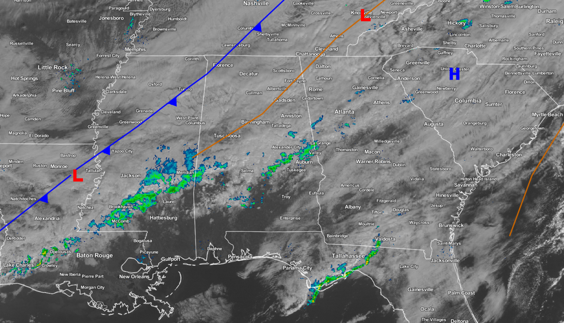
A Cloudy Midday With Rain Just South Of The Birmingham Area
At 11:30 AM, skies across almost all of the Central Alabama coverage area are currently mostly cloudy to completely cloudy, with a broken line of light rain stretching from Cuba and Lisman in Southwest Alabama to Lafayette and Valley in East Alabama. North of that broken line, most of the shower activity has come to an end. There may be a few sprinkles out there, but its hard to tell with the Birmingham radar being down for maintenance and upgrades.
The cold front is currently stretching across the northwestern corner of the state, but don’t expect any cooler temperatures with it. Afternoon highs today across the area will be in the mid to upper 50s to the low 70s across the area from north to south. High for Birmingham should top out near 62 degrees.
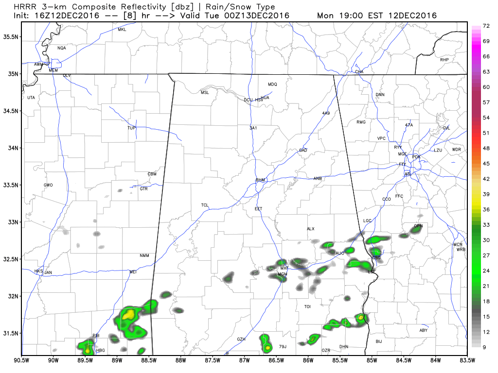
HRRR Simulated Radar valid at 6PM today.
For the rest of today, skies should remain cloudy to mostly cloudy across the area. The front will stall out in the southern parts of the area and will start to move back to the north as a warm front later during the evening hours. Any shower activity should stay along the front, and that will keep nearly all of the rain chances south of the I-20 corridor for the remainder of the day and evening. Overnight lows will not drop much, reaching the 50s.
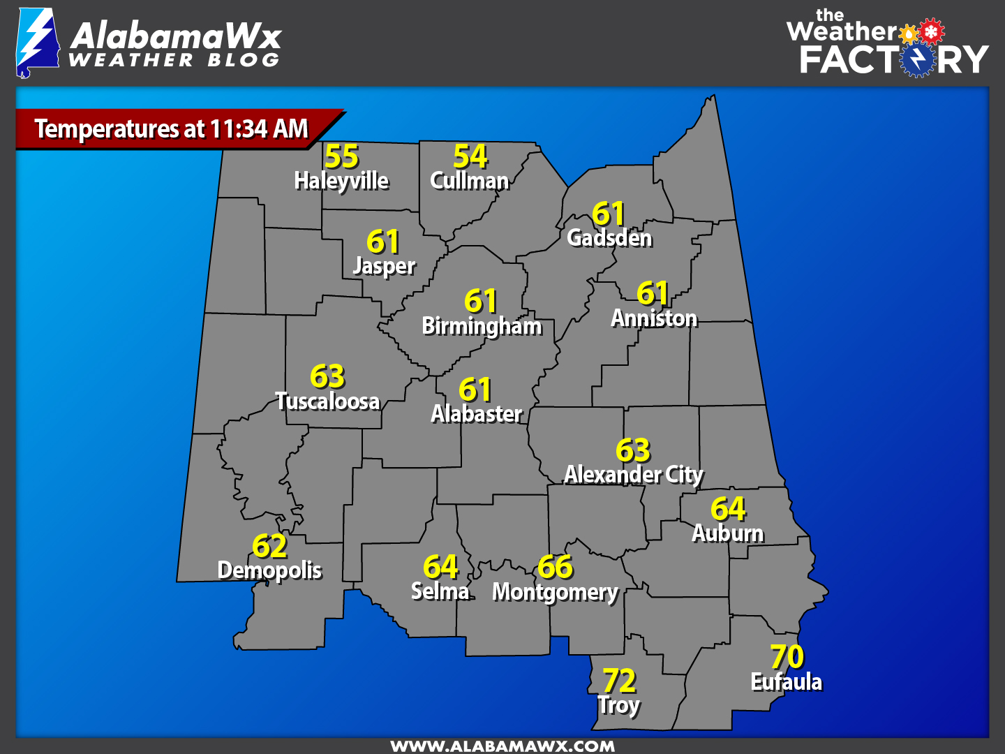
Current Temperatures Across Central Alabama
At this time, temperatures are currently ranging from the mid 50s in the extreme northern parts of the area, with a few 70s in the extreme southern parts of the area. Warm spot is currently Troy at 72 degrees, while Cullman is currently the cool spot at 54 degrees.
Birmingham’s Climatology And Records
The normal high for December 12th is 57, while the normal low is 36. The record high for today was set back in 1971 at 78 degrees. The record low was set back in 1962 at 4 degrees.
Another Cloudy Day With Rain Likely For Tuesday
Another day with cloudy skies and a chance for showers across the area. I mentioned earlier that the cold front would stall out and begin to push back to the north as a warm front. When that happens, the best chance of shower activity will be along and around the front. Afternoon highs will once again be in the upper 50s to the low 70s across the area from north to south. Rain totals from at this time to midnight Tuesday will be around 0.25 to 0.5 inches for much of the area, with higher totals in the southern parts of the area.
National Extremes
McAllen, Texas recorded the warmest high temperature for Sunday at 88 degrees. The coldest low temperature for last night into the early morning hours today was recorded in two locations: Aberdeen, South Dakota and Minot AFB, North Dakota, both at -19 degrees.
On This Day In Weather History: 1995
A severe coastal storm is blamed for five deaths and loss of power to over one million people in Oregon and Washington. Winds at Sea Lion Caves near Florence topped out at 119 mph before problems developed with the anemometer. In Newport, a gust of 107 mph occurred downtown, while Astoria and Cape Blanco also had gusts of over 100 mph. Astoria’s air pressure dropped as low as 28.53 inches, an all-time record (and comparable to the central pressure of a Category 2 hurricane!). Gusts in the Willamette Valley exceeded 60 mph.
Follow The Blog On Twitter
Be sure to follow the Alabama Wx Weather Blog on Twitter. Just click here to start following our feed.
WeatherBrains
This is the weekly netcast that’s all about weather featuring many familiar voices, including our meteorologists at ABC 33/40. You can listen anytime on the web, or on iTunes. You can find it here.
Forecaster: Scott Martin (Twitter: @scottmartinwx)
Category: Alabama's Weather
About the Author (Author Profile)
Scott Martin is an operational meteorologist, professional graphic artist, musician, husband, and father. Not only is Scott a member of the National Weather Association, but he is also the Central Alabama Chapter of the NWA president. Scott is also the co-founder of Racecast Weather, which provides forecasts for many racing series across the USA. He also supplies forecasts for the BassMaster Elite Series events including the BassMaster Classic.Subscribe
If you enjoyed this article, subscribe to receive more just like it.


