Update On The Central Alabama Weather At The Noon Hour
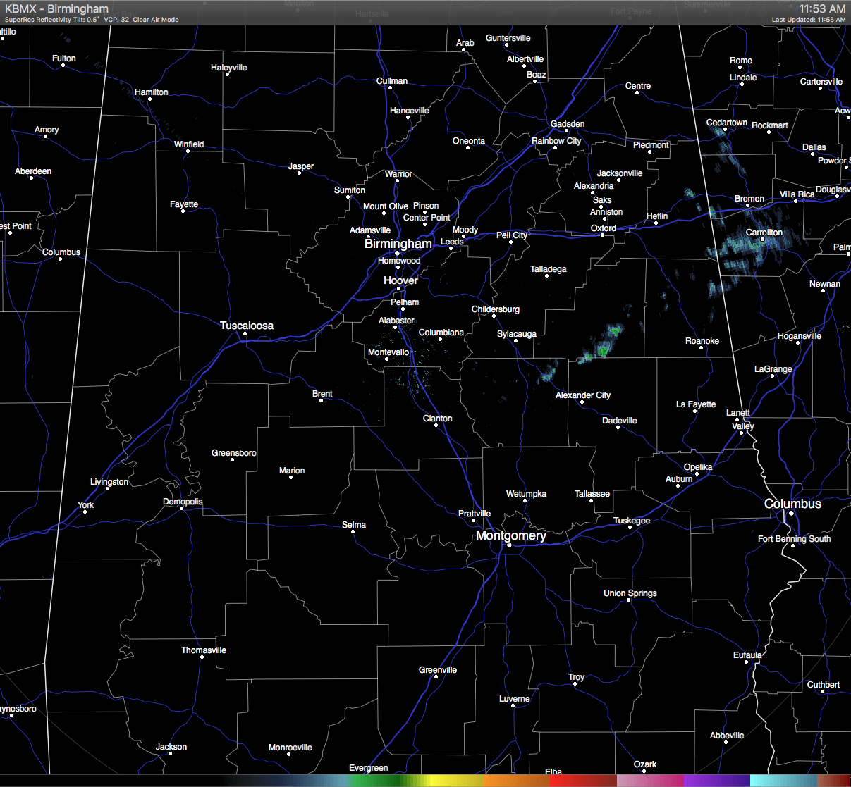
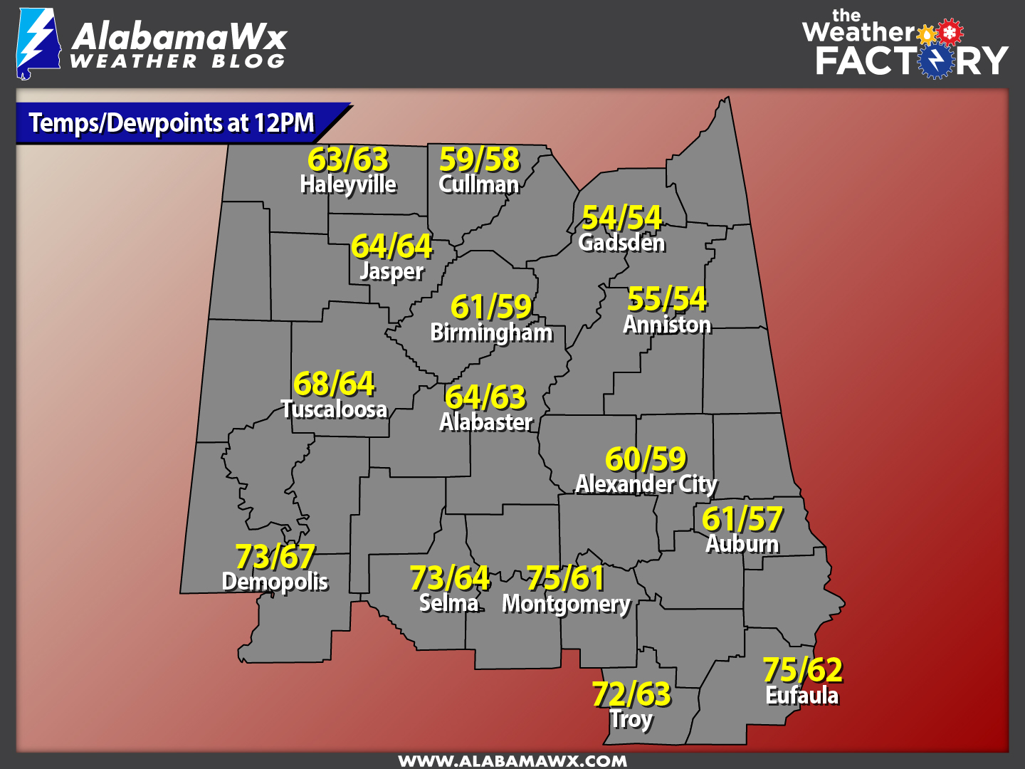
Moisture levels are really starting to increase from the southeast to the northwest at this time. We will soon see temperatures start to warm up across Central Alabama. A few showers are falling at this time over in the eastern part of Central Alabama at this time, mainly in Coosa, Tallapoosa, Clay, Randolph, and Cleburne counties. A few very light showers or sprinkles have started to move into the extreme northwestern parts of the area at this time, mainly in Marion and Winston counties. All rain activity is continuing to move off to the northeast.
Back to our west, a few more showers have developed over northeastern parts of Mississippi, and these will move over the northwestern corner of Alabama within the next hour or two.
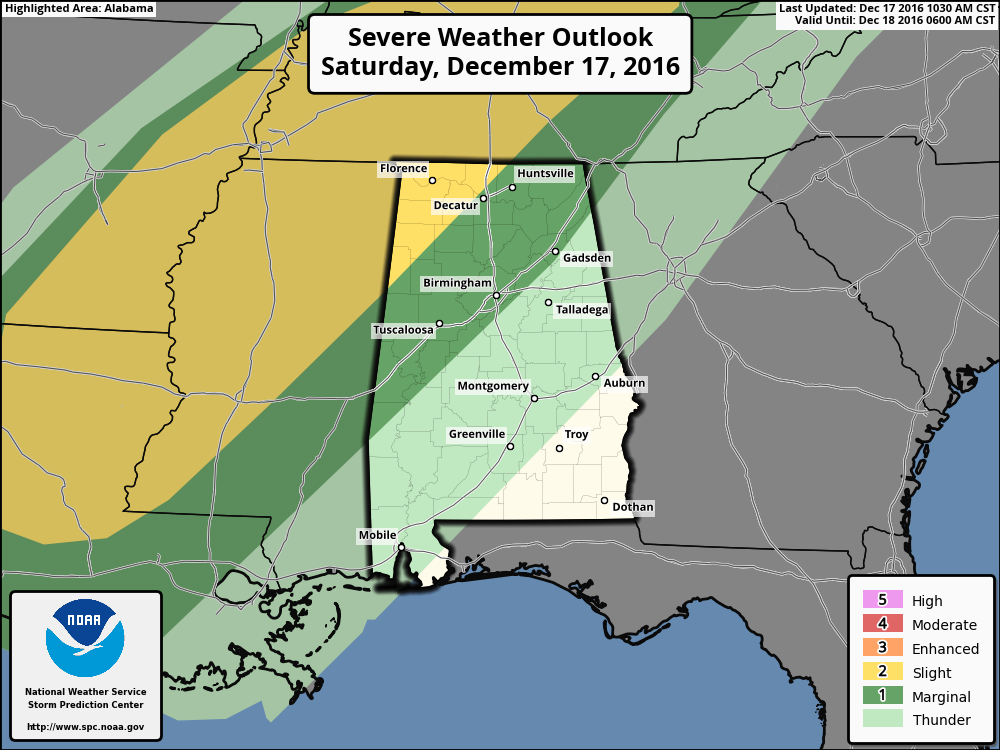
The Storm Prediction Center has updated the graphic from earlier this morning, but not any change in the risks for the state. The latest graphic is still showing the northwest corner of the state in the “Slight Risk” for severe storms during the remainder of the day today and up to 6AM tomorrow morning, with areas to the east of that in a “Marginal Risk”. The southeastern half of the state is currently not defined in a risk for severe storms.
A line of storms will develop to our west this afternoon, but will be weakening as they approach and enter the western parts of Central Alabama. The timing on the threat for severe weather for the area still appears to be from 11PM tonight through 4AM tomorrow morning, with the main threat being from damaging straight-line winds and a few isolated tornadoes. Colder temperatures will then move into the area in the 4AM-7AM time frame, and most of the precipitation should fall as rain. There could be a few spots that will reach the freezing mark, so freezing rain cannot be ruled out, but the impact should be little and will not be a prolonged event. Surface and soil temperatures are well above freezing, even if the air temperature will at or just below freezing.
Category: Alabama's Weather, Severe Weather
About the Author (Author Profile)
Scott Martin is an operational meteorologist, professional graphic artist, musician, husband, and father. Not only is Scott a member of the National Weather Association, but he is also the Central Alabama Chapter of the NWA president. Scott is also the co-founder of Racecast Weather, which provides forecasts for many racing series across the USA. He also supplies forecasts for the BassMaster Elite Series events including the BassMaster Classic.Subscribe
If you enjoyed this article, subscribe to receive more just like it.


