Central Alabama Weather Update at 11:15 PM
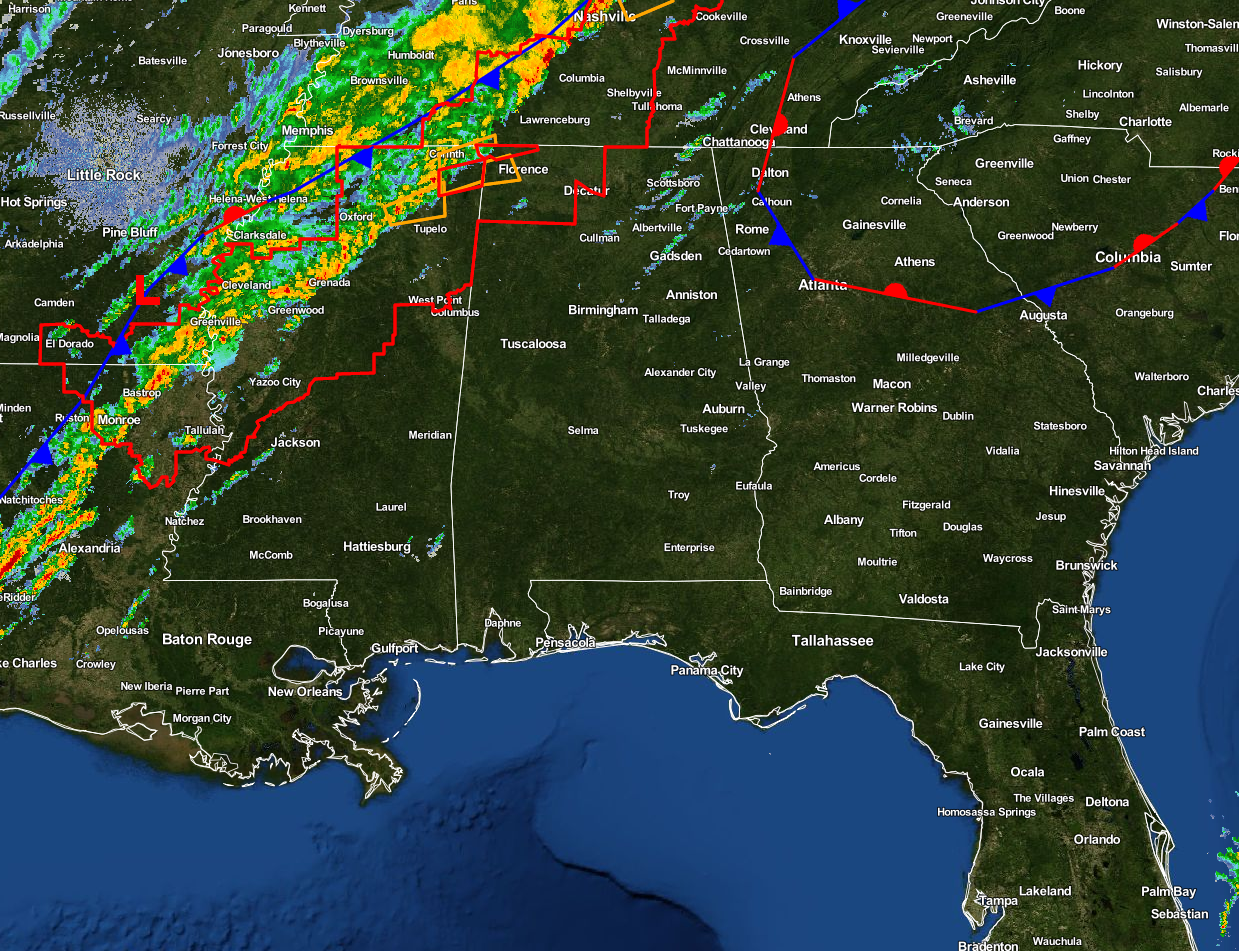
The cold front is getting closer to the area, and it appears that the line of storms have pushed back ahead of the front. A tornado watch continues in effect for the northwest corner of Alabama, portions of south and central Kentucky, west and central Tennessee, extreme northwestern Mississippi, and eastern Arkansas until 3:00 AM CST.
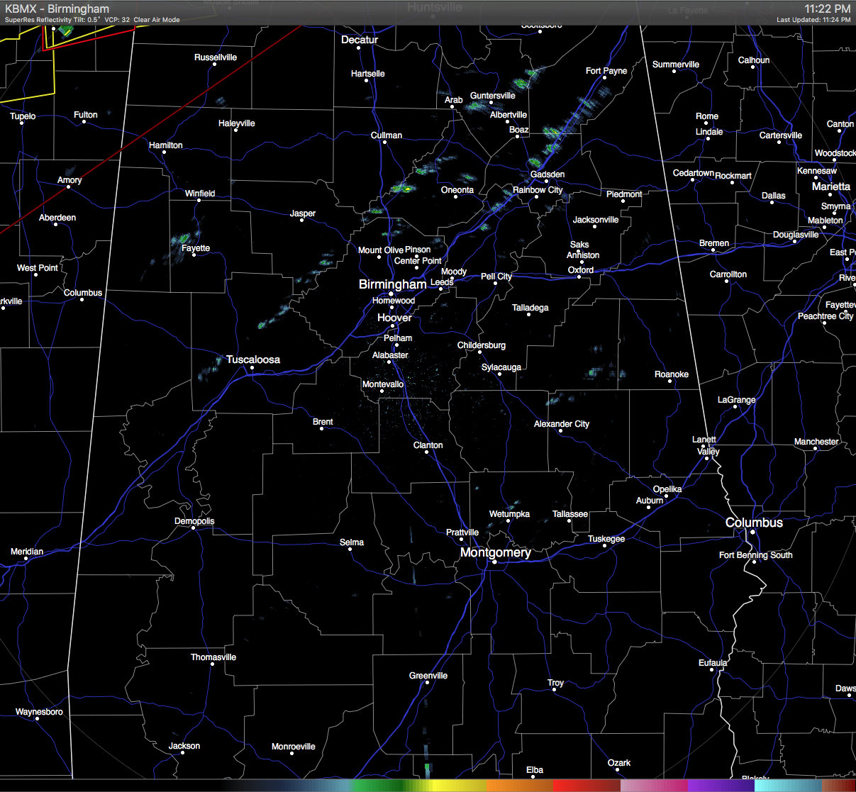
Currently across Central Alabama, only a few showers are showing up along I-59 from the Jefferson/St. Clair county line up into Etowah County, with a few more light showers or sprinkles in northeast Cullman and in eastern Coosa and western Tallapoosa counties. Temperatures are now in the 70s for the most part, with a few upper 60s out there in Auburn and Cullman. Dewpoints are well up into the 60s at this point.
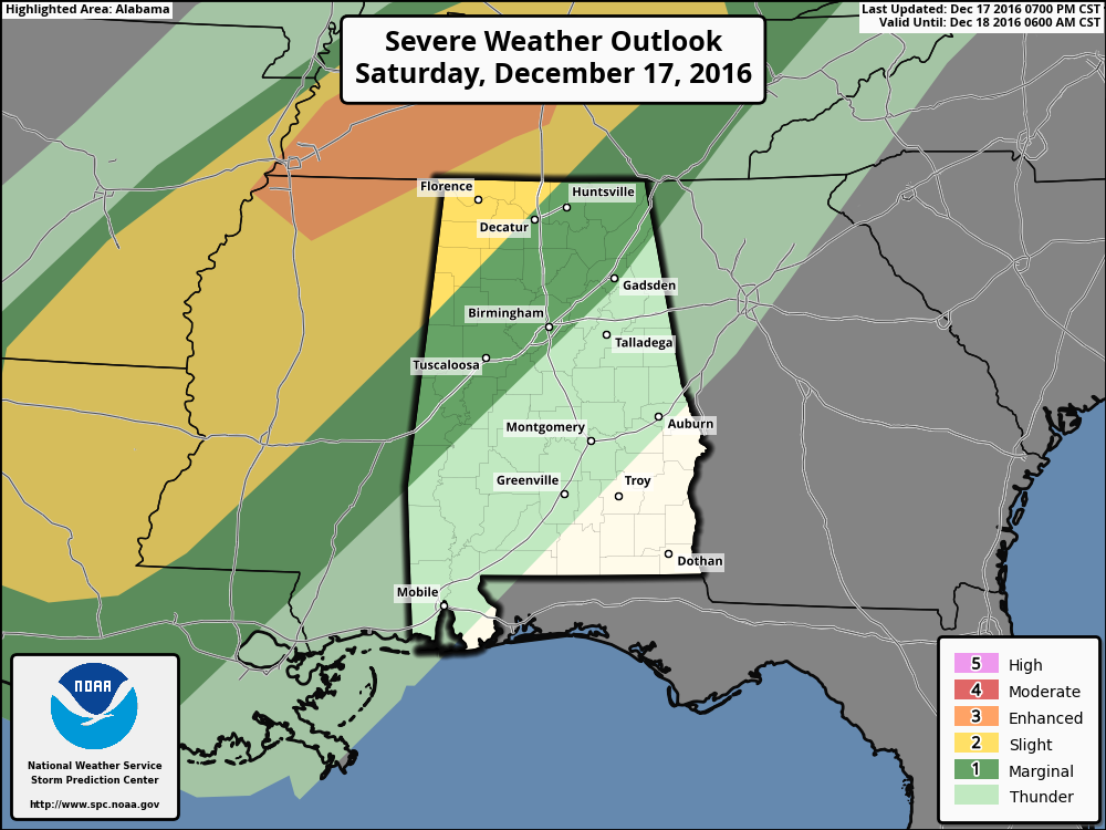
The Storm Prediction Center nailed their prediction for the Day 1 Severe Weather Outlook, with the only part of the line of storms that is severe is in the enhanced area in northeastern Mississippi and southwestern Tennessee. The northwestern corner of Alabama still remains in the slight risk, with a marginal risk stretching out to the east from there to just east of the I-59 and I-20/59 corridors. The main threat will be from damaging straight-line thunderstorm winds, but an isolated tornado or two is definitely not out of the question at this time.
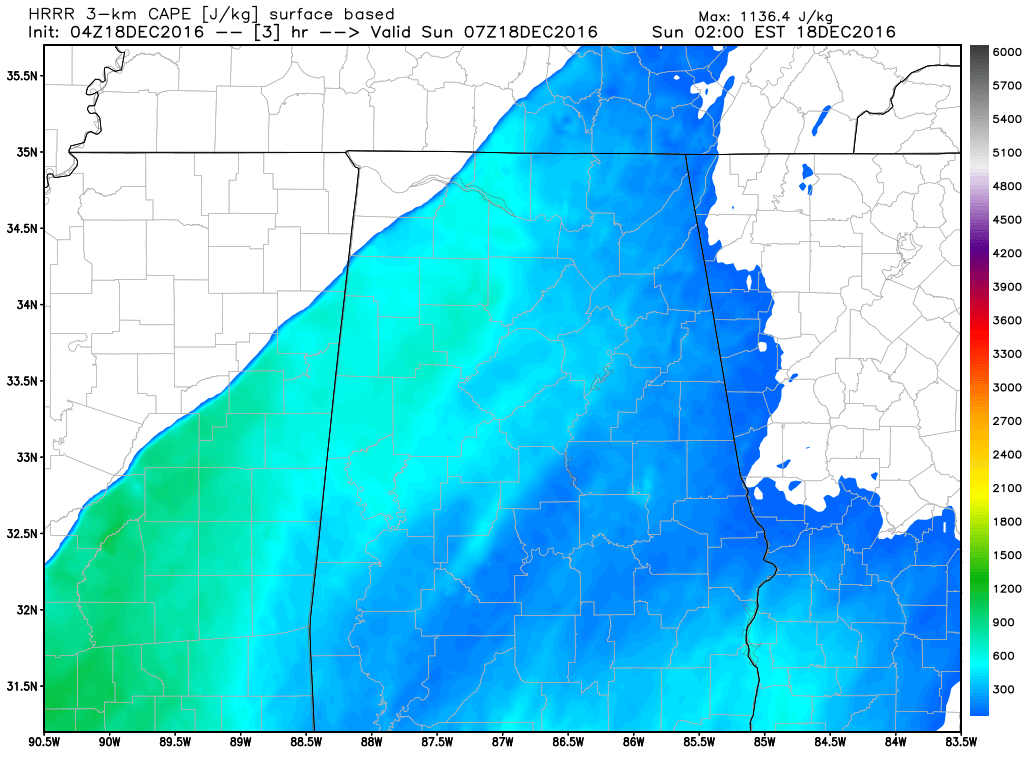
HRRR-CAPE Values at 1AM
CAPE (instability) values are still going to be highest just ahead of the line as it moves into the area, but will drop as the line progresses across the state. Helicity (shear) values are still supportive of rotating updrafts just ahead of the front.
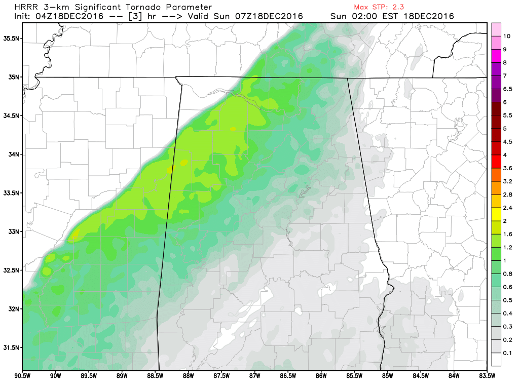
HRRR-Significant Tornado Paremeter Values at 1AM
Significant Tornado Parameter values are still highest as the front enters the area, but these values are lower than in previous model runs only reaching 1.6 and less in northwest Alabama. All of these values drop as the line weakens as the cold front moves across the state during the overnight and early morning hours.
After the front passes in the morning, colder air will start to work into the area. Temperatures will drop from the mid to upper 60s, to the mid and upper 30s within a few hours. For some areas, it will be close to a 40 degree difference between today’s highs and tomorrow’s late afternoon temperatures. As the rain starts to push out of the area, temperatures should be above freezing for much of the area, with the exception of a few sleet pellets or a few minutes of freezing rain in Marion, Lamar and Winston Counties. Even if the air temperatures fall below freezing, the event will be short, and there will be little to no impact as soil temperatures will be well above freezing. There is the possibility for some small ice accumulation along the Alabama/Tennessee state line, and NWS Huntsville has issued a winter weather advisory for those areas.
We’ll keep you updated throughout the remainder of the night and throughout the day tomorrow. Check back often, and be sure to follow us on Twitter, and on Facebook.
Category: Alabama's Weather, Severe Weather
About the Author (Author Profile)
Scott Martin is an operational meteorologist, professional graphic artist, musician, husband, and father. Not only is Scott a member of the National Weather Association, but he is also the Central Alabama Chapter of the NWA president. Scott is also the co-founder of Racecast Weather, which provides forecasts for many racing series across the USA. He also supplies forecasts for the BassMaster Elite Series events including the BassMaster Classic.Subscribe
If you enjoyed this article, subscribe to receive more just like it.


