Significant Weather Advisory: Winston County Until 2:45 AM CST
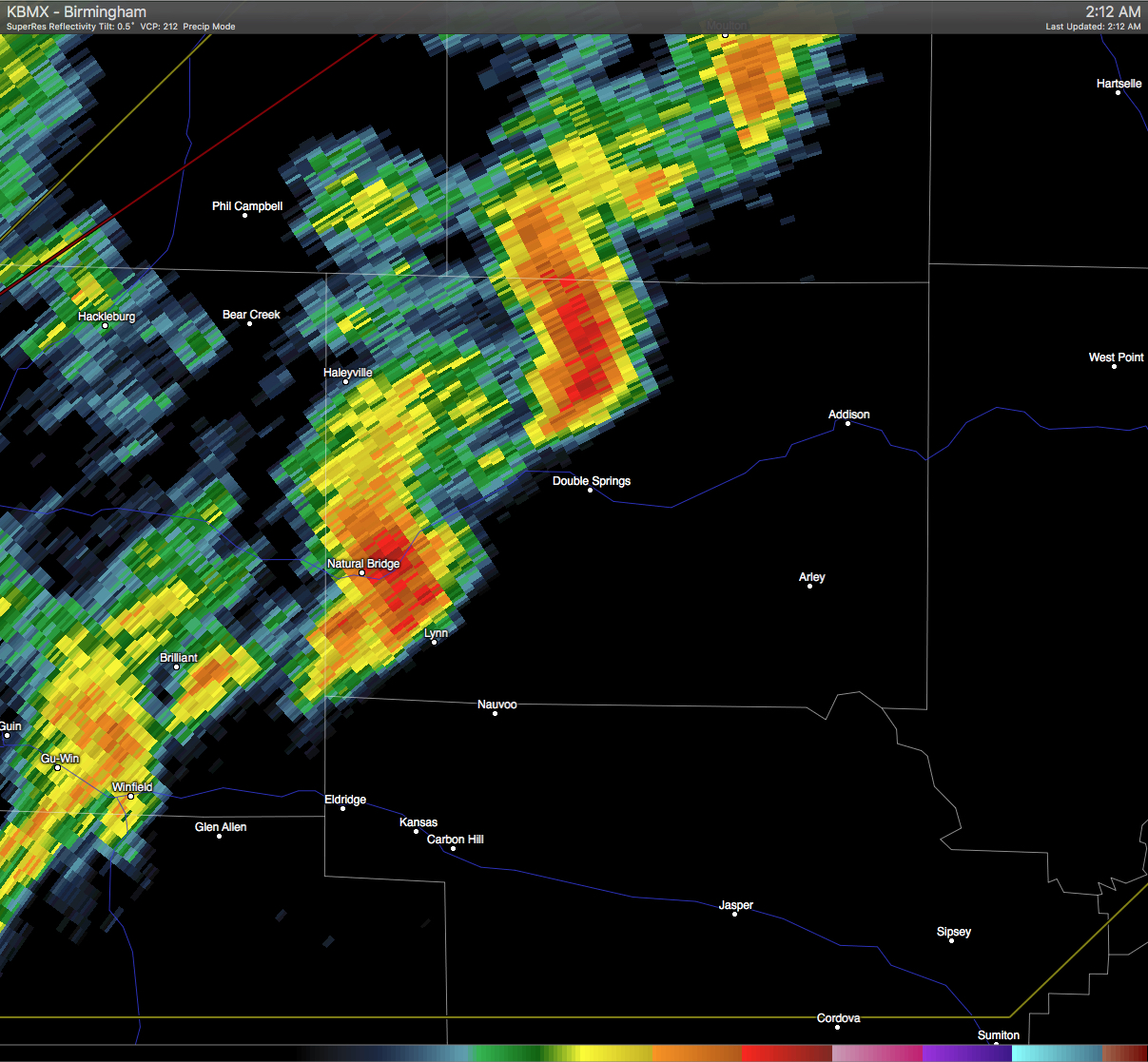
The NWS Birmingham has issued a Significant Weather Advisory for Winston County until 2:45 AM CST. At 210 AM CST, Doppler radar was tracking two strong thunderstorms in Winston county. These storms were near Natural Bridge and jsut north of Double Springs moving east at 55 mph. Winds in excess of 40 mph will be possible with this storm.
Locations impacted include Haleyville, Lynn, Arley, Double Springs, Addison, Nauvoo, Sardis, Camp McDowell, Helicon, Brushy Lake, Smith Lake, Ashbank, Inmanfield, Needmore, Poplar Springs, Falls City, Ashridge, Corinth Rec Area, Moreland and Houston Recreational Area.
Category: Alabama's Weather, Current Warnings, Severe Weather
About the Author (Author Profile)
Scott Martin is an operational meteorologist, professional graphic artist, musician, husband, and father. Not only is Scott a member of the National Weather Association, but he is also the Central Alabama Chapter of the NWA president. Scott is also the co-founder of Racecast Weather, which provides forecasts for many racing series across the USA. He also supplies forecasts for the BassMaster Elite Series events including the BassMaster Classic.Subscribe
If you enjoyed this article, subscribe to receive more just like it.


