Wet and Colder Today
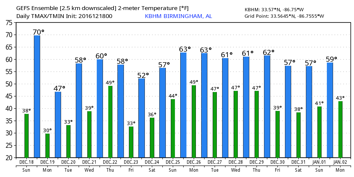
The leading edge of the precipitation this morning coincided with the leading edge of the front that had moved about halfway through Central Alabama. The temperature at Haleyville fell from 70 degrees to 43 degrees in about an hour. For the eastern sections of Central Alabama, your temperatures will stay warm until the front arrives and then you can expect temperatures to fall dramatically into the 40s. Rain is expected to continue across much of Central Alabama off and on through the day with temperatures dropping into and holding in the 40s.
Temperatures were in the 30s across the western section of the Tennessee River Valley. Precipitation that occurs there is likely to be a mix of freezing rain changing to very light snow before ending later this afternoon. There may be a little sleet mixed in for good measure. I still do not expect to see any significant travel issues with the ground temperatures so warm. The NWS in Huntsville has issued a winter weather advisory for the counties right along the Tennessee-Alabama line through noon today for the potential for some slick spots on roadways. If you are traveling north from Birmingham, please take this into account for your travel planning.

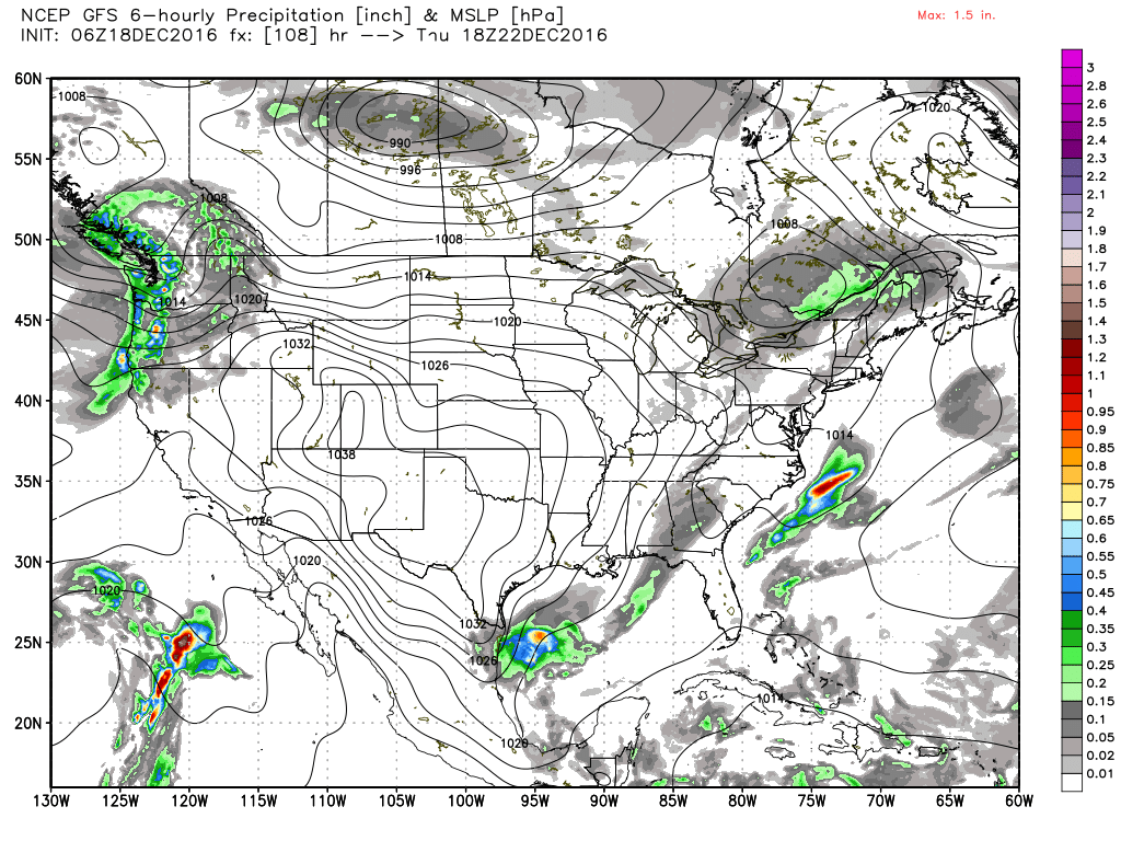
SPC has no severe weather forecast for anywhere in the country for the next three days. In fact, no thunderstorms are forecast anywhere for Day 3.
We’ll be dry on Monday as we get back to work the week before Christmas. Temperatures will remain chilly with highs in the 40s.
By Tuesday we’ve begun to recover especially in the temperature department with highs climbing well into the 50s. There is a slight hint of ridging on Wednesday as we begin to watch the next system in the parade of storm systems. It will be coming through the Dakotas on Wednesday and promising a shot at some rain once again on Thursday. Wednesday the highs should top out around the 60-degree mark.
The upper air trough swings through the Southeast US on Thursday. Right now the GFS and ECMWF are in pretty good agreement that it will not be a big rain event with rainfall totals remaining under a half inch, perhaps even under a quarter of an inch. The reason for the lack of rainfall is the lack of significant moisture return ahead of the Thursday system. The moisture has got to come in enough quantity for the atmosphere to wring out a good rain event. Besides the rain, Thursday is likely to be another one of those days when temperatures do not change much and may even fall for part of the day depending on the exact time of arrival of the front.
That trough zips by into the Southeast US Coast on Friday bringing another dry day to Central Alabama with temperatures pretty close to typical for the middle/late part of December with lows in the upper 20s and highs in the upper 50s.
Saturday should be a dry day, but we’ll be turning our eyes westward once again as yet another trough digs into the Lower Mississippi River Valley on Sunday, Christmas Day, to set the stage again for another round of wet weather. The current timing suggests that Sunday will start dry but rain will spread across Alabama during the morning and afternoon. High temperatures will be around 60 with good southerly flow ahead of the approaching front.
We come under a ridge for several days after Christmas until we see the approach of a strong trough and closed low on the 30th of December. This pattern has a wet look that could also be quite stormy for the last couple of days of 2016. But January 1st the upper pattern see a ridge over the eastern half of the country that is likely to keep us dry for the first several days of 2017.
James Spann will be back with the next edition of the Weather Xtreme Video bright and early Monday morning. I hope you have a great day. Stay warm today and Godspeed.
-Brian-
Category: Alabama's Weather
About the Author (Author Profile)
Brian Peters is one of the television meteorologists at ABC3340 in Birmingham and a retired NWS Warning Coordination Meteorologist. He handles the weekend Weather Xtreme Videos and forecast discussion and is the Webmaster for the popular WeatherBrains podcast.Subscribe
If you enjoyed this article, subscribe to receive more just like it.


