

Another Warm Day
According to NWS climate reports, new record highs were set yesterday at Birmingham (78), Tuscaloosa (80), Montgomery (82), Muscle Shoals (78), Huntsville (77), and Mobile (80). Each of these sites broke their old records by 1 or 2 degrees, so it was indeed a warm Christmas Day across the state of Alabama. This morning we are waking up to temperatures in the 60s ranging from 69 at Mobile to 61 at Fort Payne. This qualifies as “exceptionally” warm since the 30-year average highs for late December are supposed to be in the 50s. I am not expecting to see new records set today because we are going to have much more in the way of clouds to reduce the direct sunshine that we saw yesterday. However, records for today are lower than those of yesterday including 73 at Birmingham, 74 at Tuscaloosa, and 78 at Anniston. It may be close on Birmingham and Tuscaloosa.
If you are heading to the beach, you should see partly sunny days, and cool, fair nights, through the end of year with an occasional passing shower or storm. Highs will be in the lower 70s until midweek dropping into the upper 50s by Friday. Morning lows will be in the 60s, but those will drop into the 40s by Friday. See the complete Gulf Coast 7-Day Planner here.
The current weather map featured a cold front to the northwest of Alabama moving across the Mississippi River today. SPC has a small marginal risk area identified in Arkansas. Southerly flow will bring good moisture into the Southeast US ahead of the front as the surface high moves off the New England Coast into the Atlantic. While moisture values come up as evidenced by dew points in the 60s later today and into Tuesday, the primary dynamics are well north of us over Southeast Canada. So we’ll be seeing showers that will be fairly isolated today and become a bit more numerous on Tuesday. Rainfall should be the greatest across North Alabama with rainfall amounts of one half inch to three-quarters of an inch while Central Alabama is likely to get amounts less than a half inch. And because of the character of showers, not everyone gets rain.

Wednesday will see slight ridging aloft, but with that old frontal zone lying across the Southeast US we may see an isolated shower or two. The better rain chance will come Thursday as an upper trough begins digging into the eastern US. This will bring a fast moving cold front to the Southeast on Thursday with showers and perhaps a thunderstorm along with rainfall amounts of less than a quarter of an inch. The front along with the upper trough along the East Coast on Friday will drop temperatures back to more seasonal values with lows in the 30s and highs in the 50s.
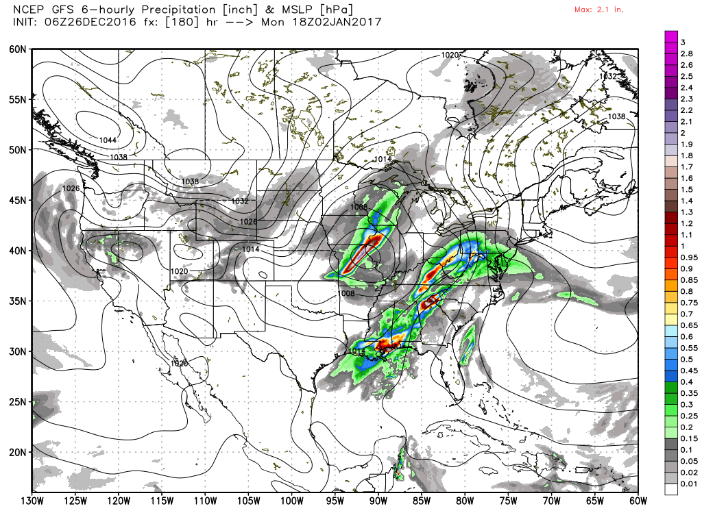
An upper ridge dries us out on Friday and keeps us that way Saturday. By late Saturday and into Sunday we will begin to see the effects of a closed low coming out of the Southwest US with a southwesterly flow that should pick up Pacific moisture and bring it into the Southeast US. This could produce a fairly significant wet period from Sunday into Monday. Unfortunately there are fairly sharp model differences on the timing of this system. The ECMWF is much faster than the GFS and does not seem to generate as much rain as the GFS. While confidence in the timing is low at the moment, the overall pattern solution seems fairly likely, so we may need to adjust the exact timing of the rain and storms as we get closer to the event. The GFS is also generating some fairly stout CAPE values associated with this system as values ramp up into the range of 1000 to 1400 j/kg over Mississippi on Monday.
Peeking into voodoo country and the primary message is relatively mild weather for the Southeast US. Another big system kicks out across the Great Lakes Region on the 5th of January which is likely to drag another front into the Southeast US. There is a broad trough over the eastern half of the country around the 8th of January, but that just seems to drop temperatures back some without any extreme cold. And by the 10th we are back to significant ridging that should keep us warm.
I’ll be filling in for James Spann on ABC 3340 at 4, 5, 6, and 10 pm today, so you can catch the latest weather forecast on all of those newscasts. I expect to have the next Weather Xtreme Video posted here by 7:30 Tuesday morning. Enjoy the mild day and Godspeed.
-Brian-

Category: Alabama's Weather
About the Author (Author Profile)
Brian Peters is one of the television meteorologists at ABC3340 in Birmingham and a retired NWS Warning Coordination Meteorologist. He handles the weekend Weather Xtreme Videos and forecast discussion and is the Webmaster for the popular WeatherBrains podcast.Subscribe
If you enjoyed this article, subscribe to receive more just like it.


