A Quick Winter Weather Update For Central Alabama At 11:15 AM
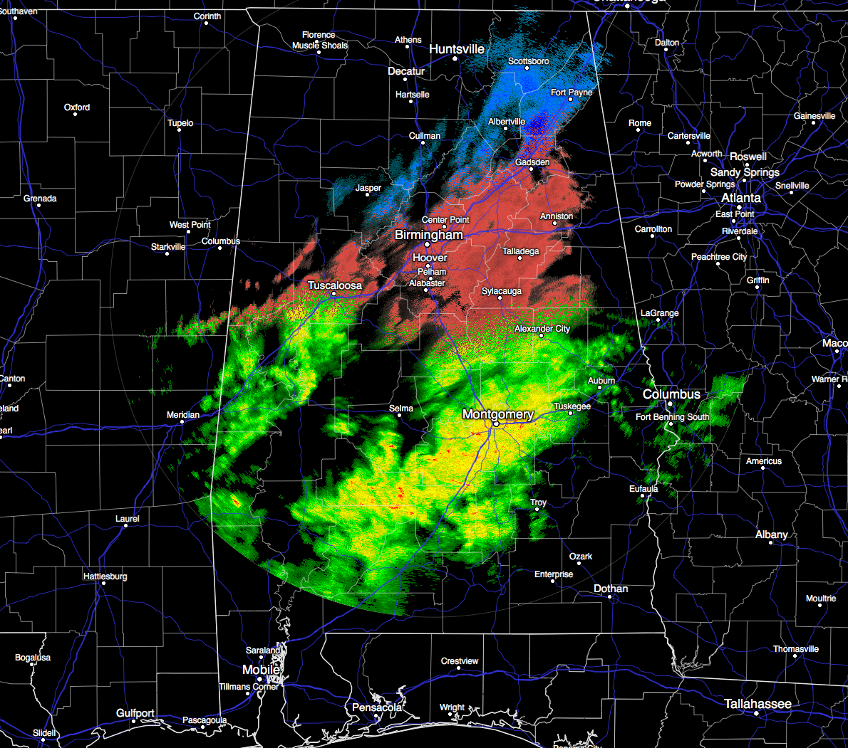
Just within the last hour, sleet and freezing rain has started falling in many locations in the western 2/3rds of the area, including Center Point, Pinson, Vestavia Hills, Deatsville, Altoona, Pell City, Alabaster… just to name a few. A sleet/freezing rain mix is now moving into eastern parts of the area, starting to affect cities such as Gadsden, Anniston, Talladega, and Sylacauga. Back to the west of I-65 and north of I-20/59, most of the precipitation is showing up as snow on radar.
Travel issues have been reported from the western half of the area already, and only expected to move east as this system progresses during the day. I still believe in the forecast from earlier is still in line with what is occurring and what will occur. NWS Birmingham will be launching another balloon at noon to investigate the changes in the temperature profile throughout the atmosphere.
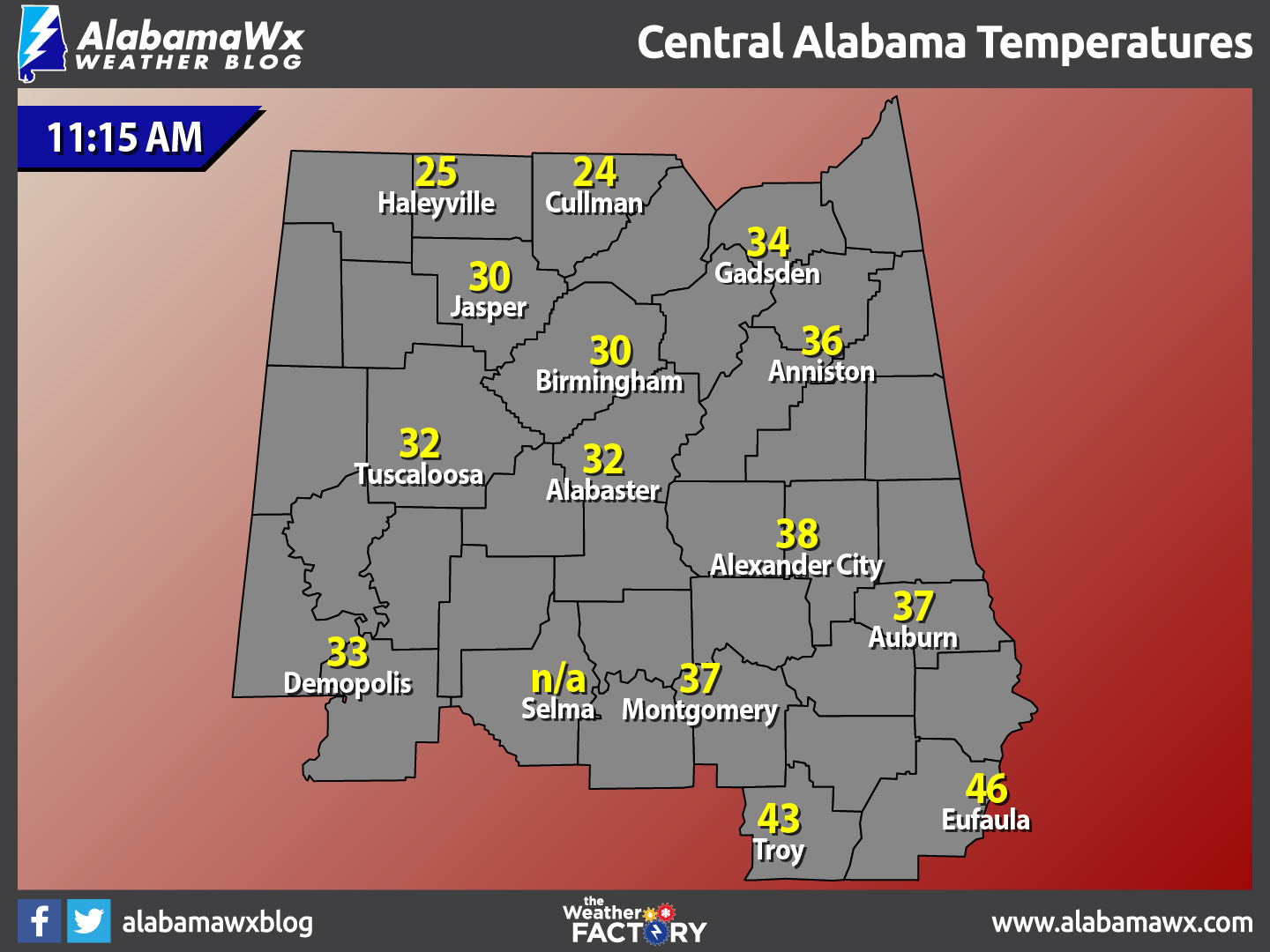
With temperatures dropping below freezing, icy spots will develop on bridges soon after the precipitation begins, and driving conditions will worsen this afternoon and tonight as snow/sleet continues to increase.
Initially ice will form on bridges, but all roads have potential to become icy, especially where heavier sleet/snow/freezing rain falls. We are in the business of forecasting the state of the atmosphere, and not road conditions; we learned in 2014 we certainly aren’t road engineers, but I would sure not encourage driving this afternoon and tonight.
With temperatures reaching the teens early tomorrow, road conditions, mostly likely, won’t improve until tomorrow afternoon. Even then we will have a hard time getting part 32 degrees, but the sky will become mostly sunny during the day.
Precipitation will be mostly sleet initially across Central Alabama, changing to snow later today and tonight as cold air deepens.
Mostly sleet and freezing rain will fall across South Alabama late tonight. All precipitation will end during the pre-dawn hours tomorrow.
We can’t rule out a few isolated power outages where heavier snow/sleet/freezing rain comes down tonight.
We’ll keep you updated throughout the day.
Category: Alabama's Weather, Winter Weather
About the Author (Author Profile)
Scott Martin is an operational meteorologist, professional graphic artist, musician, husband, and father. Not only is Scott a member of the National Weather Association, but he is also the Central Alabama Chapter of the NWA president. Scott is also the co-founder of Racecast Weather, which provides forecasts for many racing series across the USA. He also supplies forecasts for the BassMaster Elite Series events including the BassMaster Classic.Subscribe
If you enjoyed this article, subscribe to receive more just like it.


