Spring-like Warmth Continues
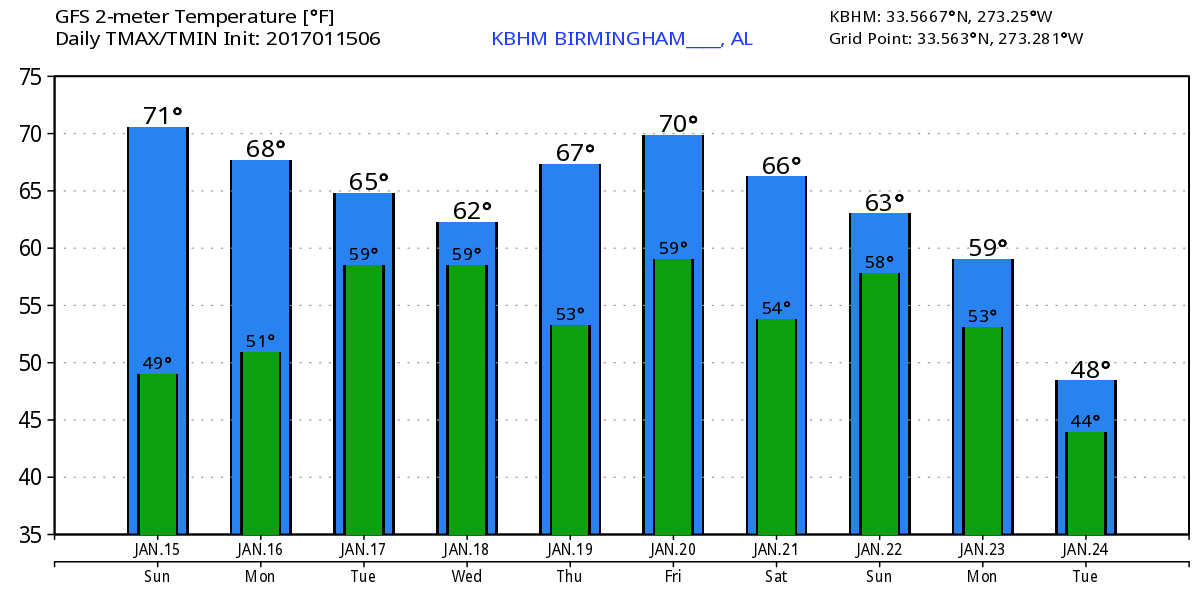
Yesterday was another day with several records falling across the state as the upper ridge in place allowed an unseasonably warm air mass to sit in place. Birmingham reached 76° which was just short of the record of 78°, but Tuscaloosa hit 75° which tied the old record set in 1960. Anniston reached 76° beating the old record of 73° set in 2007. Huntsville climbed to 76° smashing their old record of 71° in 2007, and even Mobile beat their record of 78° from 1971 by making it to 79°.
This morning we find clouds across much of the Southeast US along with some fog. Dense fog advisories were in place until about 9 am for areas along the Gulf Coast as well as along the stationary front from South Carolina through northern Mississippi to Northeast Texas. Good southerly flow will keep us warm in spite of the clouds with highs once again in the 70s. We could see record highs tied or broken this afternoon. Records for today include Birmingham 78 set in 1947, Anniston 73 set in 1950, Tuscaloosa 76 set in 1950, and Montgomery 50 set in 1950. The winter weather mess continued in the Central US.
For those headed to the beach, partly to mostly sunny weather continues for much of the week with a chance of showers and thunderstorms each day after today. Highs will be in the lower 70s throughout the forecast period. See the complete Gulf Coast 7 Day Planner here.
Severe weather today is possible over a large chunk of Central Texas as a strong upper level short wave ejects out of northern Mexico. SPC only highlights a marginal risk for Day 2 and Day 3.
For much of the next 7 days, the GFS maintains a trough over the Southwest US and northern Mexico. That pattern will result in several short waves coming out of the main trough with one Monday, one on Friday, and finally the main trough ejecting across the Lower Mississippi River Valley on Monday/Tuesday. A northern stream short wave provides a glancing blow for us in the Tuesday/Wednesday time frame.
The first short wave comes out across the top of the ridge on Monday and that will drag a cold front into the Southeast US on Tuesday. A short wave in the northern stream comes in right behind the one coming out of the Southwest US knocking the ridge down and pushing the dissipating front a little further south. So there is a chance for some showers and rain from late in the day Tuesday into Wednesday. There is a little bit of instability so the possibility exists for us to hear a little thunder, but I do not expect to see severe storms. Temperatures are forecast to remain relatively warm with highs in the 70s Monday and Tuesday cooling only slightly into the 60s for Wednesday and Thursday. While rain chances are not high with the system Tuesday/Wednesday, they do improve with the system on Friday resulting in rainfall amounts across Central Alabama in the range of one half to one and one half inches.
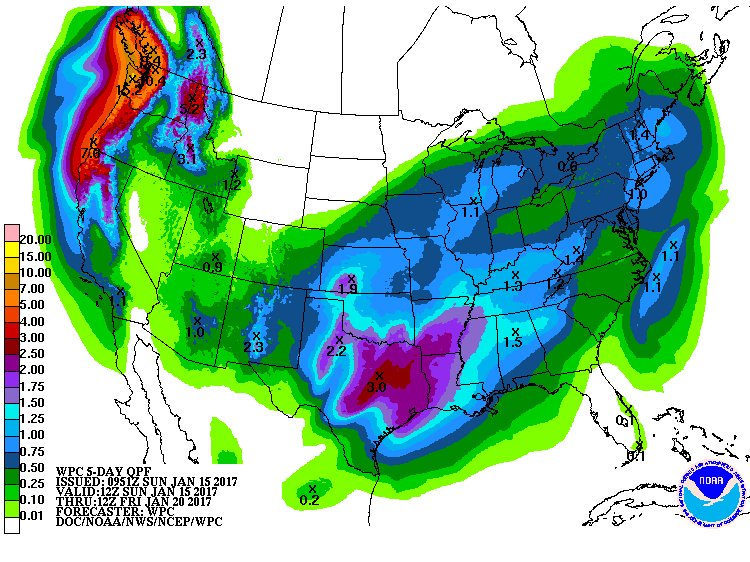
Shower chances remain with the front dangling across Central Alabama on Thursday. Friday, a strong short wave coming across the Central Mississippi River Valley will result in a surface low in the vicinity of St. Louis with a cold front pushing eastward across the Southeast US. This looks promising for a good rain event for Central Alabama with some concerns for the potential for severe weather. There are too many model differences and a good amount of uncertainty this far out, so there is no specific forecast for this event just yet. But the is enough concern to remain vigilant and keep a watchful eye on this event.
An upper ridge develops quickly along the US East Coast on Saturday, so we should be dry and relatively warm with highs in the 60s. The big event as we saw yesterday and as we see again today is for a major trough/closed low to come out of the Southwest US into Texas on Sunday and move across the Lower Mississippi River on Monday. If this pattern does verify, then we are looking at the potential for a fairly serious severe weather episode across a good chunk of the Southeast US. Again, model differences and uncertainty this far out preclude a specific severe weather forecast, but the evolution of this feature will need to be watched carefully in future model runs.
Looking out into voodoo country, the big system goes by on Tuesday while another trough digs into the western US and comes out across the Central Plains in the Wednesday/Thursday time frame. By Friday, January 27th, the GFS takes the upper flow over the Southeast US into a ridge pattern while it digs another substantial trough into Baja California around the 30th. So the pattern remains pretty active for the rest of January.
DAVIS CUP SINGLE DAY TICKETS ON SALE NOW: The U.S. will face Switzerland at the BJCC February 3rd-5th in the first round for the Davis Cup. Single-day tickets are on sale today. Buy tickets here.
James Spann will have the next edition of the Weather Xtreme video posted here first thing on Monday morning. I hope you have a great day with an opportunity to enjoy the warm weather. Godspeed.
-Brian-
Category: Alabama's Weather
About the Author (Author Profile)
Brian Peters is one of the television meteorologists at ABC3340 in Birmingham and a retired NWS Warning Coordination Meteorologist. He handles the weekend Weather Xtreme Videos and forecast discussion and is the Webmaster for the popular WeatherBrains podcast.Subscribe
If you enjoyed this article, subscribe to receive more just like it.


