10 O’Clock…And All’s Well…
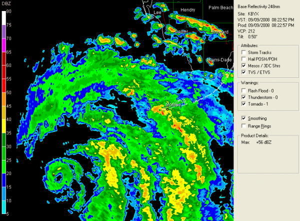
Ike is beginning to strengthen…
Not much else to say…everything points toward strengthening as it moves away from Cuba…should be a major hurricane.
Eye clearly evident on Key West radar, some 185 miles WSW of the Conch Republic.
I think it has definitely slowed. Certainly could be some wobbling going on, but over past two hours, forward translation has been NW at about 5 mph. This was not unexpected as the hurricane reacts to the weakness in the pressure field over the NE Gulf.
This hour…Key West…ESE 32 G 52 with heavy rain. Marathon…ESE 18 G 33. Tides of 2-4 feet occurred on the southeast facing shores of the Keys.
Track rationale has not changed. The current skinny black line point of landfall is Port Lavaca, Texas. Sound familiar? Hurricane Carla made landfall there in 1961. In fact, there will be a lot of similarities between Carla and Ike. Not out of the question that Ike could attain Cat 5 status as some point, although weakening will likely happen before landfall.
Top winds back up to 80 mph.
Last central pressure 967 mb. Bet it will go lower overnight. A NOAA plane is in the storm.
Category: Uncategorized


