Perry County Storm Will Affect Bibb/Chilton Counties
A fairly significant mesoscale convective vortex (MCV) appears to be developing this morning over West Central Alabama. It is at the head of a line of storms that trails back into southeastern Louisiana.
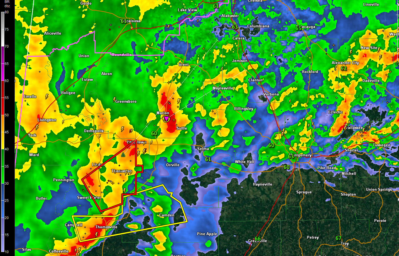
Just ahead of it, a lone storm is embedded in the rain area over Perry County. It is passing near Marion right now, but it will be into southeastern Bibb and Chilton Counties between 615-630 a.m.
It is not severe at this time, but has lots of lightning, heavy rain, strong winds and perhaps some small hail. There could be an increasing wind damage threat with this storm. Areas north of Selma could get some damaging winds.
Right behind it is the storm that has produced significant tornado damage across the Petal and Hattiesburg areas of southeastern Mississippi. That is near the apex of the MCV over southern Marengo County, where a tornado warning remains in effect. The greatest threat of a tornado is just south of Linden into the Thomaston and Uniontown areas. This storm will impact Perry County and western Dallas County as early as 630 a.m.
LATE REPORT 604 AM
Marengo E911 just paged out that they have a report of possible tornado touchdown on Highway 69 near Putnam. That is well south of Demopolis and southwest of Sweet Water.
Category: Severe Weather
About the Author (Author Profile)
Bill Murray is the President of The Weather Factory. He is the site's official weather historian and a weekend forecaster. He also anchors the site's severe weather coverage. Bill Murray is the proud holder of National Weather Association Digital Seal #0001 @wxhistorianSubscribe
If you enjoyed this article, subscribe to receive more just like it.


