

A Beautiful But Cool Midday Across Central Alabama
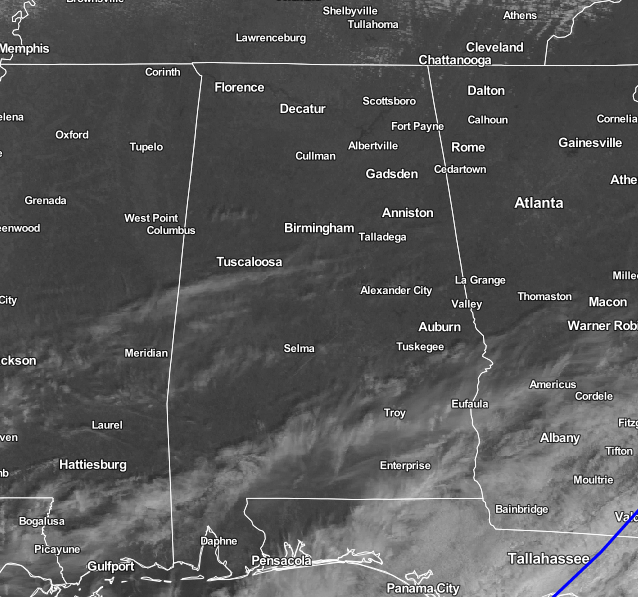
What a beautiful day out there at the midday hour across Central Alabama. Just a few clouds floating overhead mostly down in the southern half of the area. For much of the northern half, the sun is out in full force. It shall remain that way for the remainder of the afternoon, with highs reaching the lower 50s in the north, to the lower 60s in the south. Skies will continue to be mostly clear for the late night and early morning hours, and lows will be dropping down into the lower to mid 30s across the area. A few colder spots may reach the 20s.
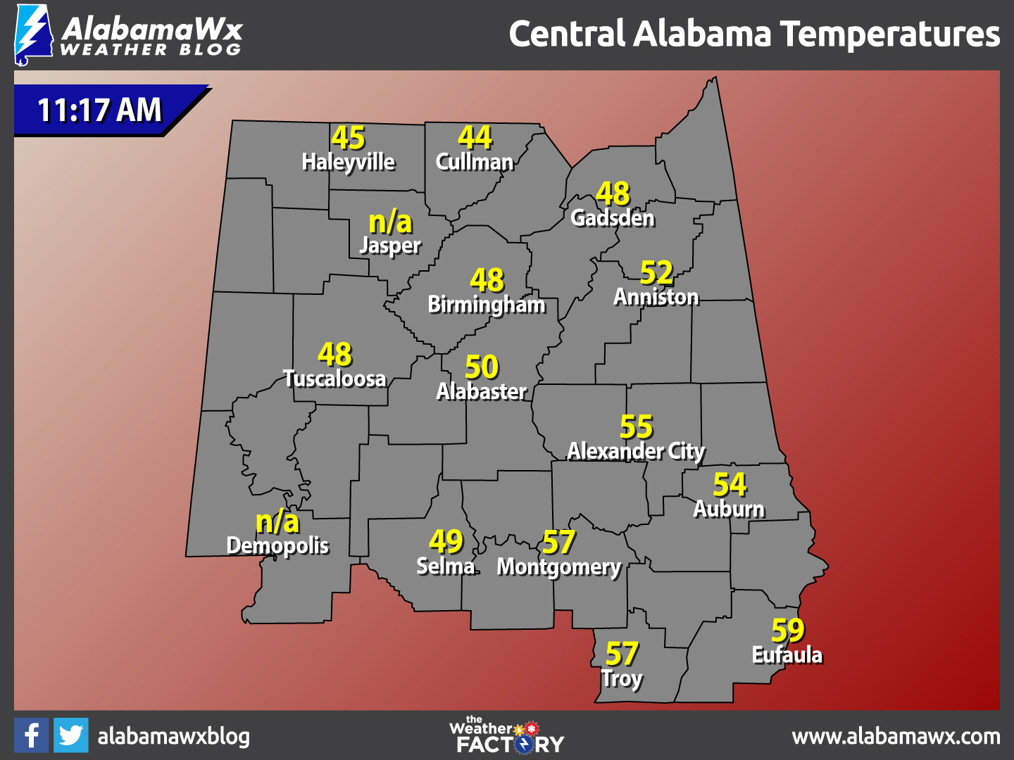
Temperatures Across Central Alabama
At 11:17 AM, temperatures are ranging from the mid 40s to the upper 50s across the area. The warm spot is currently Eufaula at 59 degrees. The cool spot is Cullman at 44 degrees.
Birmingham’s Climatology And Records
The normal high for January 26th is 54, while the normal low is 32. The record high for today was set back in 1950 at 76 degrees. The record low was set back in 1940 at 1 degrees.
Rainfall Totals from Wednesday Night
Anniston……0.19 inches
Auburn……..0.38 inches
Birmingham..0.51 inches
Calera……..0.35 inches
Montgomery..0.31 inches
Troy………..0.06 inches
Tuscaloosa..0.36 inches
Selma………0.73 inches
Friday’s Forecast
Skies will partly to mostly clear for the last day of the work week, and it will be a cool day for Central Alabama. Afternoon highs will be in the upper 40s to the mid 50s across Central Alabama from north to south. Mostly clear skies and cold temperatures is what you can expect if you head out for a Friday night activity. Overnight lows will dip down into the upper 20s to the lower 30s.
For Those Who Are Beach Bound
Plenty of sunshine from today all the way through Wednesday on the Alabama Gulf Coast. Highs will be bouncing between the mid 50s to the mid 60s. Click here to see the Beach Forecast Center page.
On This Day In Weather History: 1978
A paralyzing blizzard struck the Midwest. One to three feet of snow fell in Michigan, and 20 to 40 inches was reported across Indiana. Winds reached 70 mph in Michigan, and gusted above 100 mph in Ohio. The high winds produced snow drifts twenty feet high in Michigan and Indiana stranding thousands on the interstate highways. Temperatures in Ohio dropped from the 40s to near zero during the storm.
Follow The Blog On Social Media
Remember that we are also on Facebook and on Twitter.
WeatherBrains
This week’s episode featured famed speaker and storm chaser, Tim Marshall. This is the weekly netcast that’s all about weather featuring many familiar voices, including our meteorologists at ABC 33/40. You can listen anytime on the web, or on iTunes. You can find it here.
Forecaster: Scott Martin (Twitter: @scottmartinwx)
Category: Alabama's Weather
About the Author (Author Profile)
Scott Martin is an operational meteorologist, professional graphic artist, musician, husband, and father. Not only is Scott a member of the National Weather Association, but he is also the Central Alabama Chapter of the NWA president. Scott is also the co-founder of Racecast Weather, which provides forecasts for many racing series across the USA. He also supplies forecasts for the BassMaster Elite Series events including the BassMaster Classic.Subscribe
If you enjoyed this article, subscribe to receive more just like it.


