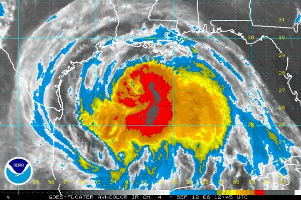
Cameron LA Likely Underwater…
REPORTS
…surge 7.34 feet 10 miles southeast of Pecan Island in Vermillion Parish, LA
…much of Cameron LA is likely underwater…surge reported at 6.05 feet at 7:30 a.m. at Calcasieu Pass.
Recon reported pressure of 954 mb at 6:42 a.m. CDT.
A great deal of very cold tops on east side of storm indicating powerful thunderstorms. Storm still slightly disorganized, hence the slow intensification…some northerly shear continues…Ike should be a major hurricane before making landfall.
Storm surge is going to be a big problem with this huge and powerful storm.
Officials in the Houston area are urging coastal zones A&B to evacuate now!
Rains of 3 inches or more will fall over much of Southeast Texas with 5-7 inches in the immediate Houston area.
Tornado watch for much of Louisiana as outer rainbands rotate across the state. Several tornado warnings have been in effect, including one for Jefferson and St. Charles Parishes in the New Orleans area. A new tornado warning was just issued Hancock County on the Mississippi Coast. The tornado threat exists for today over Lousiana and eastern Texas.
Category: Uncategorized


