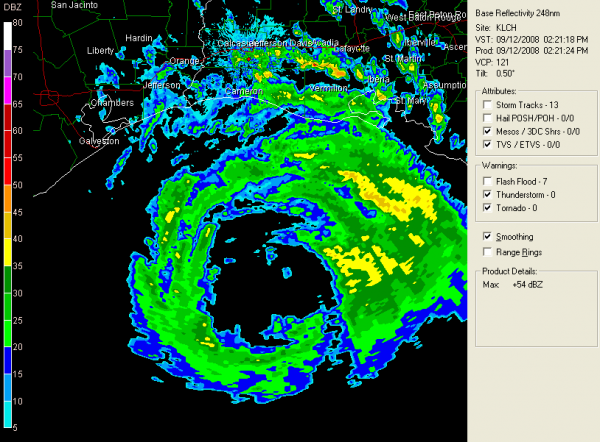
2:25 p.m. Notes
Center is now 150 miles southeast of Galveston.
COASTAL OBSERVATIONS…2 PM
SULPHUR…CLOUDY…NE22G41…29.63F
LAKE CHARLES…CLOUDY…87F…E23G36…29.63F
LAFAYETTE…LGT RAIN…82F…E12G25…29.67S
NEW IBERIA…PTSUNNY…86F…E28G41…29.65F
SALT POINT…NOT AVBL
HOUSTON HOBBY…CLOUDY…87F…NE22G30…29.61F
GALVESTON…NOT AVBL
N.O. INTL ARPT…CLOUDY…86F…SE26G49…29.74F
BUOYS…
…27.5/92.5…30 miles NE of Center and 190 miles SE of Galveston…sustained winds 106 mph 122m above ocean surface…
…Buoy 42035…25 miles east of Galveston…16.7 foot wave height…
TIDES
…Dropping along the Mississippi/Alabama and Northwest Florida Coast.
…Freeport TX…8 feet and climbing…
…Galveston Pleasure Pier…has jumped to 9.5 feet and climbing…
…North Sabine Pass…climbing toward 8 feet
…Calcasieu Pass LA…9 feet and climbing…
…Shell Beach…8 feet…but now dropping…
COASTAL FLOODING
Water is over many roads now in SE Texas and SW Louisiana…here is a late report…HGX: San Leon [Galveston Co, TX] emergency mngr reports Highway 517 eastbound at 25th impassable due to water over roadway.
MISCELLANEOUS NOTES…
Historic district in Galveston is flooded and impassable. Water into some buildings. It never flooded during Rita.
Category: Uncategorized


