

Severe Thunderstorm Warning Has Expired for Parts of Macon, Bullock Counties
200 PM UPDATE

…A SEVERE THUNDERSTORM WARNING REMAINS IN EFFECT UNTIL 230 PM CST
FOR MACON AND NORTHERN BULLOCK COUNTIES…
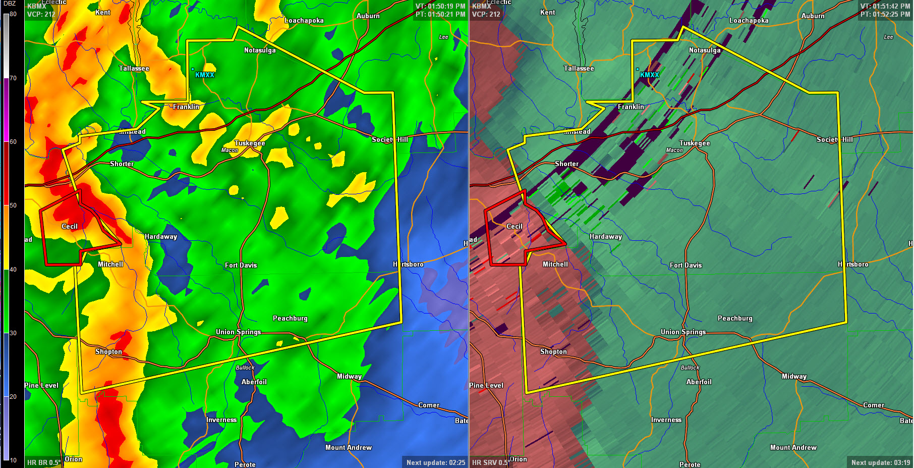
At 200 PM CST, severe thunderstorms were located along a line
extending from Reeves Airport to near Franklin Field, moving
northeast at 45 mph.
HAZARD…60 mph wind gusts.
SOURCE…Radar indicated.
IMPACT…Expect damage to roofs, siding, and trees.
Locations impacted include…
Tuskegee, Union Springs, Notasulga, Milstead, Shorter, Franklin, Lake
Tuskegee, Davisville, Society Hill, Tuskegee National Forest,
Hardaway, Liverpool, Franklin Field, Guerryton, Victoryland,
Tysonville, Liberty City, Creek Stand, Moton Field Municipal Airport
and Simsville.
The National Weather Service in Birmingham has issued a
* Severe Thunderstorm Warning for…
Macon County in southeastern Alabama…
Northern Bullock County in southeastern Alabama…
* Until 230 PM CST
* At 146 PM CST, severe thunderstorms were located along a line
extending from Tysonville to near Shopton, moving northeast at 45
mph.
HAZARD…60 mph wind gusts.
SOURCE…Radar indicated.
IMPACT…Expect damage to roofs, siding, and trees.
* Locations impacted include…
Tuskegee, Union Springs, Notasulga, Milstead, Shorter, Franklin,
Lake Tuskegee, Davisville, Society Hill, Tuskegee National Forest,
Hardaway, Liverpool, Shopton, Franklin Field, Guerryton,
Victoryland, Tysonville, Liberty City, Creek Stand and Moton Field
Municipal Airport.
Category: Archived Warnings
About the Author (Author Profile)
Bill Murray is the President of The Weather Factory. He is the site's official weather historian and a weekend forecaster. He also anchors the site's severe weather coverage. Bill Murray is the proud holder of National Weather Association Digital Seal #0001 @wxhistorianSubscribe
If you enjoyed this article, subscribe to receive more just like it.


