Showers and Storms Slowly Winding Down; Still Two Warnings in Central Mississippi
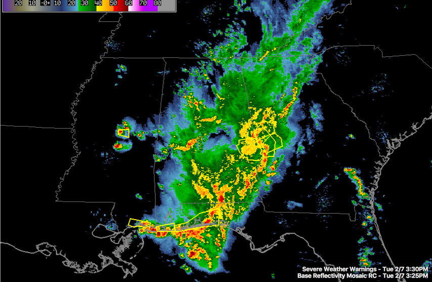
The main area of rain and storms is over South, Southeast and East Alabama at this hour.
for Lee County expired.
Another batch extends from Walker and Jefferson Counties through Bibb into Perry and Marengo Counties. This activity trails back into Mississippi. A couple of the storms over Central Mississippi have prompted severe thunderstorm warnings for large hail thanks to colder air aloft coming with the trough.
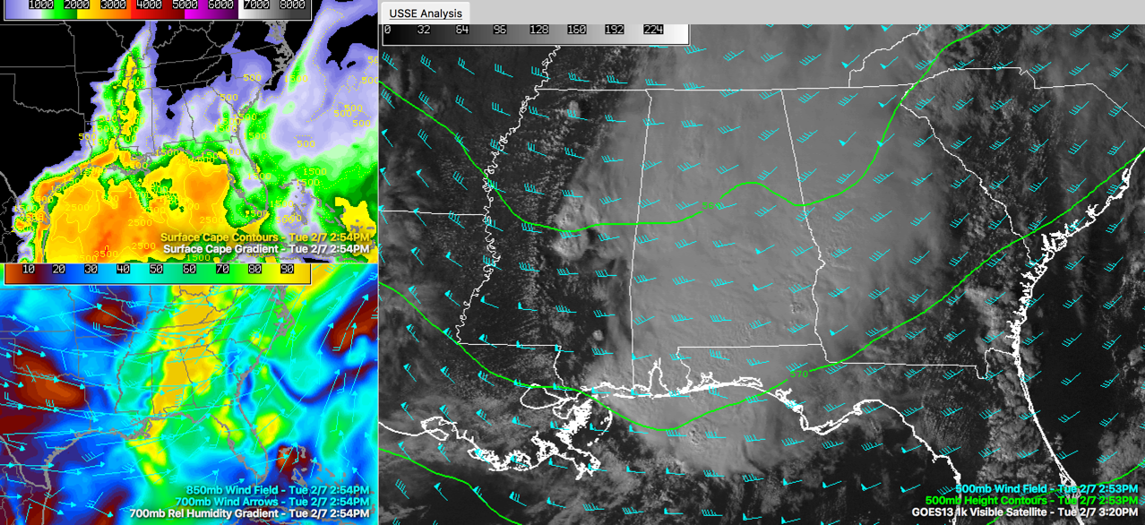
The storms over Mississippi have become more scattered and are not as strong as drier air moves in as well. Skies have actually cleared over much of Central Mississippi as you can see in the visible satellite image in the graphic. I have overlaid the upper level heights on that part of the image as well so you can see the trough to our west.
Across Central Alabama, storms will be strongest for the next few hours in a zone from Sumter, Greene, Hale, Perry, Dallas and perhaps into Chilton and Bibb Counties.
To the south, a tornado watch continues for counties south of Choctaw, Clarke, Wilcox, Butler and Crenshaw Counties. Very intense thunderstorms are moving east across the western Florida Panhandle and extreme southeast Alabama. Strong storms are moving through Andalusia right now as well as the Dothan area.
A new severe thunderstorm watch has been issued for the eastern part of the Florida Panhandle including Panama City.
Category: Alabama's Weather
About the Author (Author Profile)
Bill Murray is the President of The Weather Factory. He is the site's official weather historian and a weekend forecaster. He also anchors the site's severe weather coverage. Bill Murray is the proud holder of National Weather Association Digital Seal #0001 @wxhistorianSubscribe
If you enjoyed this article, subscribe to receive more just like it.


