Some High Clouds Over Central Alabama At Midday, Overall Nice Weather
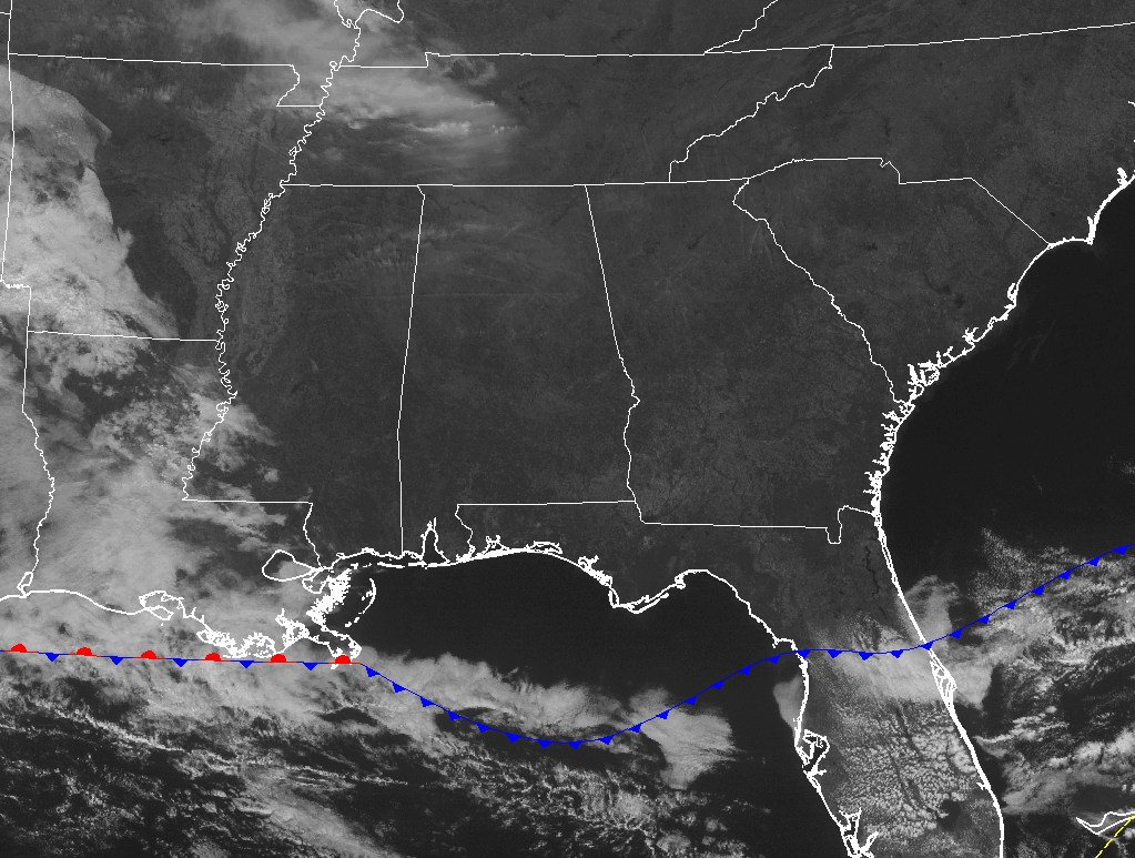
Only for a few high thin clouds, the skies across Central Alabama at the midday hour are sunny and clear. The clouds are so thin that they are hard to see on the visible satellite image. Temperatures are warming up nicely at this time, as daytime highs will be slightly above average for this time of the year. Skies will remain mostly clear to sunny for the remainder of the daylight hours, and afternoon highs will top out in the upper 50s to the upper 60s across the area. For this evening and into the overnight hours, skies will remain mostly clear. Lows will dip down into the mid 30s to the lower 40s throughout the area.
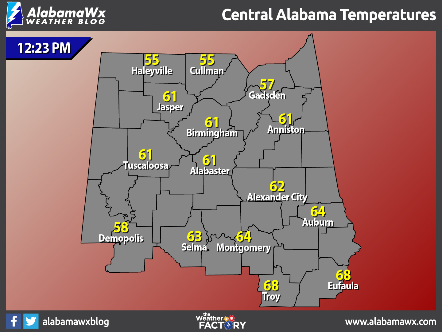
Temperatures Across Central Alabama
At 12:23 PM, temperatures are ranging from the mid 50s to the upper 60s across the area. The warm spots are currently Eufaula and Troy at 68º. The cool spots are Cullman and Haleyville at 55º.
Birmingham’s Climatology And Records
The normal high for February 13th is 58º, while the normal low is 37º. The record high for today was set back in 1962 at 83º degrees. The record low was set back in 1899 at -10º degrees.
Another Beautiful Day On Tuesday Before Storms Move In For The Evening
Skies will be mostly clear throughout most of the day on Tuesday, but a shortwave along with a surface low and a warm front will bring rain and possible thunderstorms during the late night hours on Tuesday and the pre-dawn hours on Wednesday. The latest run of the NAM-4k shows showers and storms pushing into the western locations sometime after 9PM and lasting through the early afternoon hours on Wednesday.
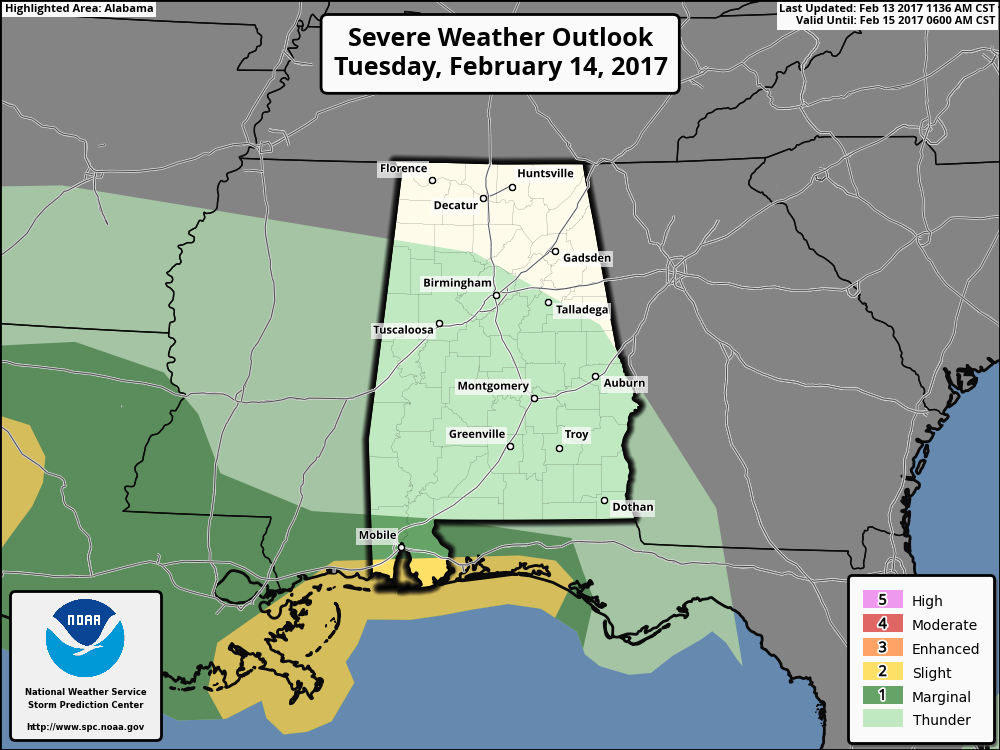
No severe storms expected for Central Alabama, but the Gulf Coast region is currently under a slight risk for severe storms for tomorrow, especially for tomorrow night through Wednesday morning. Afternoon highs on Tuesday will be in the lower 60s to the mid 70s across the area.
What To Expect At The Beach
Mostly sunny skies from today throughout the day on Tuesday, with a decent chance of showers and thunderstorms for Tuesday night through the daytime hours on Wednesday. Mainly sunny skies can be expected for Thursday through the weekend. Highs will be in the 60s throughout the week and weekend. Click here to see the Beach Forecast Center page.
National Extremes
The warmest high temperature set for the nation on Sunday afternoon was 91º, set in three different locations in Texas. The coldest low temperature for this morning was -9º, set in Big Piney, Wyoming. The highest precipitation total for the 24 hour period starting at 12PM Sunday to 12PM today was 1.90 inches at Augusta, Georgia.
On This Day In Weather History: 1885
The “Friday the 13th” avalanche at Alva, UT, killed sixteen persons, and left thirteen others buried for twelve hours before being rescued.
Follow The Blog On Social Media
Remember that we are also on Facebook and on Twitter.
WeatherBrains
To hear the latest of the weekly netcast that’s all about weather featuring many familiar voices, including our meteorologists at ABC 33/40, you can listen anytime on the web at Weatherbrains.com, or on iTunes.
Category: Alabama's Weather
About the Author (Author Profile)
Scott Martin is an operational meteorologist, professional graphic artist, musician, husband, and father. Not only is Scott a member of the National Weather Association, but he is also the Central Alabama Chapter of the NWA president. Scott is also the co-founder of Racecast Weather, which provides forecasts for many racing series across the USA. He also supplies forecasts for the BassMaster Elite Series events including the BassMaster Classic.Subscribe
If you enjoyed this article, subscribe to receive more just like it.


