Latest Mesoscale Discussion from the SPC

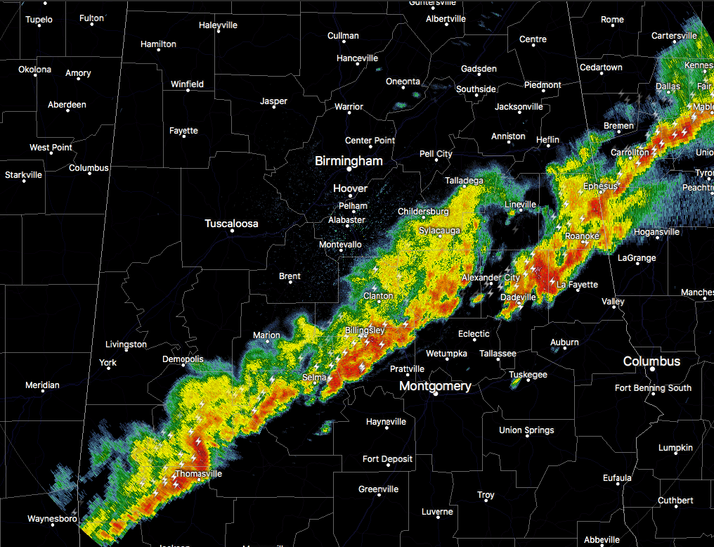
The threat for much of Central Alabama is over, but a Severe Thunderstorm Watch remains in effect for the southern parts of the area until 9:00PM tonight.
There is still a risk for strong to severe storms possible just ahead of the cold front as it continues to move through the area. Main risks continue to be from damaging straight-line thunderstorm winds and hail, but these risk will diminish with time.
The risk should lessen due to the loss of the daytime heating, and gradual stabilization of the atmosphere starts to occur over the next several hours. However, the environment currently remains supportive of an isolated severe risk. Stronger, organized cells continue to persist within the broader band of convection just ahead of the front.
Category: ALL POSTS, Severe Weather
About the Author (Author Profile)
Scott Martin is an operational meteorologist, professional graphic artist, musician, husband, and father. Not only is Scott a member of the National Weather Association, but he is also the Central Alabama Chapter of the NWA president. Scott is also the co-founder of Racecast Weather, which provides forecasts for many racing series across the USA. He also supplies forecasts for the BassMaster Elite Series events including the BassMaster Classic.Subscribe
If you enjoyed this article, subscribe to receive more just like it.


