A Quick Look At Friday Night’s Weather Across Central Alabama At 9PM
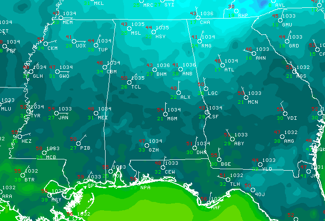
At 8:40PM, temperatures were ranging in the lower 40s to the mid 50s across Central Alabama as we are starting to head towards are overnight lows on early Saturday morning. Here is your forecast for tonight through the next 7 days…
Another chilly night is expected across Central Alabama tonight, as a surface high will move out of the Ohio Valley and into the Appalachians. Winds will slow from the daytime speeds, but they will not go completely calm and these northeasterly winds will make those overnight temperatures feel a few degrees cooler. Skies will be clear, and overnight lows will dip down into the upper 20s to the mid 30s. Wind chill values will run 2-5 degrees cooler, as winds will be out of the northeast at 2-5 MPH.
For the start of the weekend… clear, cobalt blue skies and maximum sunshine will grace Central Alabama on Saturday. A few clouds may stray across the skies during the afternoon hours, but skies will be mostly clear. Afternoon highs will be in the lower to mid 60s across the area. Skies will be mostly clear for most of the evening hours, but more clouds move in during the overnight hours. Lows will be in the mid 30s to the lower 40s.
A surface low will develop over Texas during the day on Saturday, and will start to move closer to Central Alabama on Sunday, bringing with it mostly cloudy skies. This system will be moisture-starved and will be weakening as it arrives later on Sunday, and conditions will remain dry. Afternoon highs will be in the mid to upper 60s across the area, and lows will be in the upper 40s to the lower 50s.
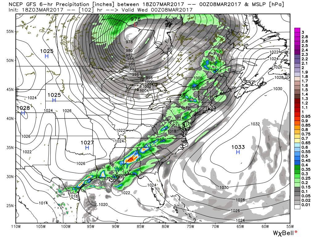
GFS Look At 6PM Tuesday Evening
For the start of the new work week, Monday will feature a mix of sun and clouds, and will be mild and breezy. Highs will be in the upper 60s to the mid 70s. A cold front will approach the area and move through on Tuesday, bringing with it our next chance of showers and thunderstorms. With the associated low being well to our north, this system will lack the instability and dynamics to support a severe weather situation; however, a strong, gusty thunderstorm is possible. Latest model runs have the front dragging a little in timing, and keeping the passage held off until early Wednesday. Highs on Tuesday will be in the upper 60s to mid 70s. Rain amounts will be in the 1/2 to 1 inch range.
After the front passes, drier conditions move in across the area, and we’ll make a return to more seasonable temperatures thanks to a surface high building in the southeast. Skies will be mostly sunny on Wednesday through Friday, and highs mainly in the mid to upper 60s with a few lower 70s possible.
Category: Alabama's Weather, ALL POSTS
About the Author (Author Profile)
Scott Martin is an operational meteorologist, professional graphic artist, musician, husband, and father. Not only is Scott a member of the National Weather Association, but he is also the Central Alabama Chapter of the NWA president. Scott is also the co-founder of Racecast Weather, which provides forecasts for many racing series across the USA. He also supplies forecasts for the BassMaster Elite Series events including the BassMaster Classic.Subscribe
If you enjoyed this article, subscribe to receive more just like it.


