A Mix Of Sun And Clouds At Midday, Just Hang On To Your Hat
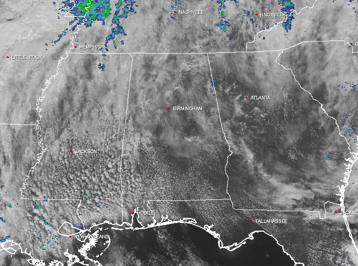
Latest Look At Our Weather At Midday
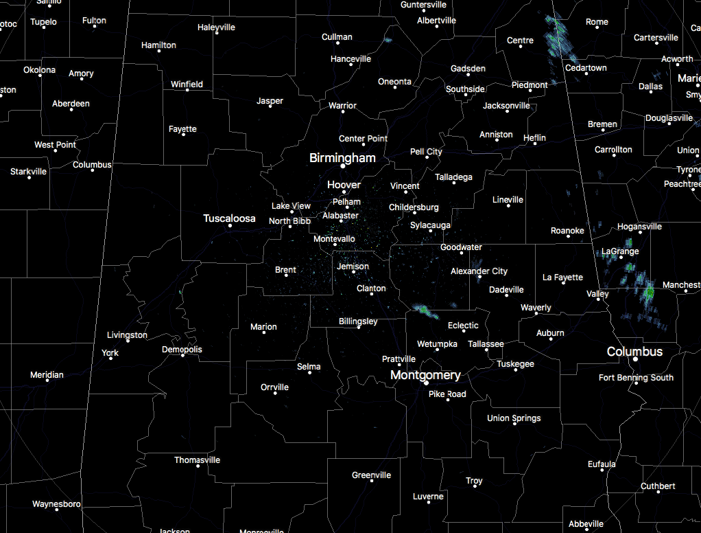
It’s a mix of sun and clouds across Central Alabama at this midday hour, with not much activity currently showing up on radar. There are a few reflectivities showing up in the northeastern corner of the area just east of Cedar Bluff and over Gaylesville. There is a pretty good chance that these may not be making it to the ground, but it would be light in nature if they were. I’m sure it’s the same situation down in the northwestern part of Elmore County, where another reflectivity is currently showing up.
One thing that you will notice is that it is a pretty nice day outside overall, if you don’t mind the clouds and the gusty winds. Those have been averaging around 10 MPH out of the south-southeast, but gusting up to 20 MPH at times. Temperatures are quite mild as well outside, so your lunch break will be quite enjoyable if you’re heading out and about.
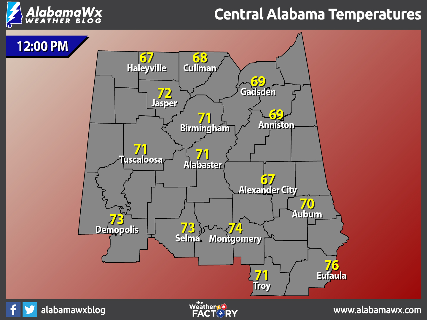
Temperatures Across Central Alabama
Temperatures are currently ranging from the upper 60s across the northern parts of the area, to the lower to mid 70s in the south. The warm spot is currently Eufaula at 76ºF, while the cool spots are Alexander City and Haleyville at 67ºF.
Average Temperatures And Records For March 6
Average daytime high for Birmingham for today is 64ºF, while the average low is 40ºF. The record high was set back in 1974 when the mercury hit an impressive 83ºF. The record low was recorded at 19ºF back in 1960.
For The Remainder Of Your Monday Across Central Alabama
Skies will generally be mostly cloudy across Central Alabama throughout the remainder of the day, with a small chance of a shower or two over the western locations of the area. A few breaks in the clouds will allow some sun to make it through, and with a south-southwesterly flow across the area, afternoon highs should have no problem reaching the low to mid 70s. Any rain that does fall will be well under 1/10th of an inch. Rain chances will start to increase during the overnight hours, especially for areas what of I-65, while the rest of the area will remain dry with mainly cloudy skies. Lows will drop into the mid to upper 50s across Central Alabama.
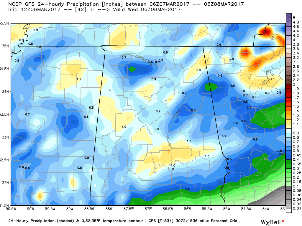
GFS Estimated Rainfall Totals for the day on Tuesday.
Storms Likely On Tuesday But Severe Threat Is Very Low
A few strong thunderstorms with some gusty winds will be possible over parts of Central Alabama during the afternoon hours on Tuesday, as a cold front pushes into the area from the northwest and makes its way to the southeast. As of now, the squall line associated with the front will have a positive tilt, meaning that it will not be conducive to damaging winds. We will have the instability values that would support severe weather, but with weak overall shear and the dynamic support well off to our north, a threat for severe storms will be low. With that being said, rainfall amounts could total 1/2 to 1 inch across much of the area. Highs will be in the mid 60s to the upper 70s across Central Alabama.
What To Expect At The Beach
For a detailed look at the weather from Fort Morgan over to Panama City Beach, click here to see our Beach Forecast Center page. Save Up To 25% on Spring Break Beach Vacations on the Alabama Gulf Coast with Brett/Robinson! The Beach Forecast is partially underwritten by the support of Brett/Robinson Vacation Rentals in Gulf Shores and Orange Beach. Click here to see Brett/Robinson’s best beach offers now!
Today In Weather History: March 6, 1954
Florida received its greatest modern-day snowfall of record, with 4.0 inches at the Milton Experimental Station. Pensacola FL equalled their 24-hour record with 2.1 inches of snow.
WeatherBrains
Tonight’s WeatherBrains kicks off a month of blockbuster guests as the Director of the Storm Prediction Center, Dr. Russ Schneider, climbs in the hot seat for 45 minutes. Also going the “Brains” this week as a Guest Panelist is Jen Watson, from the Storm Freaks podcast. Jen is a Social Media Specialist and Meteorologist at the Weather Channel. She is a part of the Storm Freaks Front podcast. Some issues that will be on the table include consistency and collaboration between the messages of the SPC and local forecast offices, recent changes at the center and new and improved products on the horizon. The threat of governmental cutbacks and other factors affecting the National Weather Service will be discussed as well. You can catch this week’s show on these outlets:
James Spann 24/7 channel on cable or over the air on the dot 2 feed
Big Brains Media website
WeatherBrains website
Subscribe to the podcast on iTunes
The Blog Is On Social Media
@AlabamaWxBlog on Facebook
@AlabamaWxBlog on Twitter
Want To Advertise on The Alabama Wx Weather Blog
Deliver your message to a highly engaged audience by advertising on the newly reformatted AlabamaWX.com website. The site enjoyed 10.2 MILLION page views in the past 12 months. Don’t miss out! We can customize a creative, flexible and affordable package that will suit your organization’s needs. Contact Bill Murray at (205) 687-0782.
Category: Alabama's Weather, ALL POSTS
About the Author (Author Profile)
Scott Martin is an operational meteorologist, professional graphic artist, musician, husband, and father. Not only is Scott a member of the National Weather Association, but he is also the Central Alabama Chapter of the NWA president. Scott is also the co-founder of Racecast Weather, which provides forecasts for many racing series across the USA. He also supplies forecasts for the BassMaster Elite Series events including the BassMaster Classic.Subscribe
If you enjoyed this article, subscribe to receive more just like it.


