A Nice Soaking Rain Ending, Another One This Weekend
Well, all in all a successful day here as far as Alabama’s weather goes. A low end severe weather threat didn’t materialize. Four severe thunderstorm warnings but no severe weather reports in the state.
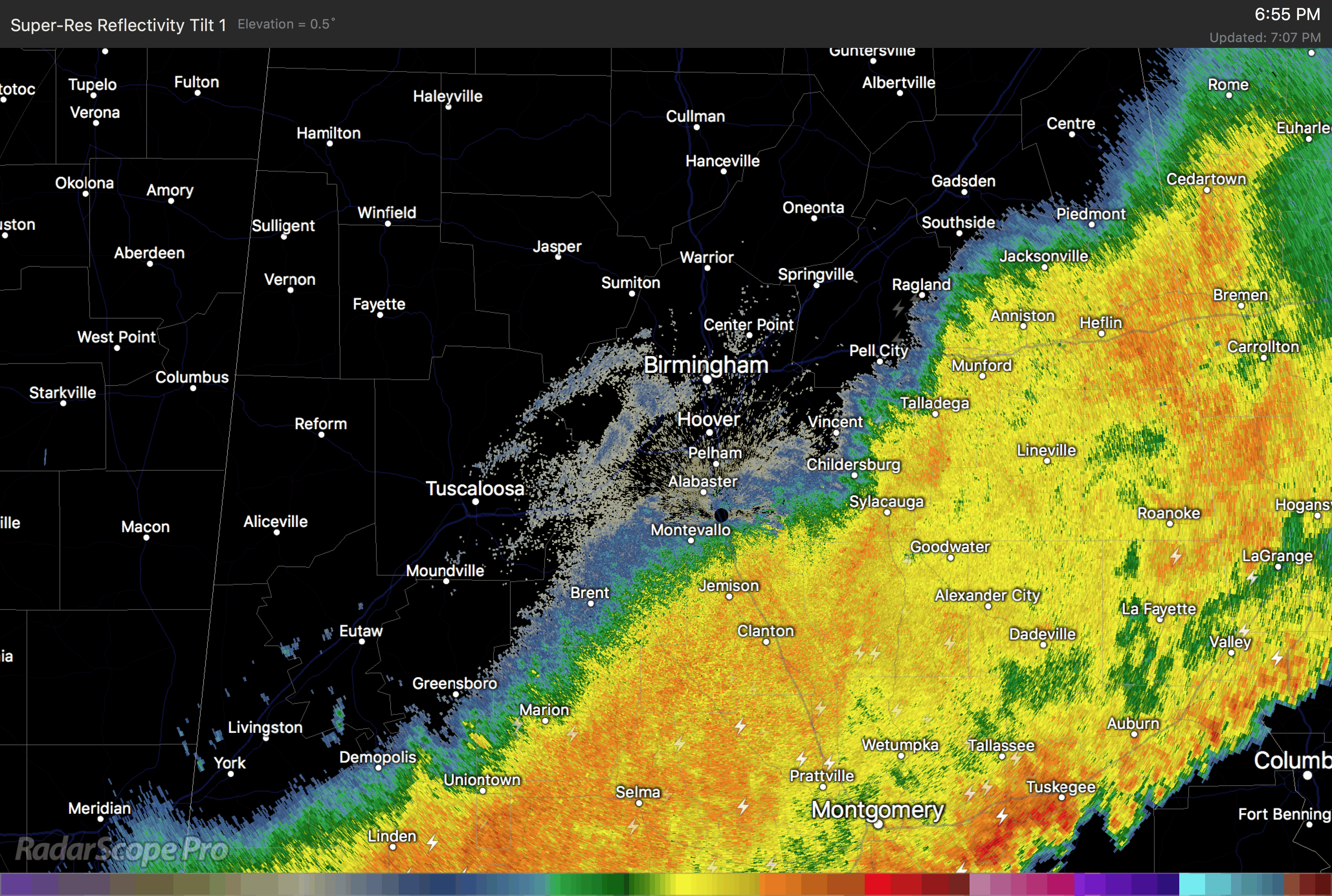
The leading edge of our line of storms extends from near Auburn to Sprague to Greenville to Monroeville to Citronelle. Behind the initial storms, there is about a 70 mile wide band of rain with embedded thunder.
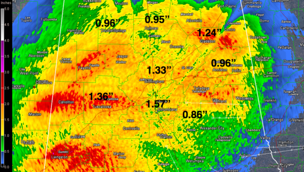
So most folks have seen a steady rain with rumbles of thunder for about three hours this afternoon and evening. Rainfall amounts are generally finishing up between one and one and one half inches. Just what the doctor ordered for the area where the drought is the worst right now.
Another soaking rain is due Saturday and Saturday night.
Here are rainfall amounts at some stations through 6:45 p.m. along with the storm total accumulations from Doppler radar.
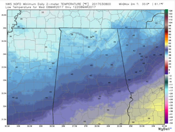
The rain will continue pushing southeastward through the evening. Lows by morning will look like this according to the NWS NDFD forecast:
Highs tomorrow will be near 70F across most of the area, except for some middle and upper 60s over Northeast Alabama.
Category: Alabama's Weather, ALL POSTS
About the Author (Author Profile)
Bill Murray is the President of The Weather Factory. He is the site's official weather historian and a weekend forecaster. He also anchors the site's severe weather coverage. Bill Murray is the proud holder of National Weather Association Digital Seal #0001 @wxhistorianSubscribe
If you enjoyed this article, subscribe to receive more just like it.


