A Quick Mid-Evening Update To Our Weather Situation
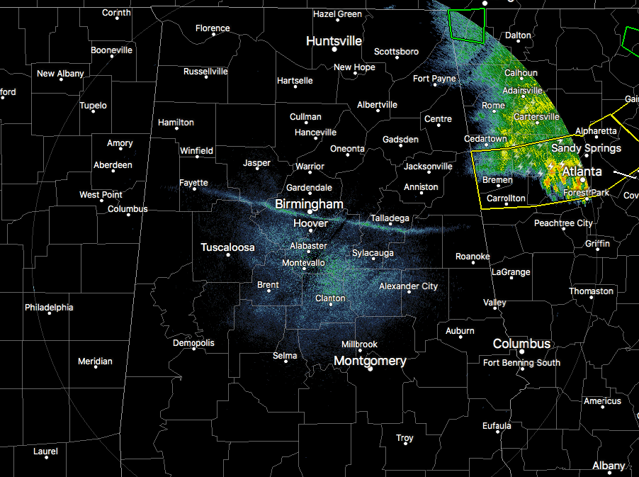
As you can see by the radar image, all of the rain activity has now pushed out of the state and well into Georgia, where several Severe Thunderstorm Warnings are in effect. The severe weather threat for North/Central Alabama has come to an end, but we will still have a small risk for showers to redevelop to our northwest, but weaken as they approach and move in to the area during the early morning hours. A few claps of thunder and maybe some small hail could be possible with these, but should not reach severe limits.
Skies will generally be mostly clear across much of the area tonight, but will begin to cloud over during the overnight and pre-dawn hours. Lows will only drop down into the mid to upper 50s.
Wednesday will feature a mix of sun and clouds, and a surface front will have moved through much of the area and will be stalling out in the southern portions of Central Alabama. There will be very little support and limited moisture, so and showers will be few and far between. Afternoon highs will fall back into the mid 60s to the upper 70s across North and Central Alabama, with a few spots possibly hitting 80 degrees in the extreme southern portions of the area.
Back to the warmth felt across Central Alabama today, both Anniston and Tuscaloosa set new record highs. Tuscaloosa made it to 88º, resetting the previous record of 85º set back in 1952. Anniston set a new record high at 86º, breaking the previous record of 83º set back in 1966.
Category: Alabama's Weather, ALL POSTS
About the Author (Author Profile)
Scott Martin is an operational meteorologist, professional graphic artist, musician, husband, and father. Not only is Scott a member of the National Weather Association, but he is also the Central Alabama Chapter of the NWA president. Scott is also the co-founder of Racecast Weather, which provides forecasts for many racing series across the USA. He also supplies forecasts for the BassMaster Elite Series events including the BassMaster Classic.Subscribe
If you enjoyed this article, subscribe to receive more just like it.


