

Severe Thunderstorm Warning Expired For Parts Of Limestone And Madison Counties
…THE SEVERE THUNDERSTORM WARNING FOR NORTHWESTERN MADISON AND
SOUTHEASTERN LIMESTONE COUNTIES WILL EXPIRE AT 515 PM CDT…
The storm which prompted the warning has weakened below severe
limits, and no longer pose an immediate threat to life or property.
Therefore, the warning will be allowed to expire. However small hail
is still possible with this thunderstorm.
A severe thunderstorm watch remains in effect until 900 PM CDT for
north central, northeastern and northwestern Alabama.
Severe Thunderstorm Warning Issued For Parts Of Limestone And Madison Counties Until 5:15PM
Mar 27th @ 4:51 pm
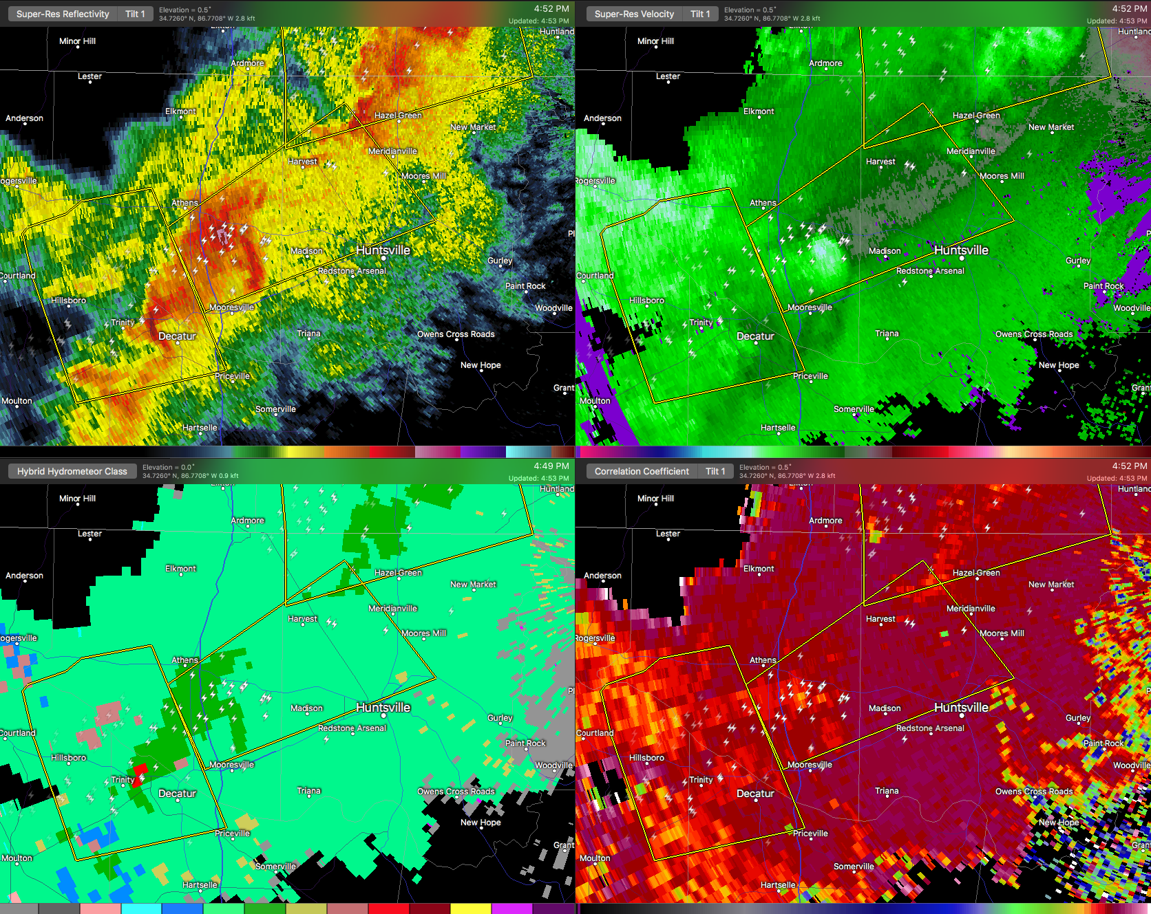

The National Weather Service in Huntsville Alabama has issued a
* Severe Thunderstorm Warning for…
Northwestern Madison County in north central Alabama…
Southeastern Limestone County in north central Alabama…
* Until 515 PM CDT
* At 450 PM CDT, a severe thunderstorm was located near Tanner, or near Athens, moving northeast at 35 mph.
HAZARD…60 mph wind gusts and quarter size hail.
SOURCE…Radar indicated.
IMPACT…Hail damage to vehicles is expected. Expect wind damage to roofs, siding, and trees.
* Locations impacted include…
Northern Huntsville, Madison, Athens, Meridianville, Alabama A And
M University, University Of Alabama In Huntsville, Harvest, Tanner, Belle Mina and French Mill.
Category: ALL POSTS, Archived Warnings
About the Author (Author Profile)
Subscribe
If you enjoyed this article, subscribe to receive more just like it.


