

Severe Thunderstorm Warning For Parts Of Jefferson County Has Expired

…A SEVERE THUNDERSTORM WARNING REMAINS IN EFFECT UNTIL 800 PM CDT FOR EAST CENTRAL JEFFERSON COUNTY… At 737 PM CDT, a severe thunderstorm was located over eastern Birmingham, moving northeast at 45 mph.
HAZARD…60 mph wind gusts and quarter size hail.
SOURCE…Radar indicated.
IMPACT…Hail damage to vehicles is expected. Expect wind damage to roofs, siding, and trees. Locations impacted include… Birmingham, Vestavia Hills, Homewood, Mountain Brook, Trussville, Gardendale, Irondale, Leeds, Moody, Fultondale, Center Point, Clay, Pinson, Tarrant, Ketona Lakes, B.j.c.c., Chalkville, Kingston, Five Points South and Grayson Valley.
Severe Thunderstorm Warning Issued For Parts Of Jefferson County Until 8:00PM
Mar 27th @ 7:23 pm
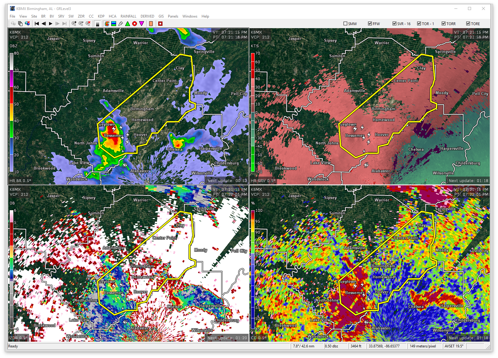

The National Weather Service in Birmingham has issued a
* Severe Thunderstorm Warning for…
Southeastern Jefferson County in Alabama…
* Until 800 PM CDT
* At 722 PM CDT, a severe thunderstorm was located over Brighton, or near Hueytown, moving northeast at 45 mph.
HAZARD…60 mph wind gusts and quarter size hail.
SOURCE…Radar indicated.
IMPACT…Hail damage to vehicles is expected. Expect wind damage to roofs, siding, and trees.
* Locations impacted include…
Birmingham, Hoover, Vestavia Hills, Bessemer, Homewood, Mountain
Brook, Trussville, Hueytown, Gardendale, Irondale, Leeds, Moody, Fairfield, Fultondale, Center Point, Pleasant Grove, Clay, Pinson, Tarrant and Midfield.
Category: ALL POSTS, Archived Warnings
About the Author (Author Profile)
Subscribe
If you enjoyed this article, subscribe to receive more just like it.


