

Severe Thunderstorm Warning Continues For Parts Of Colbert And Franklin Counties Until 10:00PM
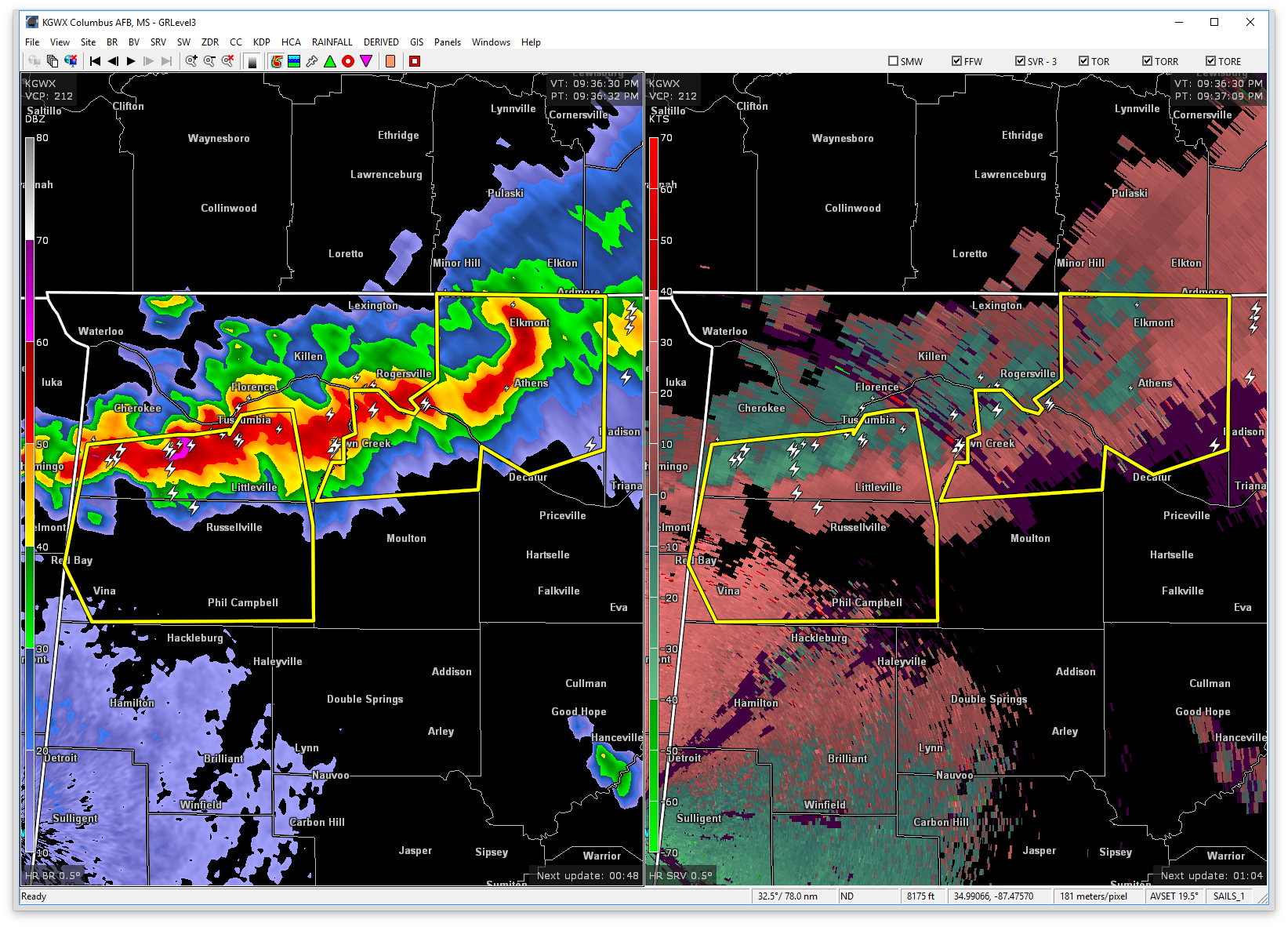

…A SEVERE THUNDERSTORM WARNING REMAINS IN EFFECT UNTIL 1000 PM CDT FOR SOUTHERN COLBERT AND FRANKLIN COUNTIES… At 937 PM CDT, a severe thunderstorm was located 9 miles southeast of Cherokee, or 10 miles southwest of Tuscumbia, moving southeast at 15 mph.
HAZARD…60 mph wind gusts and quarter size hail.
SOURCE…Radar indicated. Nickel sized hail has been reported with this storm. And trees were reported down earlier near Cherokee.
IMPACT…Hail damage to vehicles is expected. Expect wind damage to roofs, siding, and trees. Locations impacted include… Muscle Shoals, Russellville, Sheffield, Tuscumbia, Red Bay, Phil Campbell, Littleville, Belgreen, Vina and Hodges.
Severe Thunderstorm Warning Issued For Parts Of Colbert And Franklin Counties Until 10:00PM
Mar 27th @ 9:21 pm

The National Weather Service in Huntsville Alabama has issued a
* Severe Thunderstorm Warning for…
Colbert County in northwestern Alabama…
Franklin County in northwestern Alabama…
* Until 1000 PM CDT
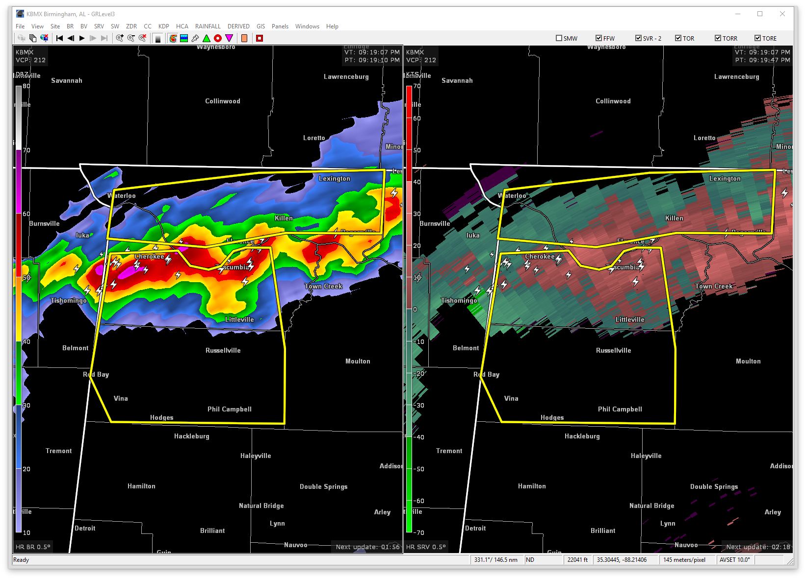
* At 920 PM CDT, severe thunderstorms were located along a line extending from near Midway to near Muscle Shoals, moving southeast at 45 mph.
HAZARD…60 mph wind gusts and quarter size hail.
SOURCE…Radar indicated.
IMPACT…Hail damage to vehicles is expected. Expect wind damage to roofs, siding, and trees.
* Locations impacted include…
Muscle Shoals, Russellville, Sheffield, Tuscumbia, Red Bay, Phil
Campbell, Cherokee, Littleville, Belgreen and Vina.
Category: ALL POSTS, Archived Warnings
About the Author (Author Profile)
Subscribe
If you enjoyed this article, subscribe to receive more just like it.


