Strong Storm Approaching Talladega & St. Clair Counties
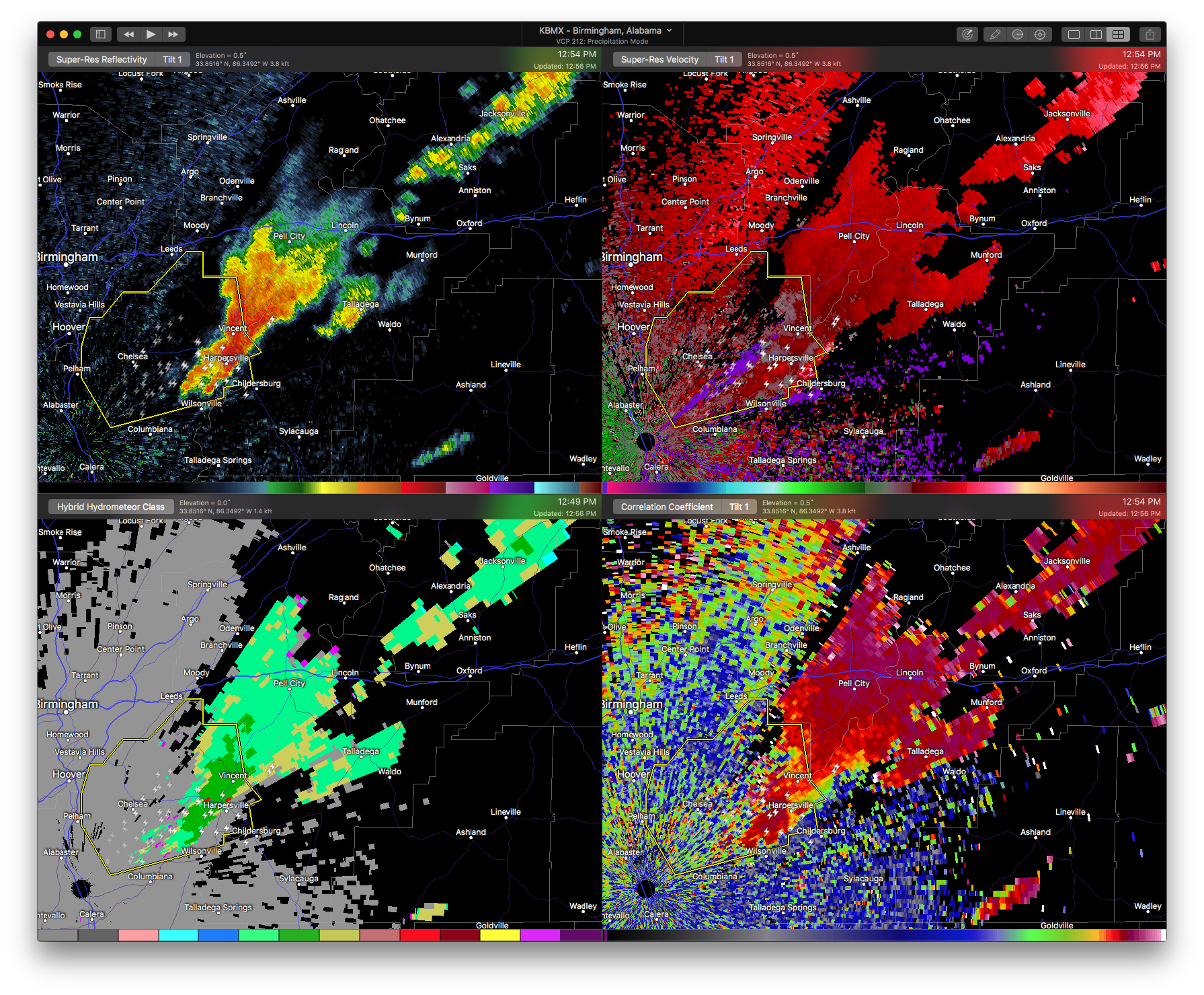
At 1252 PM CDT, a strong thunderstorm was located near Westover, or near Wilsonville, moving northeast at 50 mph. Dime size hail and winds in excess of 40 mph will be possible with this storm.
Locations impacted include Oxford, Talladega, Pell City, Childersburg, Lincoln, Vincent, Munford, Waldo, Grant Town, Alpine Bay Resort, Winterboro, Alpine, Talladega Superspeedway, Honda Manufacturing Of Alabama, Coosa Island, Logan Martin Dam, Talladega Municipal Airport, Country Club Estates, Eastaboga and Camp Mac.
Frequent cloud to ground lightning is occurring with this storm. Lightning can strike 10 miles away from a thunderstorm. Seek a safe shelter inside a building or vehicle.
Category: ALL POSTS
About the Author (Author Profile)
Scott Martin is an operational meteorologist, professional graphic artist, musician, husband, and father. Not only is Scott a member of the National Weather Association, but he is also the Central Alabama Chapter of the NWA president. Scott is also the co-founder of Racecast Weather, which provides forecasts for many racing series across the USA. He also supplies forecasts for the BassMaster Elite Series events including the BassMaster Classic.Subscribe
If you enjoyed this article, subscribe to receive more just like it.


