The Warm & Dry Pattern Continues At Midday
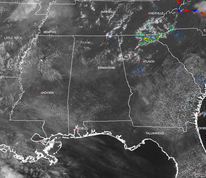
SUMMER PREVIEW CONTINUES ACROSS CENTRAL ALABAMA
After breaking the old record high of 86, on Thursday, that was set back in 1981 by reaching 88 degrees, I guess you can say we are clearly getting a preview of summertime. At the midday hour, it is another warm and dry day across Central Alabama, with mostly clear skies across the area. Even though we will have some cirrus clouds floating overhead throughout the remainder of the day, we will remain dry. Dewpoints will remain in the low to mid 50s, making our afternoon highs in the mid to upper 80s not feel all that bad. We could flirt with the record high again today (89 degrees, set back in 1981).
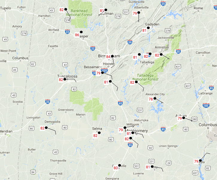
TEMPERATURES ACROSS CENTRAL ALABAMA AT 12:35 PM
At the midday hour, temperatures are up in the upper 70s to the mid 80s already across the area. The warm spot is currently Birmingham at 84 degrees, with the cool spot being Alexander City at 78 degrees (so I really wouldn’t call that cool).
WEATHER FOR SATURDAY AND EASTER SUNDAY
This pattern of possible record-breaking heat, along with partly to mostly sunny days with fair and pleasant nights, will continue throughout Sunday. The ridge in control of our pattern will remain in place, and we should stay free of any rain. Afternoon highs will be in the 80s across Central Alabama, with lows in the upper 50s to the lower 60s.
A QUICK LOOK AT NEXT WEEK
We will have a small risk for showers moving in from the north with a sagging surface front on Monday. Those rain chances will be best for the northern half of Central Alabama, and will continue into the day on Tuesday for the extreme northern locations in the area. Rainfall amounts will be light… just enough to knock the pollen and dust down for a little bit. Warm and dry conditions can be expected throughout the remainder of the work week.
A VOODOO LAND LOOK AT NEXT WEEKEND
Looks like ridging over the southeast will break down for the weekend of the April 22nd-23rd, and this will introduce a little better chance of showers and storms mainly for Saturday evening into Sunday morning.
BEACH FORECAST
Click here to see the Beach Forecast Center page. Save Up To 25% on Spring Break Beach Vacations on the Alabama Gulf Coast with Brett/Robinson! The Beach Forecast is partially underwritten by the support of Brett/Robinson Vacation Rentals in Gulf Shores and Orange Beach. Click here to see Brett/Robinson’s best beach offers now!
ON THIS DAY IN WEATHER HISTORY – April 14, 1886
A devastating tornado, 800 yards in width at times, cut a twenty mile path through Saint Cloud MN killing 74 persons. The bottom of the Mississippi River was said to have been seen during the tornado’s crossing. Eleven persons were killed at a wedding party near the town of Rice.
WEATHERBRAINS
Don’t forget you can listen to the weekly 90 minute netcast anytime on the web, or on iTunes. This is the show all about weather featuring many familiar voices, including meteorologists at ABC 33/40. Shows are usually produced on Monday evenings starting at 8:30 CDT… you can watch it live here.
ADVERTISE WITH US
Deliver your message to a highly engaged audience by advertising on the AlabamaWX.com website. Nearly two million pages views just since April 1st! Don’t miss out! We can customize a creative, flexible and affordable package that will suit your organization’s needs. Contact Bill Murray at (205) 687-0782 for more information.
Category: Alabama's Weather, ALL POSTS
About the Author (Author Profile)
Scott Martin is an operational meteorologist, professional graphic artist, musician, husband, and father. Not only is Scott a member of the National Weather Association, but he is also the Central Alabama Chapter of the NWA president. Scott is also the co-founder of Racecast Weather, which provides forecasts for many racing series across the USA. He also supplies forecasts for the BassMaster Elite Series events including the BassMaster Classic.Subscribe
If you enjoyed this article, subscribe to receive more just like it.


