Strong Storms Affecting Portions of Etowah and Cherokee Counties
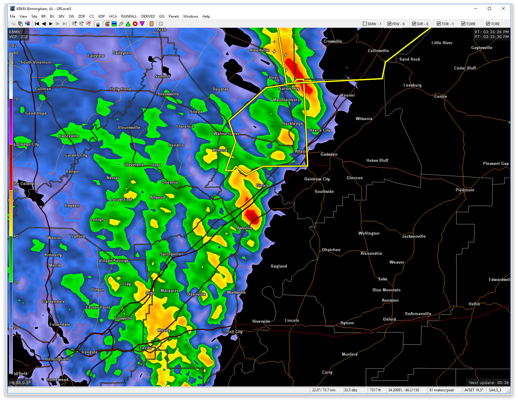
At 3:35 PM CDT, Doppler radar was tracking strong thunderstorms along a line extending from near Albertville to Reece City. Movement was northeast at 30 mph. Wind gusts up to 50 mph will be possible with these storms.
A SIGNIFICANT WEATHER ADVISORY has been issued for North/Central Etowah and West/Central Cherokee counties until 4:15PM.
Locations impacted include…
Leesburg, Reece City, Sand Rock, Tabor Road, Cherokee Rock Village, Black Creek, Crudup, Yellow Creek Falls and Keener.
Torrential rainfall is also occurring with these storms, and may lead to localized flooding. Do not drive your vehicle through flooded roadways.
Category: ALL POSTS
About the Author (Author Profile)
Scott Martin is an operational meteorologist, professional graphic artist, musician, husband, and father. Not only is Scott a member of the National Weather Association, but he is also the Central Alabama Chapter of the NWA president. Scott is also the co-founder of Racecast Weather, which provides forecasts for many racing series across the USA. He also supplies forecasts for the BassMaster Elite Series events including the BassMaster Classic.Subscribe
If you enjoyed this article, subscribe to receive more just like it.


