

A Quick Update On Our Weather Situation At 6:30PM
RADAR CHECK
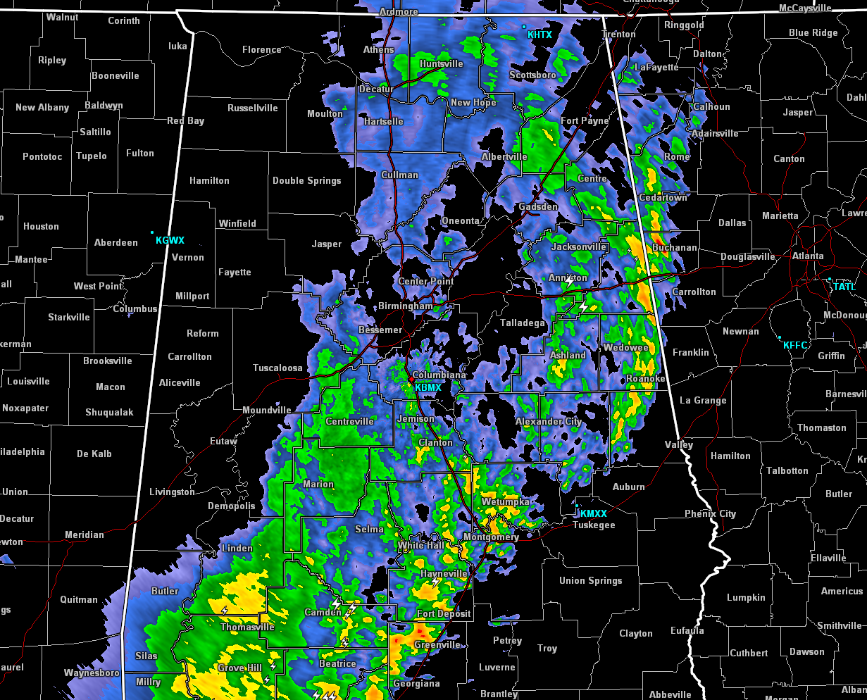
At this point on Sunday evening, the line of showers and storms is now starting to move out of the northeastern Part of Alabama into the northwestern part of Georgia. The line now stretches from Forney in eastern Cherokee County, through Wedowee and Tennant in Randolph County, curving back to the southwest through Montgomery and Fort Deposit in Lowndes County, and back into southwestern Alabama. The only warning in effect within the state is a severe thunderstorm warning for the extreme southern parts of Escambia and northeastern parts of Baldwin county until 6:30PM.
Looking at the latest conditions across the state, instability values have pretty much dropped to zero behind the line of storms, and the severe weather threat is over for locations to the west of the line. Ahead of the line, conditions ahead of the line are only marginally unstable at best. CAPE values are running in the 500-1000 J/kg, with helicity values only topping out in the 50 m2/s2 range in the southeastern locations. Temperatures are currently still running in the 80s ahead of the line, with dewpoints in the upper 60s. A few strong thunderstorms are possible, but the risk for any organized severe storm formation looks to be low at this point.
Some of the storms on the southern end of the line back to the southwest into the Florida panhandle and into Baldwin and Escambia counties may make their way into Pike and Barbour counties, and these will be the ones that will have the better risk for stronger to severe storms. Gusty winds will be the main risk, but an isolated spin up tornado is not out of the question, so don’t let your guard down as of yet.
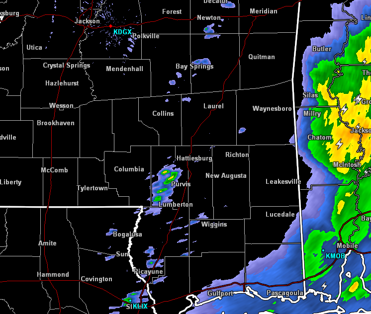
There are a few showers developing back behind the main line of storms back into southeastern Mississippi, and these have the possibility of developing into a line that would affect Central Alabama, but the severe threat from these are nearly zero.
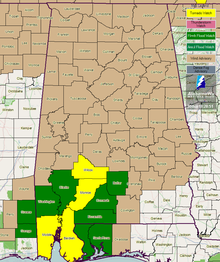
All counties in the Central Alabama area have been removed from the Tornado Watch that was scheduled to expire at 7:00PM. Only a few counties back into southern parts of the state remain in a Tornado watch until 7:00PM, along with a Flash Flood Watch in effect for much of the southwestern corner of the state until 7:00AM.
Category: Alabama's Weather, ALL POSTS
About the Author (Author Profile)
Scott Martin is an operational meteorologist, professional graphic artist, musician, husband, and father. Not only is Scott a member of the National Weather Association, but he is also the Central Alabama Chapter of the NWA president. Scott is also the co-founder of Racecast Weather, which provides forecasts for many racing series across the USA. He also supplies forecasts for the BassMaster Elite Series events including the BassMaster Classic.Subscribe
If you enjoyed this article, subscribe to receive more just like it.


