Upon Further Review….
As we I have stated here many times this week, there is little skill in forecasting a cold core snow event like this here in Alabama. Now that the heavy snow band is being established, we will need to make some adjustments to the early morning package presented here earlier. It sure seems like the heaviest snow band will be father to the south.
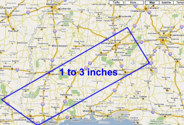
SOUTHWARD ADJUSTMENT: Based on radar trends and the banding pattern that is setting up over Louisiana and South Mississippi, we are now going to forecast the best chance of 1 to 3 inches of snow on grassy areas southward:
Somewhere in that area, a small band of heavier snow is possible. And, in that band, the snow could come down heavy enough for the snow to stick on road surfaces, even with temperatures that are slightly above freezing. Still most road surfaces will remain wet and widespread travel issues are not expected, other than wet roads.
Stay tuned… more to come as this early December winter storm continues to develop…
Category: Uncategorized


