A Quick Central Alabama Weather Update At 9:30PM
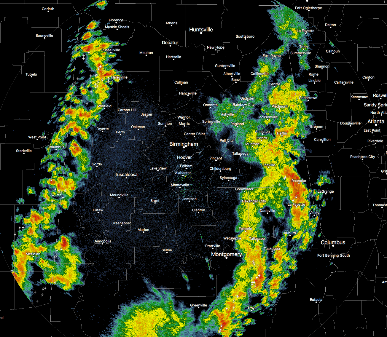
The latest check of the radar has a the main line of showers and storms continuing to push off into extreme eastern parts of the state, with a few heavier storms… one stretching from Wadley to Auburn, and another stretching from Luverne to Dozier. Hurtsboro will be receiving its first rain of the day within a few minutes, while locations in Barbour County are still waiting for their first drops of the day.
Our focus can start to shift back to the west as a line of showers and storms has developed rather quickly and is moving into the western portions of Central Alabama, with one strong storm which has warranted a Significant Weather Advisory to be issued until 10:00PM for Sumter County. This line is currently stretching from Waterloo and Cherokee up in northwestern Alabama back to the south-southwest through Hackleburg and Hamilton, down through Sulligent and Vernon, and ending over York and Livingston, before exiting the state back into Mississippi. Most of these storms are now elevated, but some small hail and gusty winds are possible with this line.
NWS Birmingham will be extending the Wind Advisory beyond 10PM for Central Alabama for the wake low behind the main rain shield. It will go until 7:00AM Monday morning, or until the passage of the front.
Category: Alabama's Weather, ALL POSTS
About the Author (Author Profile)
Scott Martin is an operational meteorologist, professional graphic artist, musician, husband, and father. Not only is Scott a member of the National Weather Association, but he is also the Central Alabama Chapter of the NWA president. Scott is also the co-founder of Racecast Weather, which provides forecasts for many racing series across the USA. He also supplies forecasts for the BassMaster Elite Series events including the BassMaster Classic.Subscribe
If you enjoyed this article, subscribe to receive more just like it.


