

Sunny And A Little Breezy Across Central Alabama At Midday

Looking at the visible satellite image of the state at the 1PM hour, we have clear skies across nearly the entire state, with the exception of a few clouds in the northern part of the state. And with these clear skies, that means that there is no rain in our area… for now, anyway. Up to the north in central and eastern Tennessee, a weak short wave is rotating around the backside of the trough that brought the colder temperatures to us yesterday. There is an area of rain along that boundary and is expected to move into the northern portions of the state in just a couple of hours.
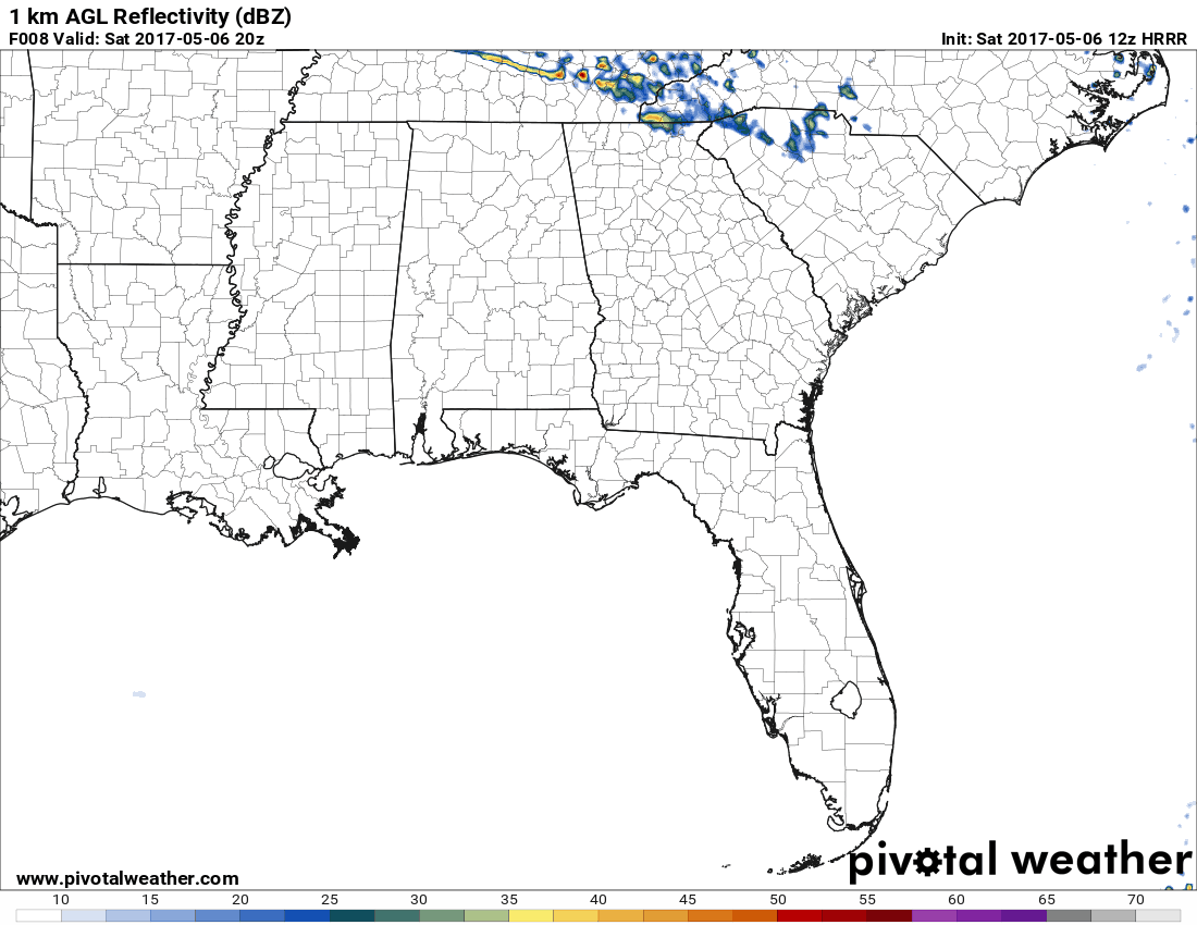
The latest HRRR model run has the rain activity moving into the northern part of the state around the 4PM hour and growing until we lose the heating of the day, then the line starts to dissipate. The best chances of showers or a few storms will be in the northern parts of Alabama, especially the northeastern corner. Those chances decrease as the short wave moves into the northern parts of Central Alabama this evening, and showers should be completely dissipated by the time it reaches just below the I-20 corridor.

SPC does have the northeast corner of the state, mainly east of Huntsville, in a marginal risk for severe storms today. Even though moisture and instability will be quite limited, sufficient vertical shear and a strong wind field may allow a storm or two to strengthen enough to have damaging winds and some hail.
In Central Alabama, we’ll have mostly clear to sunny skies for the remainder of the afternoon, with afternoon highs reaching the mid to upper 70s across the area. For tonight, there will be a small risk of showers for the northeastern parts of the area, with a little higher risk in the extreme northeastern locations. The rest of the area should remain dry with mostly clear skies. Overnight lows will be in the upper 40s to the mid 50s across the area.
CHAMBER OF COMMERCE WEATHER ON SUNDAY
Sunday is going to be an absolutely beautiful day across Central Alabama, especially if you are heading out to Talladega to watch the big race out at the track. Skies will be sunny throughout the entire day, and afternoon highs will reach the mid 70s to the lower 80s across the area. Winds will be out of the north at 5-10 MPH, and with lower humidity levels, those temperatures will feel rather comfortable. A clear, star-filled sky, can be expected tomorrow night, and overnight lows will be in the mid 40s to the lower 50s.
WE WARM UP WITH CALM WEATHER THROUGHOUT MUCH OF THE WEEK
Central Alabama will get to enjoy a nice stretch of calm weather throughout much of the work week, and temperatures will be on a warming trend. Sunny skies and fair nights can be expected from Monday through Wednesday, and highs starting off in the upper 70s to the mid 80s, to the mid and upper 80s by Wednesday. Clouds will start to build in during the day on Thursday, before showers and thunderstorms move in for Thursday evening and through Friday. It is too early to tell if severe weather will be an issue, but the latest GFS is showing surface-based CAPE values in the 1000-2000 J/kg range, so it will bear watching this week.
BEACHBOUND
If you would like to see what the weather holds for Ft. Morgan over to Panama City Beach, click here to see the Beach Forecast Center page. Save Up To 25% on Spring Break Beach Vacations on the Alabama Gulf Coast with Brett/Robinson! The Beach Forecast is partially underwritten by the support of Brett/Robinson Vacation Rentals in Gulf Shores and Orange Beach. Click here to see Brett/Robinson’s best beach offers now!
THIS DAY IN WEATHER HISTORY – May 6, 1975
A massive tornado hit Omaha, NE, killing three persons, injuring 133 others, and causing 150 million dollars damage. The tornado struck during the late afternoon moving northeastward through the industrial and residential areas of west central Omaha, and lifting over the northern section of the city. The twister, which cut a swath ten miles long and as much as a quarter of a mile wide, was the mostly costly in U.S. history up til that time.
Category: Alabama's Weather, ALL POSTS
About the Author (Author Profile)
Scott Martin is an operational meteorologist, professional graphic artist, musician, husband, and father. Not only is Scott a member of the National Weather Association, but he is also the Central Alabama Chapter of the NWA president. Scott is also the co-founder of Racecast Weather, which provides forecasts for many racing series across the USA. He also supplies forecasts for the BassMaster Elite Series events including the BassMaster Classic.Subscribe
If you enjoyed this article, subscribe to receive more just like it.


