

A Gorgeous May Day in Alabama
This is Hurricane Awareness Week in Alabama and in other states along the Gulf and Atlantic coasts. The National Hurricane Center will be focusing on hurricane preparedness along the East Coast of the US with stops by the NOAA P3 hurricane hunter aircraft. The 2017 hurricane season in the Atlantic Basin begins on June 1.

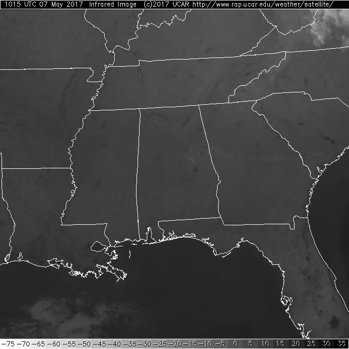
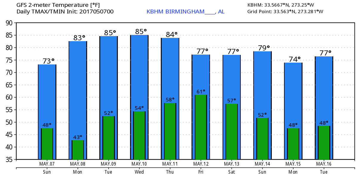
The day begins in Alabama with clear skies which cover all of the Southeast US. Temperatures are cool but not quite as chilly as Saturday morning with readings in the lower 50s. Plenty of sunshine today will see the afternoon highs climb into the middle 70s, still a few degrees below the 30-year averages for this time of year.
The weather will be good for Central Alabama all the way through Wednesday. An upper ridge will be making its way across the eastern half of the country, so I expect to see our highs increase with highs in the 80s Monday through Wednesday.
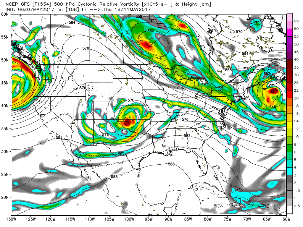
Wednesday we begin to watch a strong upper trough and closed low kick eastward out of the Four Corners area of the Southwest US. The upper trough will weaken as it moves across the Mississippi River on Friday bringing rain to Central Alabama possibly as early as Thursday evening. SPC has included in their outlooks for Days 4 and 5 the potential for severe weather in parts of Oklahoma and North Texas on Day 4 (Wednesday) and parts of Arkansas, northern Louisiana, Southeast Oklahoma, and Northeast Texas for Day 5 (Thursday). It will be warm on Thursday with highs in the middle 80s as clouds increase.
A surface low will move eastward from the Texas Panhandle on Thursday to North Alabama on Friday and off the North Carolina coast on Saturday. The upper flow turns northwesterly after the passage of the upper trough on Saturday so you can expect to temperatures for next weekend to drop back a little into the 70s for Saturday and Sunday and both promise to be dry.
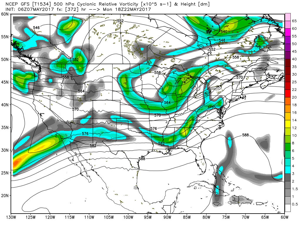
Looking into voodoo country, the GFS is not nearly as bullish on the upper ridge as it was yesterday. The GFS holds a deep trough over the East Coast through the 18th of May. The pattern then transitions from the deep trough to a rather strong upper ridge by the 20th of May. At the end of the period the pattern is fairly noisy with several short waves traversing the Continental US.
If you would like to see what the weather holds for the beaches from Ft. Morgan to Panama City Beach, click here to see the Beach Forecast Center page. Save Up To 25% on Spring Break Beach Vacations on the Alabama Gulf Coast with Brett/Robinson! The Beach Forecast is partially underwritten by the support of Brett/Robinson Vacation Rentals in Gulf Shores and Orange Beach. Click here to see Brett/Robinson’s best beach offers now!
James Spann will have the next Weather Xtreme Video here on Monday morning. I hope you enjoy the great weather for this Sunday. Godspeed.
-Brian-
Category: Alabama's Weather, ALL POSTS
About the Author (Author Profile)
Brian Peters is one of the television meteorologists at ABC3340 in Birmingham and a retired NWS Warning Coordination Meteorologist. He handles the weekend Weather Xtreme Videos and forecast discussion and is the Webmaster for the popular WeatherBrains podcast.Subscribe
If you enjoyed this article, subscribe to receive more just like it.


