Satellite Sheldon’s Latest Take On Our Weather Pattern
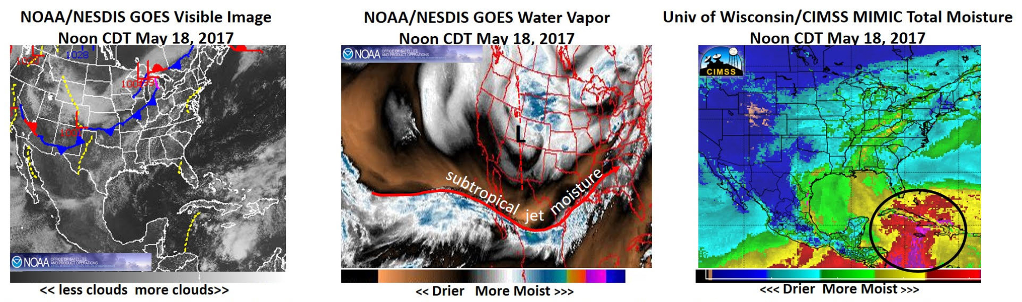
The last significant rainfall most of us have seen was a few weeks ago in late April or early May. The satellite visible image at the far left continued to show mostly quiet weather over Alabama this afternoon as most of the severe and flooding weather will continue to be confined closer to a frontal system well west and northwest of us. But, there was enough moisture, both in the upper level as seen by the middle satellite image and the low levels by the far right image, to allow for a few stray showers through Saturday, but definitely NOTHING significant.
So, when will we all get a chance for some significant rainfall? Maybe on Sunday and especially Sunday afternoon into night as that front (on far left satellite image) in the middle of the country and developing strong comma swirl through (middle image) now giving snow to parts of the Rockies gets closer to us. For significant rainfall (1-1.5″) to occur late in the weekend, we will need the help of the high moisture now in the Gulf of Mexico to get involved. For even higher amounts of over 1.5″, which are now NOT being forecasted, we will need the help of the extremely high moisture now in the western Caribbean (identified in the black circle on far right moisture image) to also get involved.
You can follow the moisture trends from the Gulf of Mexico and western Caribbean.
Category: Alabama's Weather, ALL POSTS
About the Author (Author Profile)
Scott Martin is an operational meteorologist, professional graphic artist, musician, husband, and father. Not only is Scott a member of the National Weather Association, but he is also the Central Alabama Chapter of the NWA president. Scott is also the co-founder of Racecast Weather, which provides forecasts for many racing series across the USA. He also supplies forecasts for the BassMaster Elite Series events including the BassMaster Classic.Subscribe
If you enjoyed this article, subscribe to receive more just like it.


