UPDATE: Strong Storm Affecting Pickens, Fayette, & Lamar Counties
UPDATE:
A SIGNIFICANT WEATHER ADVISORY FOR NORTHEASTERN PICKENS…WESTERN FAYETTE AND EASTERN LAMAR COUNTIES UNTIL 5:30 PM CDT
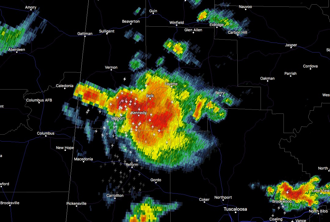
At 5:03 PM CDT, Doppler radar was tracking a strong thunderstorm over Kennedy, or near Millport, moving north at 35 mph. Pea size hail and winds in excess of 40 mph will be possible with this storm.
Locations impacted include…
Winfield, Fayette, Vernon, Sulligent, Millport, Glen Allen, Kennedy, Belk, Beaverton, Ashcraft Corner, Blooming Grove, Crews, Bluff, Lamar County Airport, Cody, Stone Wall, Wayside, Richard Arthur Field, Shaw and Bevill State College Fayette.
Frequent cloud to ground lightning is occurring with this storm. Lightning can strike 10 miles away from a thunderstorm. Seek a safe shelter inside a building or vehicle.
_______________________________________________________________
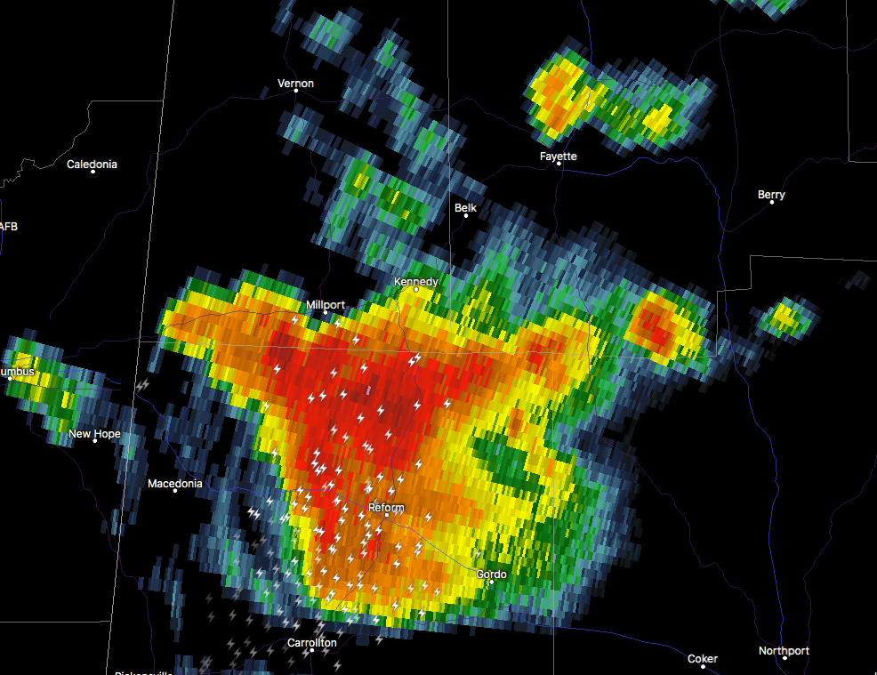
A strong thunderstorm is currently affecting the northern part of Pickens County, especially the locations of Gordo, Reform, and Carrollton. This storm is pushing to the north-northeast at close to 30 MPH. This storm is producing torrential rainfall along with dangerous cloud to ground lightning. Please seek shelter if you are indoors and wait until the storm passes before resuming any outdoor activities.
Locations that will be affected by this storm within the next 60 to 90 minutes are Kennedy, Belk, Fayette, Glen Allen, and Winfield.
About the Author (Author Profile)
Scott Martin is an operational meteorologist, professional graphic artist, musician, husband, and father. Not only is Scott a member of the National Weather Association, but he is also the Central Alabama Chapter of the NWA president. Scott is also the co-founder of Racecast Weather, which provides forecasts for many racing series across the USA. He also supplies forecasts for the BassMaster Elite Series events including the BassMaster Classic.Subscribe
If you enjoyed this article, subscribe to receive more just like it.


