

Muggy Air With Numerous Showers At Midday In Central Alabama
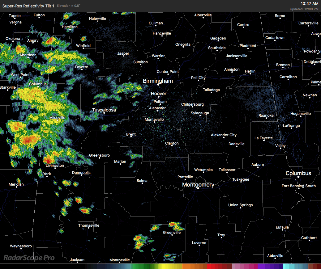
It’s warm and muggy across Central Alabama as we approach the midday hour on this first Friday of June. Radar is pretty active mainly on the western side of the area, especially with the shower activity that is crossing the state line. We also have a few showers and thunderstorms in the extreme southern parts of the area. All of the activity is slowly drifting to the northeast. If it’s not raining at your location at this point, skies are generally mostly cloudy.
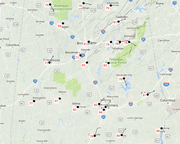
TEMPERATURES THROUGHOUT CENTRAL ALABAMA AT 11:50AM
It’s warm and muggy out there already, with current temperatures ranging from the mid 70s to the mid 80s throughout the area. Eufaula is the warm spot at 86 degrees, with Haleyville and Anniston as the cool spots at 75 degrees.
FOR THE REST OF TODAY
We’ll have a risk for scattered to numerous showers and thunderstorms throughout the remainder of the afternoon and early evening hours, with the better chances of those in the western half of the area. Otherwise, there will be more clouds than sun with the highs topping out in the lower to mid 80s. With the precipitable water values running high, rainfall amounts could be heavy, and some minor flash flooding could occur. Later tonight, there will be a few lingering showers or thunderstorms out there across the area, but most will have partly to mostly cloudy skies. Overnight lows will be in the mid to upper 60s.
SATURDAY’S WEATHER
This is nearly a “Wash and Repeat” forecast. With the warm and muggy pattern continuing across Central Alabama, we’ll have a risk of showers and thunderstorms mainly during the afternoon hours. Chances of rain will be greater the farther south you are in Central Alabama. Otherwise, there will be more clouds than sun, and afternoon highs will be in the mid to upper 80s across the area, with overnight lows in the upper 60s to the lower 70s.
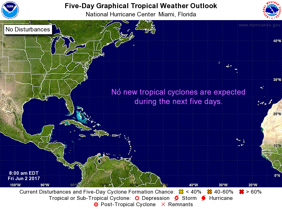
A LOOK AT THE TROPICS
All remains quiet and no tropical storms are expected to form within the next 5 days in the Atlantic or Gulf of Mexico. As far as the Pacific, Tropical Storm Beatriz has weakened into a remnant low. We’ll have to see what happens if this is able to hold together and moves into the Gulf. Will it develop into something?
HEADING TO THE BEACH
From now through Tuesday, there will be more clouds than sun at the beaches of Alabama and the Florida Panhandle, with a good chance of showers and Thunderstorms each day. Highs in the lower to mid 80s, with lows in the 70s. Click here to see the AlabamaWx Beach Forecast Center page.
The Beach Forecast is partially underwritten by the support of Brett/Robinson Vacation Rentals in Gulf Shores and Orange Beach. Click here to see Brett/Robinson’s Own Your Summer specials now!
WEATHERBRAINS
Don’t forget you can listen to our weekly 90 minute netcast anytime on the web, or on iTunes. This is the show all about weather featuring many familiar voices, including our meteorologists here at ABC 33/40. We will produce this week’s episode tonight at 8:30… you can watch it live here.
Category: Alabama's Weather, ALL POSTS
About the Author (Author Profile)
Scott Martin is an operational meteorologist, professional graphic artist, musician, husband, and father. Not only is Scott a member of the National Weather Association, but he is also the Central Alabama Chapter of the NWA president. Scott is also the co-founder of Racecast Weather, which provides forecasts for many racing series across the USA. He also supplies forecasts for the BassMaster Elite Series events including the BassMaster Classic.Subscribe
If you enjoyed this article, subscribe to receive more just like it.


