

Humid Air Mass through Midweek
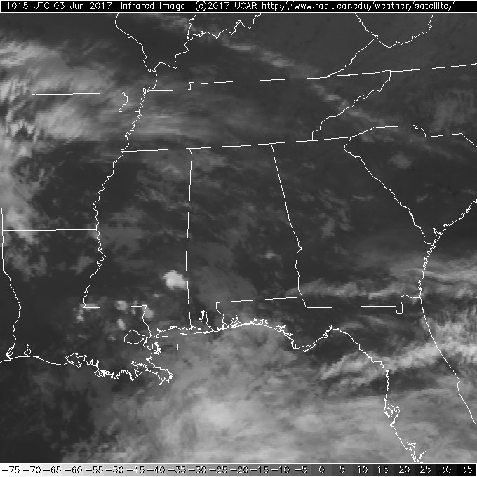
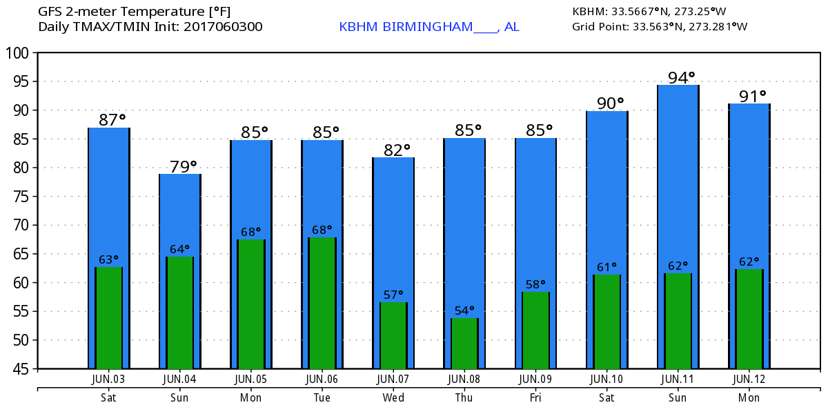
Dew points across North and Central Alabama remain in the 60s this morning, so we stay in a soupy, humid air mass which is not likely to change much until late Tuesday and Wednesday. That along with a trough located over Oklahoma and North Central Texas will keep the potential for showers and thunderstorms very high through Tuesday. Temperatures today will once again see the highs reach the lower and middle 80s with a combination of sunshine and clouds.
The upper low over North Central Texas will gradually move eastward over the next several days. In the meantime, we’ll be watching a strong upper closed low over the eastern Great Lakes area that will be sending a trough down across the eastern US. By Tuesday and Wednesday, the Texas trough and the eastern US trough will combine to sweep through the Southeast US bringing a welcome change to our air mass. Until then, you can expect to see highs in the 80s with showers and thunderstorms likely just about every day with the primary threat coming during the afternoon and evening hours.
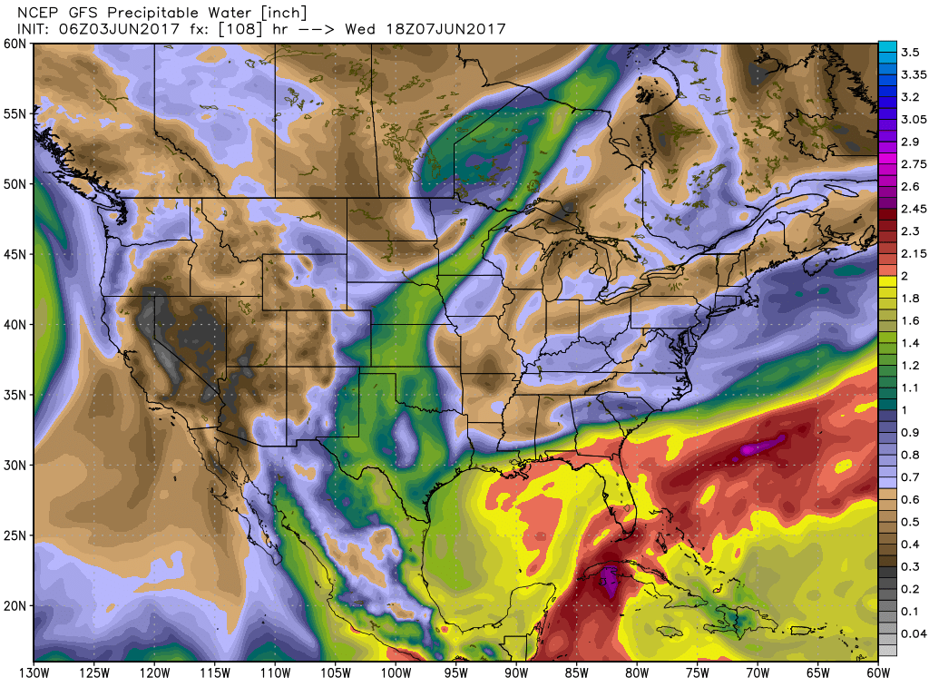
As the two upper troughs finally move on by on Wednesday, we will see an air mass change with precipitable water values finally dropping below 1 inch as a northwesterly flow ushers in drier and slightly cooler air at midweek. Highs Tuesday and Wednesday should be in the lower 80s.
We stay under the northwesterly flow through the end of the week as an upper ridge to our west gradually moves eastward and begins to warm things up. While dew points will remain down, the impact of the ridge will be to allow temperatures to warm up so that by next weekend we’ll be seeing highs edge pretty close to 90 degrees.
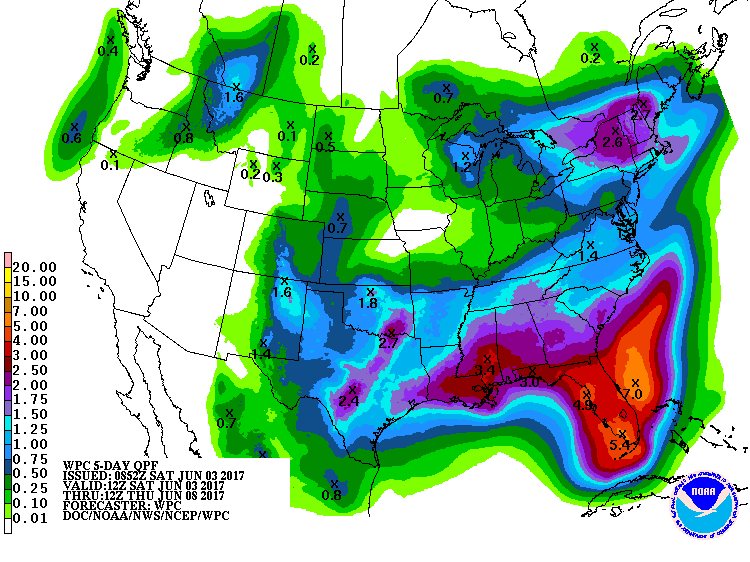
The rain over the last week or so has really helped to reduce drought conditions across Alabama. The latest drought monitor showed 88 percent of Alabama to be free of drought. Rainfall over the next few days through early Wednesday will be in the range of 1 to 2 inches for many locations which will continue to help keep drought conditions from returning. Not everyone sees those rainfall values since the rain will come in the form of showers.
We are officially into the 2017 hurricane season for the Atlantic Basin, and all remains quiet for now.
Looking out into voodoo country, the primary feature will be that of an upper ridge, so it looks like the main message is that the middle of June will be warm. For now, at least, it does not appear to be an excessive amount of heat.
Thanks for tuning into the Weather Xtreme Video today. I expect to have the next one posted first thing come Sunday morning. Enjoy your day, stay dry, and be mindful of any storms with lightning. Godspeed.
-Brian-
Category: Alabama's Weather, ALL POSTS
About the Author (Author Profile)
Brian Peters is one of the television meteorologists at ABC3340 in Birmingham and a retired NWS Warning Coordination Meteorologist. He handles the weekend Weather Xtreme Videos and forecast discussion and is the Webmaster for the popular WeatherBrains podcast.Subscribe
If you enjoyed this article, subscribe to receive more just like it.


