

Nice And Warm As We Approach Midday Across Central Alabama
CURRENTLY ACROSS CENTRAL ALABAMA
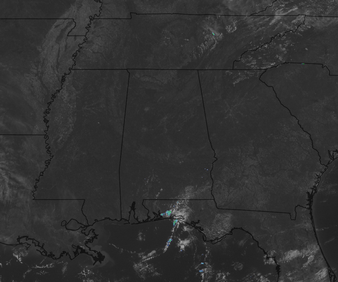
What a beautiful and warm day across Central Alabama at the 11 o’clock hour. Skies are mainly clear on the visible satellite image at this point, but we do have a few clouds that have developed overhead that are not showing up on satellite as of this point. Good news is that there is no rain in the area, as we have had our fill of it for a little bit, but it looks like rain chances will ramp back up as we enter into the next work week.
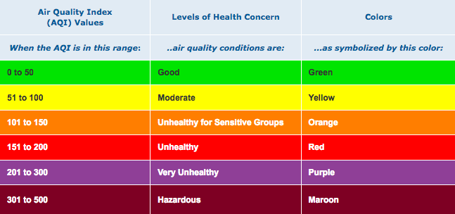
AIR QUALITY ALERT FOR TODAY
A code orange air quality alert for ozone as been issued for today due to Ozone forecasted to be 108. Conditions today are considered unhealthy for sensitive groups. Active children and adults, and people with lung disease, such as asthma, should reduce prolonged or heavy exertion outdoors.
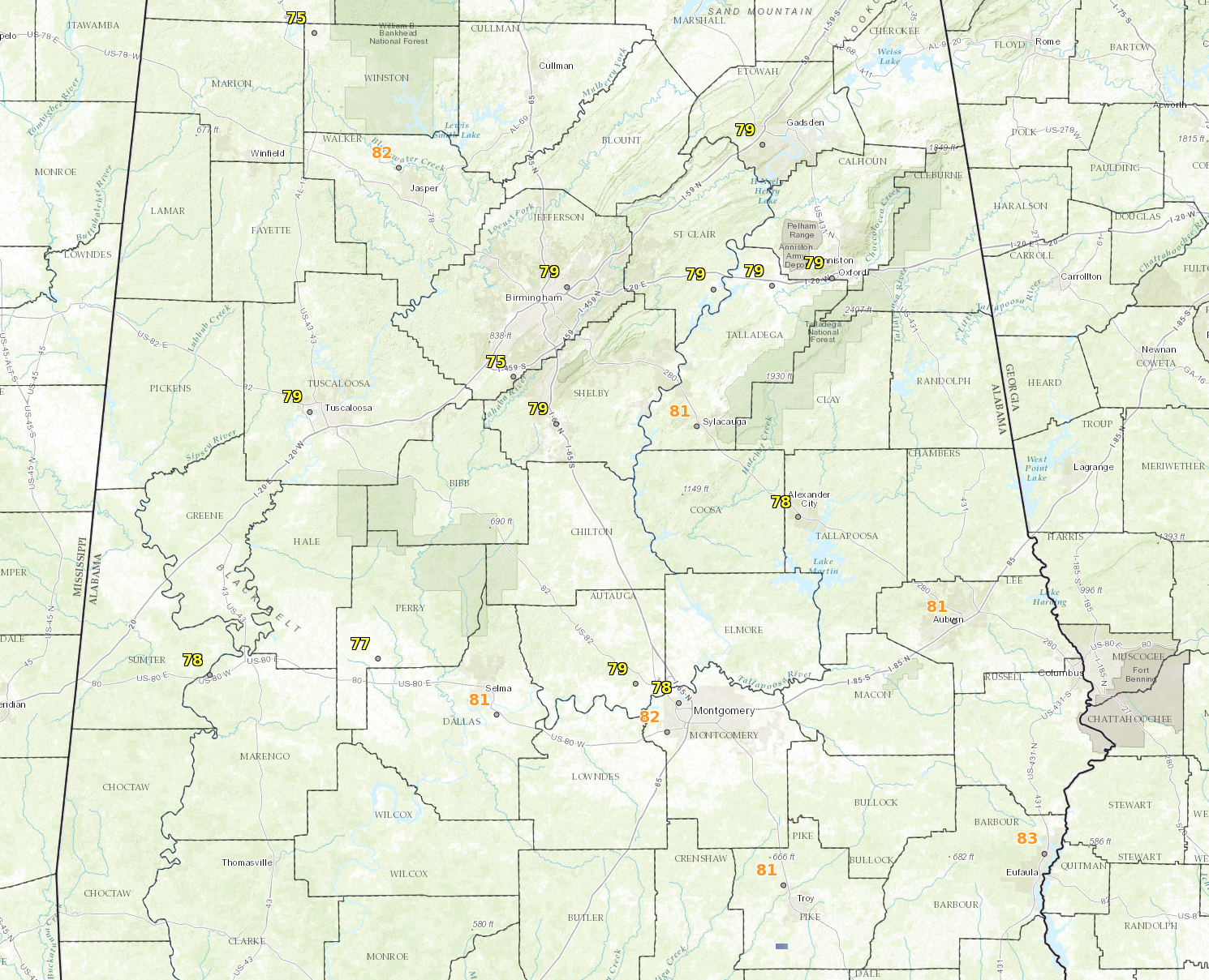
TEMPERATURES ACROSS CENTRAL ALABAMA AT 11:00AM
It is warming on up at the 11 o’clock hour, with temperatures already up in the mid 70s to the lower 80s throughout the area. As usual, the warm spot in the area is Eufaula at 83 degrees, with Bessemer and Haleyville tied as the cool spots at 75 degrees.
FOR THE REST OF TODAY
It will be a great a warm day across the area… Skies will be mostly clear throughout the remainder of the daytime hours, and afternoon highs will make it up into the mid to upper 80s for the most part, with some of the northern locations in the area staying in the lower 80s. Tonight will feature mostly clear to clear skies, with overnight lows in the upper 50s to the lower 60s.
A LOOK AT THE WEEKEND WEATHER
We will stay dry throughout the weekend for much of Central Alabama, but we do have a very small risk of an isolated afternoon shower or thunderstorm over the southern parts of the area on Sunday. Otherwise, we will have a mix of sun and clouds with temperatures nearing the “hot” category. Afternoon highs will be in the 85 to 91 degree range throughout the area, with lows in the upper 60s to the lower 70s.
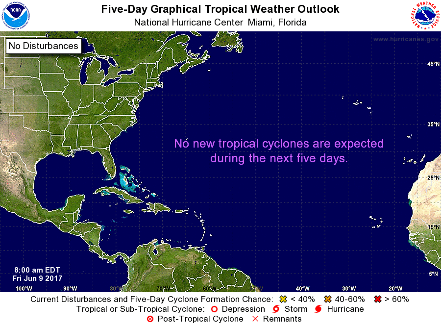
A LOOK AT THE TROPICS
All remains quiet and no tropical storms are expected to form within the next 5 days in the Atlantic Ocean, Caribbean Sea, or the Gulf of Mexico.
HEADING TO THE BEACH
Click here to see the AlabamaWx Beach Forecast Center page. The Beach Forecast is partially underwritten by the support of Brett/Robinson Vacation Rentals in Gulf Shores and Orange Beach. Click here to see Brett/Robinson’s Own Your Summer specials now!
TODAY IN WEATHER HISTORY – 1953
A tornado hit the town of Worcester MA killing ninety persons. The northeastern states usually remain free of destructive tornadoes, however in this case a low pressure system, responsible for producing severe thunderstorms in Michigan and Ohio the previous day, brought severe weather to New Hampshire and central Massachusetts. The tornado, up to a mile in width at times, tracked 46 miles through Worcester County. It mangled steel towers built to withstand winds of 375 mph. Debris from the tornado fell in the Boston area, and adjacent Atlantic Ocean.
WEATHERBRAINS
Don’t forget you can listen to our weekly 90 minute netcast anytime on the web, or on iTunes. This is the show all about weather featuring many familiar voices, including our meteorologists here at ABC 33/40. We will produce this week’s episode tonight at 8:30… you can watch it live here.
Category: Alabama's Weather, ALL POSTS
About the Author (Author Profile)
Scott Martin is an operational meteorologist, professional graphic artist, musician, husband, and father. Not only is Scott a member of the National Weather Association, but he is also the Central Alabama Chapter of the NWA president. Scott is also the co-founder of Racecast Weather, which provides forecasts for many racing series across the USA. He also supplies forecasts for the BassMaster Elite Series events including the BassMaster Classic.Subscribe
If you enjoyed this article, subscribe to receive more just like it.


