

Sunday Afternoon Update
Not a bad looking Sunday afternoon in progress across Central Alabama with a good supply of sunshine and warm temperatures in the middle 80s, heading for the upper 80s for daytime highs.
The humidity has returned, with dewpoints near 70F across the central part of the state.
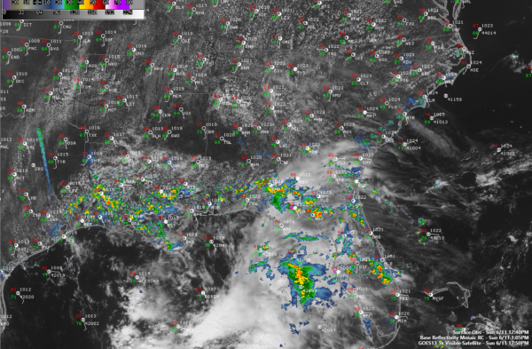
A healthy field of cumulus has developed in areas along and north of US-78, and some of those clouds have gotten some vertical development, and showers and storms may develop soon in this area. These storms could have gusty winds with them, along with lightning and brief heavy rain, but severe weather is not a real threat.
To the south, storms are lifting through South Alabama along the seabreeze front. These storms will make it into South Central Alabama by early evening, but should weaken before they reach the US-80 Corridor around 8-9 p.m.
Rain chances should increase tomorrow as deeper moisture to the south surges northward. This moisture will set the stage the rest of the week for elevated rain chances. The best chances may come Thursday and Friday as a front tries to settle in here from the north.
Looked out at the end of the morning run of the GFS to see what it was doing with the potential tropical system in the Gulf. This run takes a weaker system into southern Mexico. This reduces the total rainfall amount expected here to around two inches.
The 7 day forecast has been tweaked and posted. Now we will be watching the radar for the rest of the afternoon.
Category: Alabama's Weather, ALL POSTS
About the Author (Author Profile)
Bill Murray is the President of The Weather Factory. He is the site's official weather historian and a weekend forecaster. He also anchors the site's severe weather coverage. Bill Murray is the proud holder of National Weather Association Digital Seal #0001 @wxhistorianSubscribe
If you enjoyed this article, subscribe to receive more just like it.


