Possible Tornado Near Apalachicola, FL From PTC3
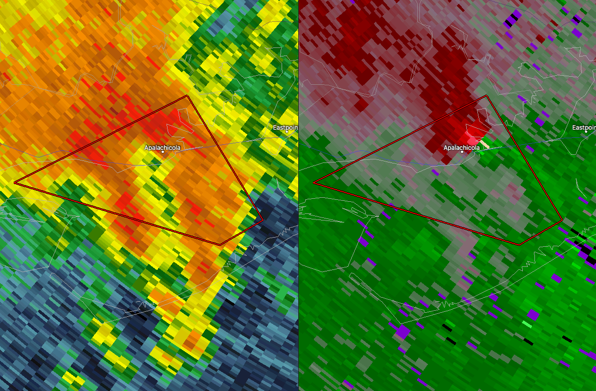
One of the feeder bands spawned off of Potential Tropical Cyclone Three is currently affecting the Florida Panhandle, and a possible tornado has formed near Apalachicola and is moving to the northwest. Here is the warning text from NWS Tallahassee…
BULLETIN – EAS ACTIVATION REQUESTED
Tornado Warning
National Weather Service Tallahassee FL
1044 AM EDT TUE JUN 20 2017
The National Weather Service in Tallahassee has issued a
* Tornado Warning for…
East central Gulf County in the Panhandle of Florida…
Northwestern Franklin County in Big Bend of Florida…
* Until 1130 AM EDT/1030 AM CDT/
* At 1043 AM EDT/943 AM CDT/, a severe thunderstorm capable of
producing a tornado was located near Apalachicola, moving northwest
at 20 mph.
HAZARD…Tornado.
SOURCE…Radar indicated rotation.
IMPACT…Flying debris will be dangerous to those caught without
shelter. Mobile homes will be damaged or destroyed.
Damage to roofs, windows, and vehicles will occur. Tree
damage is likely.
* This tornadic thunderstorm will affect Apalachicola and then
remain over mainly rural areas of east central Gulf and
northwestern Franklin Counties, including the following locations:
Howard Creek and Bay City.
PRECAUTIONARY/PREPAREDNESS ACTIONS…
TAKE COVER NOW! Move to a basement or an interior room on the lowest
floor of a sturdy building. Avoid windows. If you are outdoors, in a
mobile home, or in a vehicle, move to the closest substantial shelter
and protect yourself from flying debris.
Category: The Attic
About the Author (Author Profile)
Scott Martin is an operational meteorologist, professional graphic artist, musician, husband, and father. Not only is Scott a member of the National Weather Association, but he is also the Central Alabama Chapter of the NWA president. Scott is also the co-founder of Racecast Weather, which provides forecasts for many racing series across the USA. He also supplies forecasts for the BassMaster Elite Series events including the BassMaster Classic.Subscribe
If you enjoyed this article, subscribe to receive more just like it.


