Tornado Warning For Parts of Jefferson And Shelby Counties Until 3:30PM
BULLETIN – EAS ACTIVATION REQUESTED
Tornado Warning
National Weather Service Birmingham AL
243 PM CDT THU JUN 22 2017
The National Weather Service in Birmingham has issued a
* Tornado Warning for…
West central Shelby County in Alabama…
South central Jefferson County in Alabama…
* Until 330 PM CDT
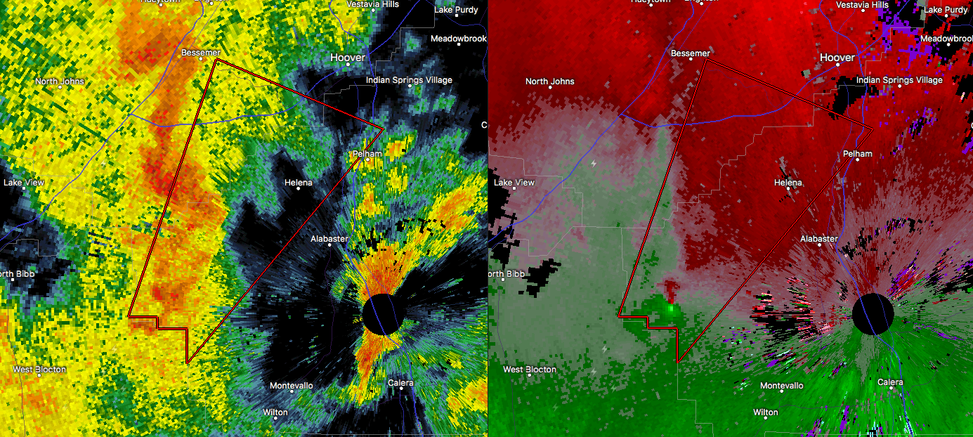
* At 243 PM CDT, a tornado producing storm was located near Maylene,
or 8 miles northwest of Montevallo, moving northeast at 30 mph.
HAZARD…Damaging tornado.
SOURCE…Radar confirmed tornado.
IMPACT…Flying debris will be dangerous to those caught without
shelter. Mobile homes will be damaged or destroyed.
Damage to roofs, windows, and vehicles will occur. Tree
damage is likely.
* Locations impacted include…
Hoover, Alabaster, Bessemer, Pelham, Helena, Regions Park Or Hoover
Met, Oak Mountain Amphitheater, Joe Tucker Park, Bessemer Airport
and Lake Cyrus.
PRECAUTIONARY/PREPAREDNESS ACTIONS…
To repeat, a tornado is on the ground. TAKE COVER NOW! Move to a
basement or an interior room on the lowest floor of a sturdy
building. Avoid windows. If you are outdoors, in a mobile home, or in
a vehicle, move to the closest substantial shelter and protect
yourself from flying debris.
Category: Archived Warnings
About the Author (Author Profile)
Scott Martin is an operational meteorologist, professional graphic artist, musician, husband, and father. Not only is Scott a member of the National Weather Association, but he is also the Central Alabama Chapter of the NWA president. Scott is also the co-founder of Racecast Weather, which provides forecasts for many racing series across the USA. He also supplies forecasts for the BassMaster Elite Series events including the BassMaster Classic.Subscribe
If you enjoyed this article, subscribe to receive more just like it.


