What To Expect Through The Rest Of Friday Evening
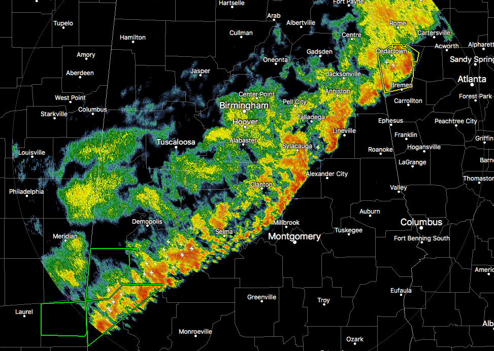
RADAR CHECK AT 5:45PM
The good news is that the threat of severe weather from Post-Tropical Cyclone Cindy is tarting to come to an end across Central Alabama. There is still a Marginal Risk for severe storms across the southeastern parts of Central Alabama, especially for locations east of Selma to Sylacauga to Heflin. For everyone else to the west, the severe threat is over.

We will have more showers and storms move in during the overnight hours, as a cold front will be making its way through the state. Latest HRRR shows storms entering into the state around 10PM-midnight, then making it to the Birmingham metropolitan area around 12AM-2AM, and dissipating greatly as it continues to move east and exiting the state before 10AM. No severe weather is expected with these showers and storms.
SATURDAY
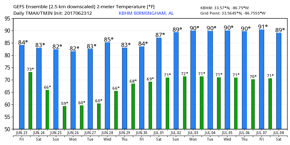
We could have a few showers and storms linger into the late morning and early afternoon hours on Saturday, but we’ll begin to dry out for a while. Skies will stay mostly cloudy throughout the day, and drier and more comfortable air will move in during the evening hours. Afternoon highs will be in the lower to mid 80s across the area, with lows in the mid 60s to the lower 70s.
SUNDAY
Skies will begin to clear out during the day from north to south, and will be mostly sunny before the sun sets in Central Alabama. It will feel much more comfortable as dewpoints will be down in the upper 50s to the lower 60s, way better than the lower to mid 70 dewpoints that we have felt within the past few days. Afternoon highs will be in the lower to mid 80s, and overnight lows down in the lower to mid 60s.
NEXT WEEK
We will have mostly sunny and really comfortable days throughout the new work week ahead, along with clear cool nights through Wednesday night. Unfortunately, moisture will begin its return to Central Alabama, and we could have a few isolated to scattered showers starting on Thursday afternoon. Highs will start off in the lower to mid 80s at the beginning of the week, and warming into the mid to upper 80s by the end of the work week.
TROPICS
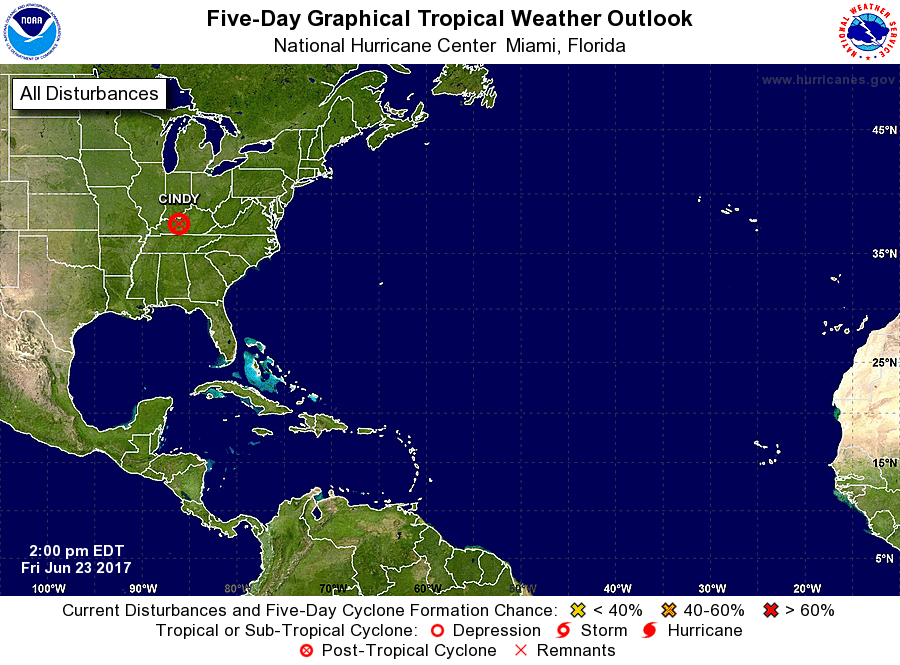
All has quieted down across the Atlantic Ocean, Gulf of Mexico, and the Caribbean Sea at this point. No tropical development is expected during the next 5 days.
BEACH FORECAST
Click here to see the AlabamaWx Beach Forecast Center page. The Beach Forecast is partially underwritten by the support of Brett/Robinson Vacation Rentals in Gulf Shores and Orange Beach. Click here to see Brett/Robinson’s Own Your Summer specials now!
WEATHERBRAINS
Don’t forget you can listen to our weekly 90 minute netcast anytime on the web, or on iTunes. This is the show all about weather featuring many familiar voices, including our meteorologists here at ABC 33/40.
Category: Alabama's Weather, ALL POSTS
About the Author (Author Profile)
Scott Martin is an operational meteorologist, professional graphic artist, musician, husband, and father. Not only is Scott a member of the National Weather Association, but he is also the Central Alabama Chapter of the NWA president. Scott is also the co-founder of Racecast Weather, which provides forecasts for many racing series across the USA. He also supplies forecasts for the BassMaster Elite Series events including the BassMaster Classic.Subscribe
If you enjoyed this article, subscribe to receive more just like it.


