

One Last Hurrah for the Showers, Storms
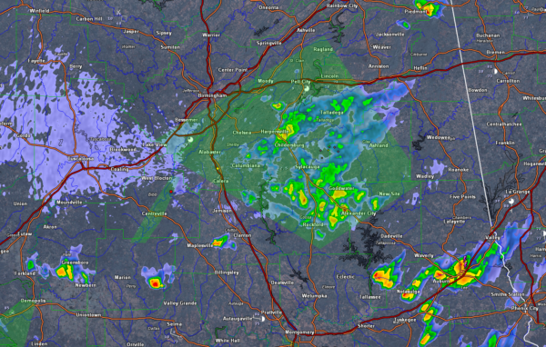
Reflectivity on left, one hour rainfall on right.
Showers and storms this afternoon developed in the I-59 Corridor and have been pushing southeast.
They have prompted the NWS to issue an Areal Flood Warning for several Counties.
They are mainly over Hale, Perry, Chilton, southern Shelby, Coosa and Clay counties and a little further south in the I-85 Corridor from Tuskegee to Auburn and Valley.
Some areas picked up one half to one inch of rain from the additional showers.
In addition, many area rivers are in flood from the recent heavy rain. Pay attention to specific river forecasts for your area.
Be alert for flooded roads and low spots. Do not drive through flooded areas. Turn around, don’t drown!
You certainly won’t need that advice next week.
How about sunny skies, low 80s, low humidity and a light north wind tomorrow? And nice weather through Thursday.
Category: Alabama's Weather, ALL POSTS
About the Author (Author Profile)
Bill Murray is the President of The Weather Factory. He is the site's official weather historian and a weekend forecaster. He also anchors the site's severe weather coverage. Bill Murray is the proud holder of National Weather Association Digital Seal #0001 @wxhistorianSubscribe
If you enjoyed this article, subscribe to receive more just like it.


