

Comfortable At Midday In Central Alabama, But The Muggies Return Tomorrow
ENJOY TODAY WHILE YOU CAN… HUMIDITY LEVELS RISE TOMORROW
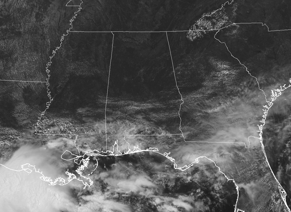
As we approach the midday hour across Central Alabama, I do not believe that you could complain about the weather, except that it’s a work day. The sun is out in full force across the area, with just a few small cumulus floating overhead in the southern portions of the area. All of Central Alabama is dry as of now, with the only rain showing up down in Mobile and Baldwin counties.
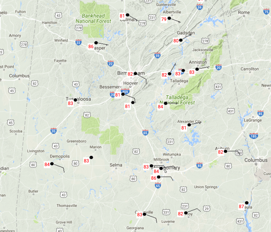
TEMPERATURES AT 11:30AM
Current temperatures across Central Alabama are in the 80s at this point. The warm spot is currently Eufaula at 87 degrees, while the cool spot of Gadsden is sitting at 80 degrees.
CLIMATE & HISTORICAL RECORDS FOR JUNE 28TH
The normal high for the date is 89 degrees, while the normal low is 68 degrees. The record high of 104 degrees was set back in 1931, while the record low of 53 degrees was set back in 1968.
FOR THE REST OF YOUR LAST “HUMP DAY” OF JUNE
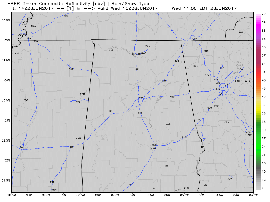
For the rest of the afternoon hours, skies will stay generally sunny mainly north of the I-20 corridor, but clouds will build in from the south for locations south of that. Afternoon highs will be in the mid to upper 80s throughout Central Alabama. The latest run of the HRRR model is hinting that showers and storms will develop during the next few hours in the extreme southern part of the state and move northward. Locations such as Demopolis, Fort Deposit, Troy, and Eufaula may see rain before midnight. Tonight’s lows will be in the upper 60s to the lower 70s.
THE TYPICAL ALABAMA SUMMERTIME PATTERN RETURNS ON THURSDAY
Scattered showers and thunderstorms, mainly during the afternoon and evening hours, make a return to our forecast as a deep layer of moisture expands from the south to cover Central Alabama. We’ll have more clouds than sun throughout the day when it is not raining, and tomorrow will not be an all day wash out. Afternoon highs will be cooler, down into the lower to mid 80s. Odds for any one location getting rain is over 3 in 5, or 60%.
HEADING TO THE BEACH
For a detailed look at the weather from Fort Morgan over to Panama City Beach, click here to see the AlabamaWx Beach Forecast Center page. The Beach Forecast is partially underwritten by the support of Brett/Robinson Vacation Rentals in Gulf Shores and Orange Beach. Click here to see Brett/Robinson’s “Own Your Summer” specials now!
A LOOK AT THE TROPICS
All remains quiet across the Atlantic basin, and tropical storm formation is not expected through the next five days.
TODAY IN WEATHER HISTORY
June 28, 1989 – Evening thunderstorms deluged Winnfield LA with eleven inches of rain in four hours and fifteen minutes, and Baton Rouge LA reported 11 inches of rain in two days. Totals in west central Louisiana ranged up to 17 inches. Thunderstorms produced severe weather in the Northern High Plains. Two inch hail broke windows in nearly every building at Comstock, NE. Thunderstorms in North Dakta produced two inch hail at Killdeer, and golf ball size hail at Zap.
WEATHERBRAINS
Don’t forget you can listen to our weekly 90 minute netcast anytime on the web, or on iTunes. This is the show all about weather featuring many familiar voices, including our meteorologists here at ABC 33/40. you can watch it live here on Monday nights at 8:30PM CDT.
Category: Alabama's Weather, ALL POSTS
About the Author (Author Profile)
Scott Martin is an operational meteorologist, professional graphic artist, musician, husband, and father. Not only is Scott a member of the National Weather Association, but he is also the Central Alabama Chapter of the NWA president. Scott is also the co-founder of Racecast Weather, which provides forecasts for many racing series across the USA. He also supplies forecasts for the BassMaster Elite Series events including the BassMaster Classic.Subscribe
If you enjoyed this article, subscribe to receive more just like it.


