More Strong Storms Are Moving Into Northwestern Alabama
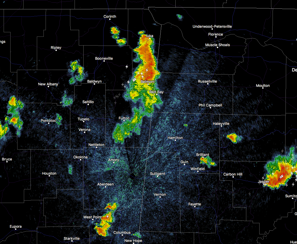
At 8:41 PM CDT, Doppler radar was tracking a cluster of strong thunderstorms centered near Tishomingo State Park, moving northeast at 45 mph. Wind gusts around 50 mph will be possible with this cluster of storms.
Locations impacted include…
Cherokee, Malone, Posey Loop, Allsboro, Red Rock, Pride Landing, Pogo, Mt Hester, Srygley Church and Maud.
Strong gusty winds will be capable of knocking down small tree limbs along with other small unsecured items. Seek safe shelter until these storms have passed. Very heavy rainfall is also occurring with this cluster of storms and may lead to localized flooding. Do not drive your vehicle through flooded roadways.
Category: Archived Warnings
About the Author (Author Profile)
Scott Martin is an operational meteorologist, professional graphic artist, musician, husband, and father. Not only is Scott a member of the National Weather Association, but he is also the Central Alabama Chapter of the NWA president. Scott is also the co-founder of Racecast Weather, which provides forecasts for many racing series across the USA. He also supplies forecasts for the BassMaster Elite Series events including the BassMaster Classic.Subscribe
If you enjoyed this article, subscribe to receive more just like it.


