A Brief Check On Our Weather At 2:20PM
Radar Check
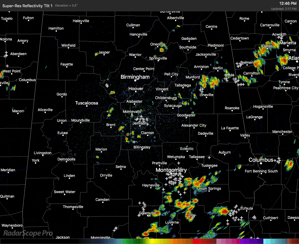
A few strong thunderstorms are developing out there across Central Alabama at this time, with the strongest storm on radar being located over the north and central parts of Montgomery County, affecting the state Capitol and back to the south and southwest. This storm is nearly stationary and may be producing some gusty winds and dangerous cloud-to-ground lightning.
We also have several scattered storms that are affecting the west and central parts of Jefferson County, mainly over Fairfield, Midfield, and over to the Jefferson/Tuscaloosa County line.
Other shower and storms are out there in the extreme eastern parts of Central Alabama. Places such as Munford and Lineville are receiving heavy rainfall, along with Edwardsville and Ranburne.
No severe warnings are in effect, and no severe weather is expected. It’s just your typical summertime afternoon in Central Alabama for mid-July.
Category: Alabama's Weather, ALL POSTS
About the Author (Author Profile)
Scott Martin is an operational meteorologist, professional graphic artist, musician, husband, and father. Not only is Scott a member of the National Weather Association, but he is also the Central Alabama Chapter of the NWA president. Scott is also the co-founder of Racecast Weather, which provides forecasts for many racing series across the USA. He also supplies forecasts for the BassMaster Elite Series events including the BassMaster Classic.Subscribe
If you enjoyed this article, subscribe to receive more just like it.


