The Cold Front Approaches At Midday
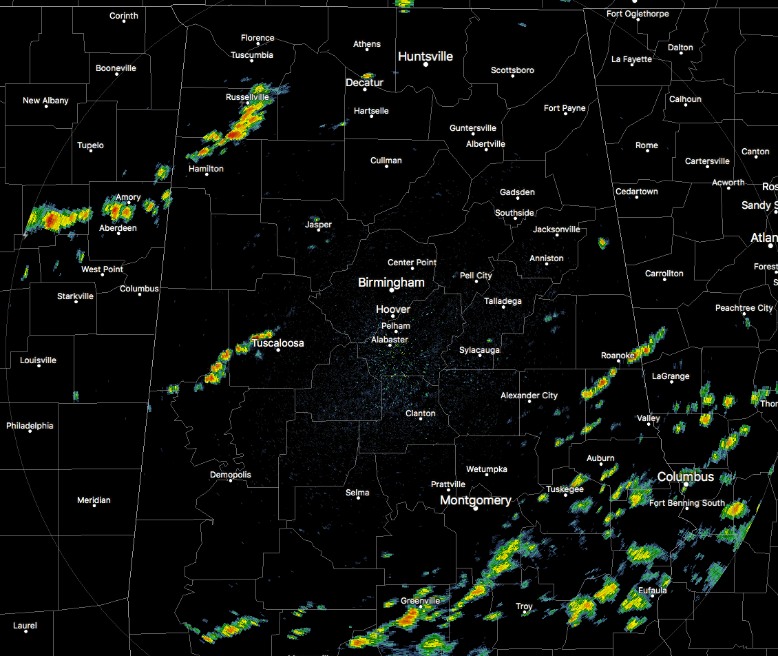
Radar Check At 12:35 PM
A cold front has started moving into the northwest corner of the state and a few showers and storms have formed out ahead. Those are currently located across the northern and western parts of Marion County and just clipping the northwestern tip of Lamar County before crossing the state line back into Mississippi. A few isolated storms have developed over parts of Tuscaloosa and Pickens County. All of these are moving to the southeast.
We also have scattered to numerous showers and storms over the southeastern portion of Central Alabama. These are moving to the northeast. The good news about those storms and the ones to the south along the coast is that they are cutting off any energy from reaching the advancing cold front.
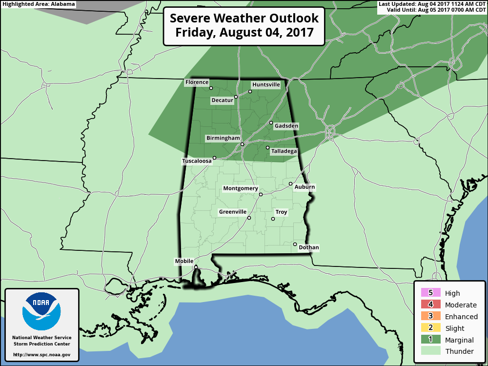
SPC continues to have the northern half of the state in a Marginal Risk for severe storms throughout the remainder of the day and tonight. The main threat will be from a risk of wet microburst winds, but the overall severe threat will be very low due to the southern storms.
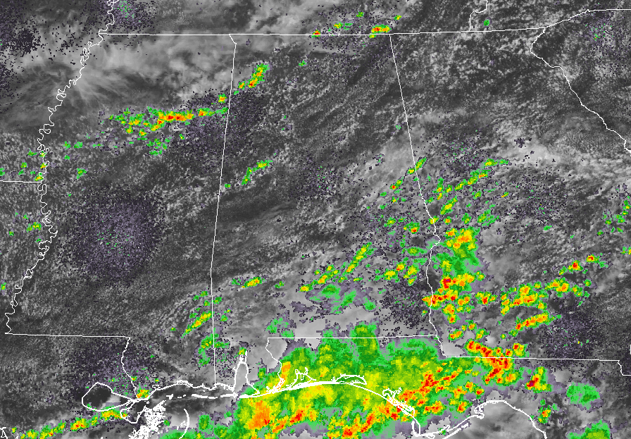
Temperatures At 12:35 PM
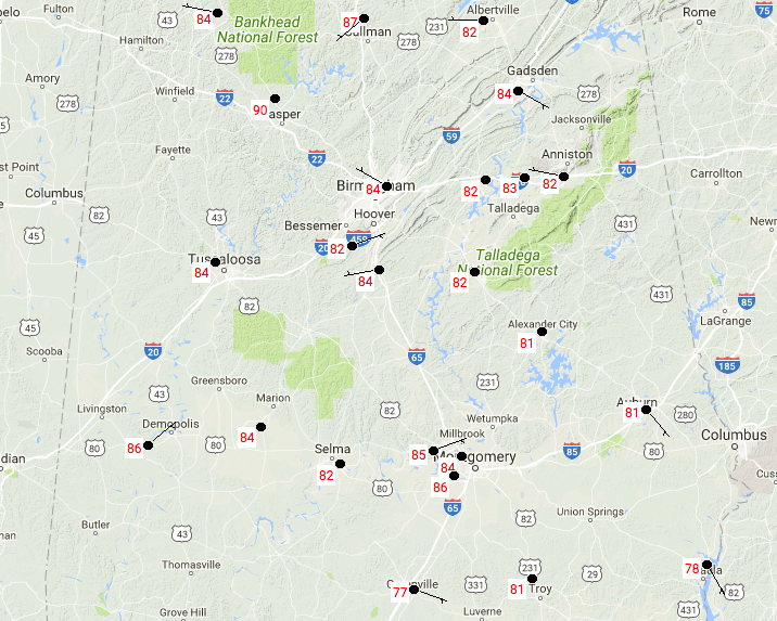
At this time, temperatures are ranging from the upper 70s to the upper 80s across the area. Birmingham is currently at 84 degrees, with the warm spot being Cullman at 87 degrees. The coolest spots in the area are down in the southern parts of the state where there is more clouds and shower activity.
For The Rest Of Your Friday
We’ll have a risk of scattered showers and storms throughout the remainder of the day and into the late evening hours. There is a possibility for a few storms becoming strong to marginally severe. The best chances for rain will be in the southern locations of the area. Afternoon highs will be throughout the 80s to near 90 degrees with lows in the mid-60s to the lower 70s.
The Central Alabama Weekend
With the front stalling across portions of Central Alabama on Saturday, the chance for scattered showers and storms will be over the southern half of the area, while the northern half will enjoy a day free from storms. Highs will be in the mid-80s to the lower 90s. Showers and storms will become likely on Sunday, with highs in the upper 80s to near 90 degrees.
Got Beach Plans?
Rain and storms are in the forecast in the days ahead. For a detailed look at the weather from Fort Morgan over to Panama City Beach, click here to see the AlabamaWx Beach Forecast Center page.
The Beach Forecast is partially underwritten by the support of Brett/Robinson Vacation Rentals in Gulf Shores and Orange Beach. Click here to see Brett/Robinson’s “Own Your Summer” specials now!
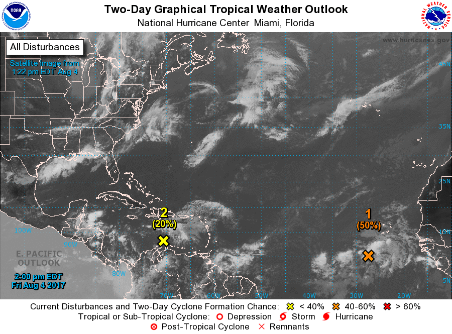
Taking A Peek At The Tropics
The area of concern closest to home is located over the east-central Caribbean Sea, and is forecast to move rather quickly to the west-northwest at 15 MPH. Environmental conditions will be conducive for development and a tropical depression could form within the next 5 days. Chances are about 60%.
A broad low that is several hundred miles south-southwest of the Cabo Verde Islands is moving to the west-northwest at 15-20 MPH. Environmental conditions will be conducive for tightening up and develop during the next few days, and a tropical depression is likely to form next week when it moves into the tropical Atlantic Ocean. Chances are high at 80%.
Stay up-to-date with “The Latest On The Tropics…” running post in the Tropical Weather category on the AlabamaWx Weather Blog home page.
Advertise With Us!
Now is the time to set your marketing campaign on AlabamaWX. The site has enjoyed a 71% jump in page views this year! The website has already enjoyed 10,157,915 page views this year. We can customize a creative, flexible and affordable package that will suit your organization’s needs. Contact Bill Murray at (205) 687-0782.
E-Forecast
Get the AlabamaWx seven-day forecast delivered directly to your inbox by email twice daily. It is the most detailed weather forecast available in Central Alabama. Click here to subscribe. It’s free!
Today In Weather History
August 4, 1980 – A record forty-two consecutive days of 100-degree heat finally came to an end at the Dallas-Fort Worth Airport. July 1980 proved to be the hottest month on record with a mean temperature of 92 degrees. There was just one day of rain in July, and there was no measurable rain in August. There were 18 more days of 100-degree heat in August, and four in September. Hot weather that summer contributed to the deaths of 1200 people nationally, and losses from the heat across the country were estimated at twenty billion dollars.
WeatherBrains
Check out the show at www.WeatherBrains.com. You can also subscribe on iTunes. You can watch the show live at live.bigbrainsmedia.com on Monday nights starting at 8:30 PM CDT. You will be able to see the show on the James Spann 24×7 weather channel on cable or directly over the air on the dot 2 feed.
Category: Alabama's Weather, ALL POSTS
About the Author (Author Profile)
Scott Martin is an operational meteorologist, professional graphic artist, musician, husband, and father. Not only is Scott a member of the National Weather Association, but he is also the Central Alabama Chapter of the NWA president. Scott is also the co-founder of Racecast Weather, which provides forecasts for many racing series across the USA. He also supplies forecasts for the BassMaster Elite Series events including the BassMaster Classic.Subscribe
If you enjoyed this article, subscribe to receive more just like it.


