Extended Period of Unsettled Wet Weather
Much of North and Central Alabama enjoyed a shower-free day yesterday with some lowered humidity and highs climbing to around 90 degrees. The cold front which brought that nice weather stalled out between Birmingham and Montgomery. The sky remained mostly clear across Central and North Alabama this morning, but that is not likely to last too long as the stalled front begins to make the trek back north in response to a weak short wave coming across Arkansas. Temperatures were in the 60s across North Alabama and in the lower 70s across Central Alabama. Radar was already showing showers in Southeast Mississippi this morning, and showers should continue to become more numerous into the late morning and afternoon. The additional cloud cover and the presence of numerous showers will help to cap the afternoon highs in the middle and upper 80s.
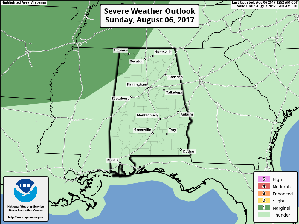
SPC had defined an areal of marginal risk for severe thunderstorms for today, Day 1, across western Tennessee and Kentucky extending westward into West Texas. The marginal risk area barely clipped the northwest corner of Alabama catching parts of Lauderdale, Colbert, Franklin, Marion, and extreme northwestern Lamar counties. The primary threats will be damaging wind and marginally severe hail.
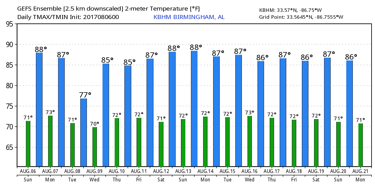
The upper air pattern for the rest of the week and into the weekend will be changing very little with a broad trough hung up over the eastern two thirds of the country. This pattern keeps a gradient in the pressure field lying across Tennessee where the southern edge of the westerlies will persist all the way through next weekend. Aloft there is going to be a stream of weak short waves which will help to enhance rain chances. While the main threat is likely to come with afternoon heating, these weak disturbances could help to produce rain outside of the primary heating of the day. At the surface, a weak frontal boundary will lie across the same area along which we’ll see several weak low pressure systems traverse. So with relatively deep moisture in place as indicated by precipitable water values riding very close to the 2 inch mark, we’ll see plenty of clouds along with numerous showers and thunderstorms. These conditions will keep the temperatures in check with highs mainly in the middle 80s. GFS MOS guidance actually prints out an 81 high for Tuesday. There will be day-to-day variation in high temperatures depending on the exact timing of showers and the overall cloud situation.
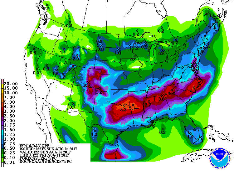
Rainfall over the next five days through Friday morning could be substantial with a south to north gradient ranging from around 1 inch across South Alabama to 4 inches across North Alabama. Much of Central Alabama is in the range of 2 to 3 inches. The rainfall that we expect to see could result in isolated flash flooding issues as we progress through the week. Actual locations for flash flood concerns are going to depend on several factors including how much rain falls and the specific location of that heavy rain.
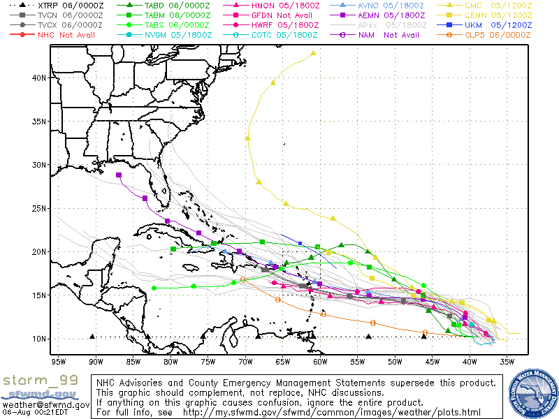
The tropical Atlantic remained somewhat active with two systems to watch. The first was located in the South Central Caribbean and was moving steadily west-northwest. The favored track brings the disturbance across the Yucatan Peninsula and into the Southwest Gulf (Bay of Campeche) late Monday or Tuesday. The system could become a depression before reaching the Yucatan Peninsula or after emerging into the Southwest Gulf. A hurricane hunter aircraft is scheduled to investigate the area later today. Both the ECMWF and the GFS appear to develop the system into a hurricane over the Southwest Gulf before it goes ashore on the Mexican coast.
The second area was about 1100 miles southwest of the Cabo Verde Islands and was chugging steadily west-northwestward. Various model guidance maintains a track that would bring the area of disturbed weather into the northern Caribbean very close to the islands and Cuba. While some slow strengthening may occur over the next couple of days, the overall conditions along the track ahead of this system do not appear very favorable for significant development. Both the ECMWF and the GFS bring this system into the Bahamas around August 13th, a week from today. The ECMWF is more aggressive in forecasting a stronger system than the GFS, however, the ECMWF keeps the system west of the US coastline as it recurves to the northeast while the GFS projects a weaker system that recurves right along the coastline. It is still way too early to tell what either of these systems will do.
At the beaches of Alabama and Northwest Florida, the chance for showers will continue today and for of next week. No complete washouts but showers could be fairly numerous at times today. You can expect to see highs mainly in the middle 80s and lows in the upper 70s. There is a moderate risk for rip currents today. Click here to see the AlabamaWx Beach Forecast Center page. The Beach Forecast is partially underwritten by the support of Brett/Robinson Vacation Rentals in Gulf Shores and Orange Beach. Click here to see Brett/Robinson’s Own Your Summer specials now!
Looking out into voodoo country, the GFS has retracted the idea of nosing the Bermuda high into and across the Southeast US. Instead, the GFS is now very bullish on maintaining an anomalously deep trough over the eastern half of the Nation. This pattern is great for the eastern half of the country since it mains below average temperatures over that area along with above average precipitation for the southern two-thirds of the eastern US.
Don’t forget you can listen to our weekly 90 minute netcast anytime on the web, or on iTunes. This is the show all about weather featuring many familiar voices, including our meteorologists here at ABC 33/40.
Thanks so much for tuning into the Weather Xtreme Video this week while James Spann has been on vacation. I’ll pass the reins to him tomorrow as we get back on the regular two-a-day schedule once again. I hope that you have a great day. I’ll be handling the weather duties this evening on ABC 3340 New at 5 and 10 pm, so be sure to check then for the latest forecast. Godspeed.
-Brian-
Category: Alabama's Weather, ALL POSTS
About the Author (Author Profile)
Brian Peters is one of the television meteorologists at ABC3340 in Birmingham and a retired NWS Warning Coordination Meteorologist. He handles the weekend Weather Xtreme Videos and forecast discussion and is the Webmaster for the popular WeatherBrains podcast.Subscribe
If you enjoyed this article, subscribe to receive more just like it.


